Winter Weather To Return To Northeastern Oklahoma Tuesday
Patchy and some dense fog will be underway this morning across part of northeastern OK with greater fog potential across southern to east central parts of the state where dense fog advisories will remain for the morning hours.Monday, January 27th 2020, 7:02 am
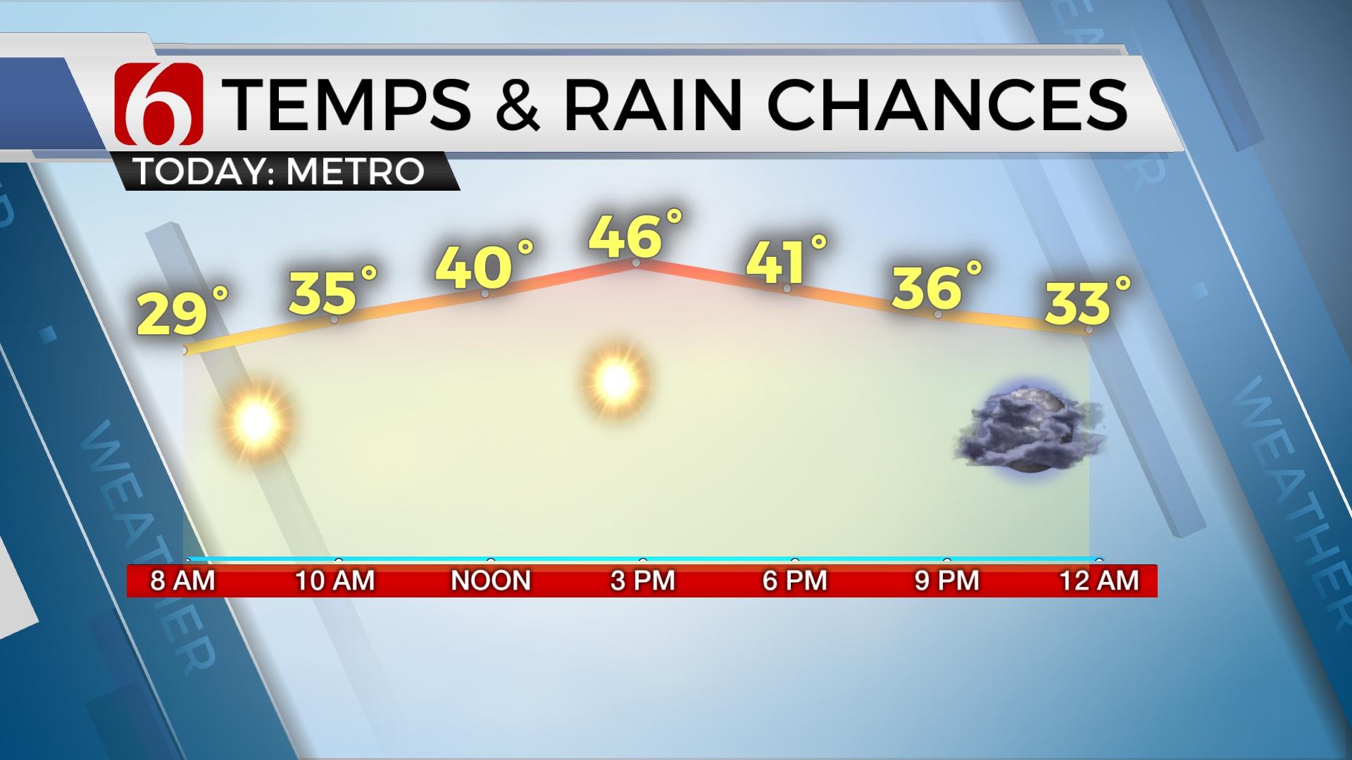
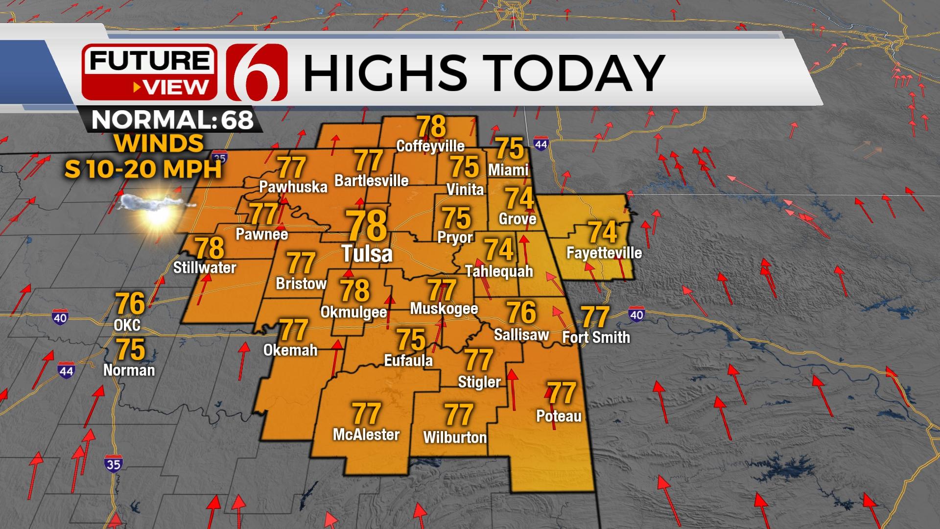
Patchy and some dense fog will be underway this morning across part of northeastern OK with greater fog potential across southern to east central parts of the state where dense fog advisories will remain for the morning hours. Most of the temperatures this morning will remain in the lower to mid-30s. After the fog or low cloud deck mixes out, mostly to partly sunny conditions are likely to remain for most of the day across northeastern areas with some clouds across the south. Afternoon highs should be reaching the upper 50s and lower 60s for many locations with cooler readings across southeastern Kansas and extreme northeastern OK this afternoon.
Another strong looking storm system will take aim at the southern plains Tuesday quickly bringing rain and colder air across the state. There will remain a chance for some wintry weather impacts on the northern (or top side) of the storm system Tuesday afternoon and evening across northeastern OK and southeastern Kansas, with potentially for some spotty accumulations. Much higher chances for accumulating snowfall will be across northwestern OK into southwestern Kansas where a winter storm watch will be underway Tuesday with 3 to 6 inches possible.
This system will exit the area late Tuesday night with most of Wednesday remaining moisture free. Another wave will drop across the plains Friday with a few showers followed by another robust warm-up next weekend.

The next upper level wave is dropping rapidly across the western U.S. this morning and will approach the state Tuesday morning to afternoon. Most data support this quasi-open wave to begin getting stronger and slowly closing by Tuesday night as it ejects across the state. As this process occurs, colder air aloft will spread from the west to east allowing rain to approach eastern OK early Tuesday morning to midday. Almost all of this early period should be a cold rain.
There may be a small window across extreme northeastern OK early tomorrow morning that could support a minor mix. Tuesday morning rain will quickly change to snow across northwestern OK with impactful accumulations. By afternoon to early evening, rain may attempt to change to some wintry mix or snow to the northwest of the metro, mostly across far northern OK and southeastern Kansas with some minor accumulations expected. As noted above, the better location for heavy snowfall appears across NW OK and southwestern Kansas, but some winter mix of rain to snow seems possible along and northwest of the I-44 corridor sometime Tuesday afternoon into the evening.
Some changes are always possible, so check back later today and tonight for updates.
Temperatures have continued to trend colder with each run of data for the Tuesday afternoon and evening period with most of tomorrow in the 30s across the north. There will be warmer readings likely across southeastern and east central OK keeping all precipitation rain in these areas with some isolated thunder along the Red River.

Wednesday morning will start with the system ejecting but temps would remain near or slightly below freezing. Afternoon highs would move into the upper 30s to lower 40s north and mid-40s south along with sunshine.
Thursday morning features lows in the upper 20s and lower 30s with highs around 50 before a fast-moving upper level system drops across the plains by evening. The moisture will be very thin and limited for this wave, but a few spotty showers may be possible. This chance will remain near 10% or less. Another wave should also quickly drop south Friday night into Saturday morning, but once again, it appears the moisture will be either slightly east of the region, or too low to mention probabilities at this time. After this wave quickly leaves, a warming trend will quickly commence with lows in the mid to upper 30s with Saturday afternoon in the upper 50s and Sunday in the upper 60s.
In summary, after this morning’s fog, we’re in fine shape for the day with highs in the upper 50s to lower 60s for most locations. But a fast-moving system arrives Tuesday with rain changing to snow for some across the north along with more cold air.
Thanks for reading the Monday morning weather discussion and blog.
Alan Crone
More Like This
January 27th, 2020
November 30th, 2022
November 1st, 2022
August 26th, 2022
Top Headlines
December 13th, 2024
December 13th, 2024
December 13th, 2024
December 13th, 2024


