Cold Air, Rain Chances Arriving Wednesday
A mild morning morphs into colder weather later this afternoon and tonight before rain arrives Thursday night into Friday.Wednesday, January 15th 2020, 6:49 am
A mild morning morphs into colder weather later this afternoon and tonight before rain arrives Thursday night into Friday.

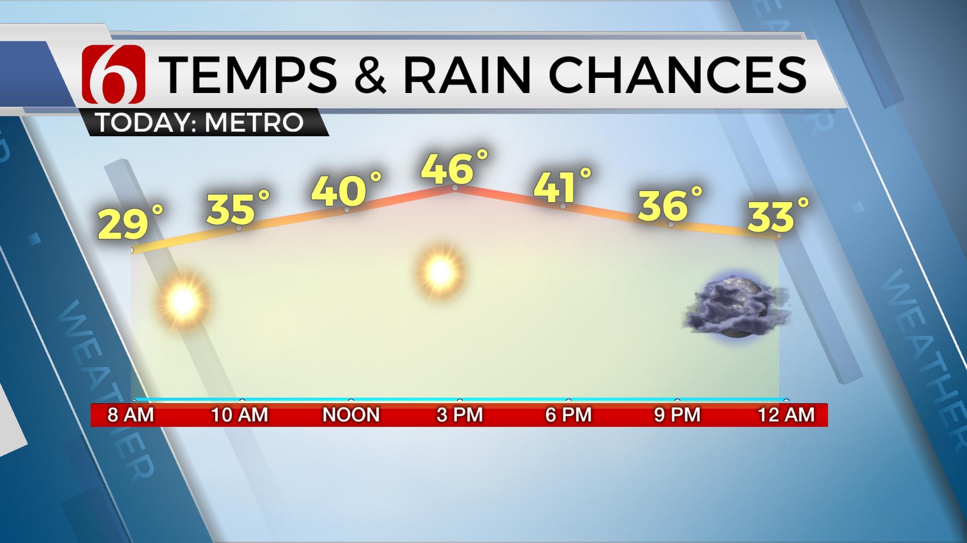
The soupy clouds yesterday kept some of us in the 50s, but in the spots of clearing sky and sunshine, lower to mid-60s were common. Even in January, you can get warm weather. But that’s about to end. A series of cold fronts will move across the region bringing near and below normal temperatures back to the state, including the likelihood of increasing rain chances for the next 48 to 60s for some locations. Most of the today will be rain free with the exception of a few locations across extreme eastern and southeastern OK where enough moisture and instability exist for a few showers or rumbles of thunder as today's cold front passes into that region. This front will cross the Tulsa metro sometime this morning, probably around midday, but the colder air may lag slightly behind the front with temperatures reaching upper 50s or lower 60s across northern OK before dropping into the upper 40s by late afternoon. Locations across southeastern OK will easily reach the mid-60s this morning with some lower 70s possible along the Red River counties before turning colder later tonight and overnight. The gusty north winds will develop postfrontal this evening and keep the boundary located to our south, mostly along the Red River or north Texas.

Temperatures will continue to drop this evening and should be near freezing by midnight and below freezing overnight into Thursday morning. We’ll be dry across our entire eastern OK and southern Kansas region during this period. But to our southwest, moisture will rapidly return with rain developing across the western areas of north Texas and spreading into southwestern or west central Oklahoma early Thursday morning. And these areas will be very close or even slightly below freezing. This will set the potential for sleet and freezing rain for our neighbors well west.
Thursday midday to afternoon some of the moisture begins moving northeast into far northeastern OK and southern Kansas. I anticipate our temps will be either in the upper 30s or lower 40s at this point, but well above freezing. But there will be a process that allows temps to drop a few degrees Thursday early evening to our west that may provide us with a small window for freezing rain across extreme western Osage county into southern Kansas. This period will be no more than an hour or three before southeast winds quickly return and readings move above freezing. This very low probability of light freezing rain will remain northwest or north of the metro and all of eastern OK late Thursday evening, if the magnitude of today’s cold front is correct. The only areas of concern currently will be the extreme northwestern regions of our areas of concern.

By Friday midday to late afternoon, south winds will increase the moisture and warmth across the region with temperatures slowly climbing into the 40s to near 50 by afternoon in the metro, and into the mid or upper 50s by late Friday night with rain and some thunder positioned across the northern sections of the state. I may need to lower the Friday chances for extreme southern OK but will keep the pops high for these regions also at this point Friday.

Friday evening the cold front slams back across the metro and clears all eastern OK by pre-dawn Saturday with chilly and breezy conditions invading eastern OK Saturday as highs will top out in the 40s with some sunshine and gusty winds. The data this morning suggest additional clouds and colder air may arrive Sunday that would keep us also quite cold, with highs either in the upper 30s or lower 40s. I’ve adjusted the numbers down a few degrees from previous forecasts to account for this potential Sunday.
Next week we’re looking at a progressive pattern that will bring numerous systems across the country with colder air spilling southward. Its back to winter. Stay tuned.
Thanks for reading the Wednesday morning weather discussion and blog.
Have a super great day!
Alan Crone
More Like This
January 15th, 2020
November 30th, 2022
November 1st, 2022
August 26th, 2022
Top Headlines
December 11th, 2024
December 11th, 2024
December 11th, 2024
December 11th, 2024


