Friday To Bring Threat Of Severe Storms To Eastern Oklahoma
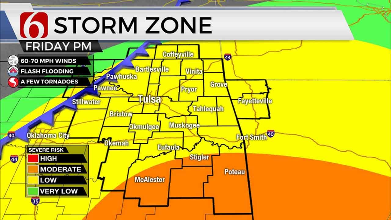
Severe storms are a possibility anywhere across Green Country by Friday afternoon into early Friday evening. All modes of severe weather are possible, including damaging winds, some hail, and a few tornadoes.Thursday, January 9th 2020, 5:51 pm
A very busy stretch is ahead for Green Country with severe storms, flooding potential, bitter cold, and some snow all in the cards!
Areas of rain will continue Thursday night into early Friday morning, mostly across southeastern Oklahoma. By mid to late morning Friday, rain and thunderstorms look to become more widespread across much of eastern Oklahoma.
Severe storms are a possibility anywhere across Green Country by Friday afternoon into early Friday evening. All modes of severe weather are possible, including damaging winds, some hail, and a few tornadoes.
After sunset Friday, the biggest threat for severe weather should shift across southeastern Oklahoma. The threat for a few tornadoes will continue, along with a threat for flash flooding.
Storms will shift east of Green Country late Friday night, with significantly colder air moving in. By early Saturday morning, a wintry mix of rain, sleet, and brief ice will develop west of Tulsa. This should quickly changeover to snow as Saturday morning progresses. Snow accumulation of a few inches is most likely across northeast Oklahoma, with lower amounts across southeast Oklahoma. In addition, wind chills could dip into the teens or single digits Saturday morning with stiff north winds.
Wintry precipitation will come to an end by Saturday afternoon, but some slick travel will be possible wherever the heaviest accumulations occur. Continue to check back for updates over these next few days as details become more clear!

More Like This
January 9th, 2020
November 30th, 2022
November 1st, 2022
August 26th, 2022
Top Headlines
December 15th, 2024
December 15th, 2024
December 15th, 2024
December 15th, 2024


