Warm Weather, Strong To Severe Storms Late Thursday
Warm Weather, Strong To Severe Storms Late ThursdayThursday, May 14th 2020, 6:18 am
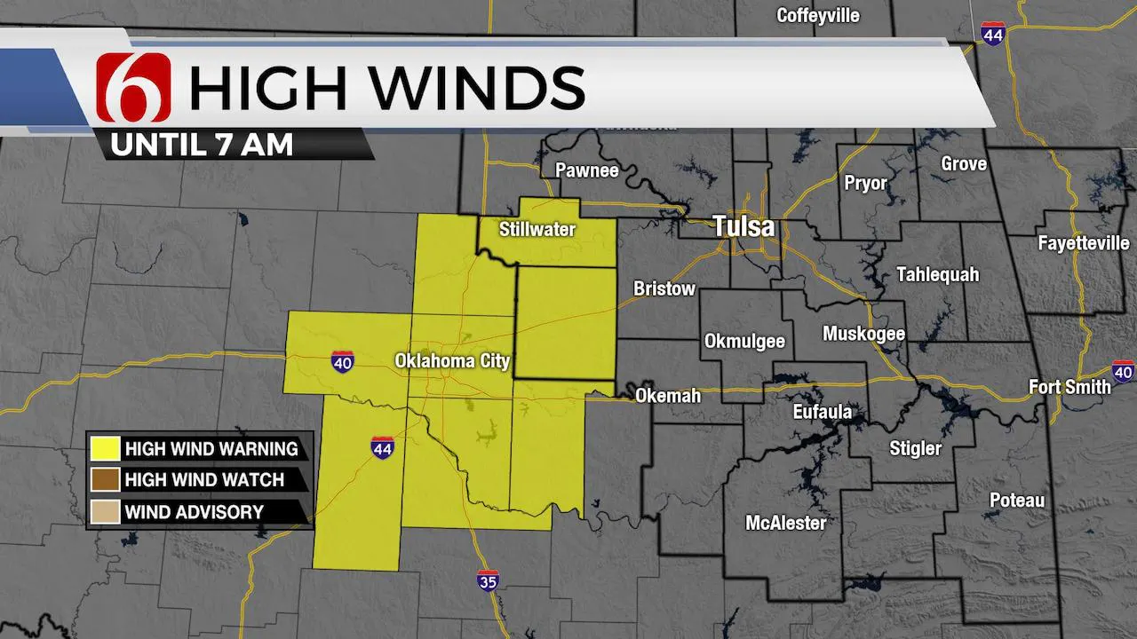
Decaying showers near central OK creating high winds near and north of OKC metro. A high wind warning remains across these areas to the southwest of the Tulsa metro through 7am. Environmental winds from 40 to 55 mph will be possible along with higher gusts nearing 70 mph in a few spots. A 74 mph wind gusts was recorded earlier this morning at Tinker Air Force Base. Some of these stronger winds could draw closer to the western edge of Creek to Pawnee counties during the next hour or so. No counties in our immediate coverage area are currently included in high wind warnings.

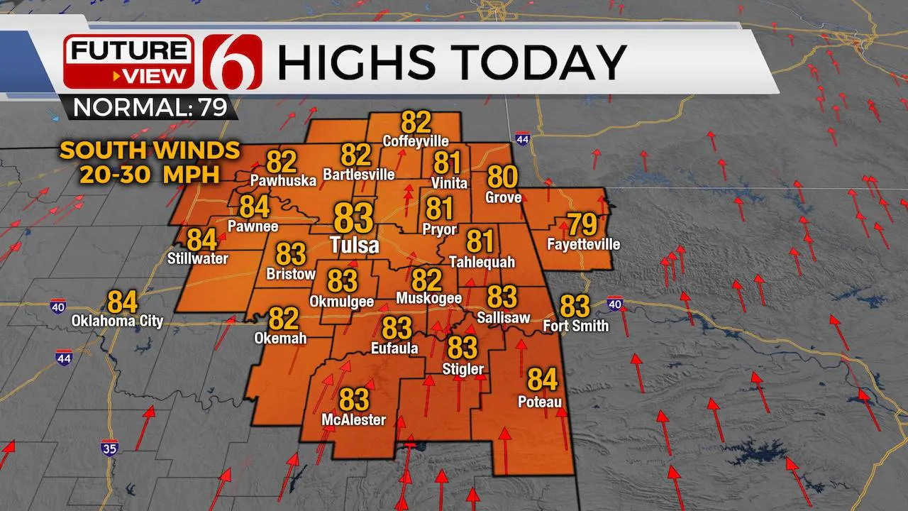
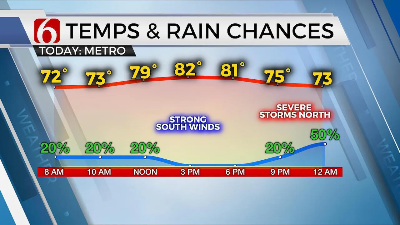
The warm and humid weather will remain for the next few days including chances for additional storms, and some severe weather threats. A few storms will persist this morning across east-central or southeastern OK remaining from last nights activity. These should continue to weaken. But it appears a convectively induced area of vorticity will move across part of southeastern OK this morning and possibly near the metro by midday. I’ll keep a mention for a few storm chances in the forecast this morning through midday due to the possibility of this MCV moving across the area. Several the hi-res models yesterday depicted this MCV nearby this morning. Temps this morning will mostly be in the upper 60s and lower 70s with afternoon highs reaching the lower 80s this afternoon with gusty south winds from 20 to 30 mph. We should be dry for the afternoon and may even see more sunshine later today compared to yesterday. But another disturbance will trigger storms to our north this afternoon and those will take a run at the area later tonight.

Another higher chance of storms will arrive tonight as a boundary moves into southeastern Kansas with storms developing along this feature and moving southeast late tonight into early Friday morning. Locations from highway 412 northward, including the Tulsa metro will remain in a higher category of storms late tonight into early Friday including all modes of severe weather threats. The higher threats will more than likely remain extremely heavy rainfall and damaging winds, but some hail will also be possible. The tornado threat will be low but not zero with this system. Some of the hi-res models take this developing convective system ( MCS) entirely across northeastern and southeastern OK tomorrow morning. If so, this will effectively turn-over the atmosphere and would keep Friday afternoon and evening stable across the northern part of the state while additional storms would be possible across southwestern to southcentral OK. If the MCS does not clear the entire area Friday morning, Friday afternoon and evening storms would be possible across NE OK and southeastern Kansas. The specific placement and probabilities for Friday afternoon and evening can’t be resolved with any confidence this morning due to the wildcard placement of any outflows.

This weekend doesn’t appear to be a wash-out, but we’ll also need to keep some mentions for storms Saturday. By Sunday, it appears things begin to dry out as mid-level ridging builds across the state. Both GFS and EURO have trended toward bringing a front across the region Sunday as an upper level system stays south of the Red River. This feature appears to be too far south to impact our area Sunday with any storms. As it moves eastward into Monday, mid-level ridging will occur across most of Oklahoma for a few days, allowing pleasant and dry conditions through most of next week.
Temps may drop a few degrees Saturday through Monday with afternoon highs in the mid to upper 70s. But the pattern will continue supporting mostly warm and above average temps for all next week.
Thanks for reading the Thursday morning weather discussion and blog.
Have a super great day!
Alan Crone
More Like This
May 14th, 2020
August 8th, 2023
July 4th, 2023
May 8th, 2023
Top Headlines
December 12th, 2024
December 12th, 2024
December 12th, 2024


