Sunny Tuesday; Rain, Storms Returning For Memorial Day Weekend
Sunny Tuesday; Rain, Storms Returning For Memorial Day WeekendTuesday, May 19th 2020, 5:46 am
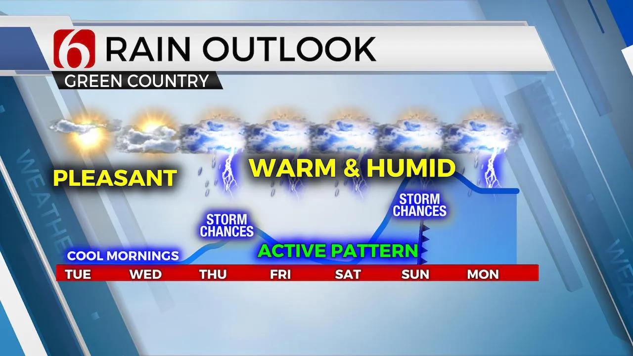
No major issues again today with sunshine and a few clouds along with afternoon highs reaching the mid to upper 70s across most of northeastern OK along with northeast winds from 5 to 12 mph. A mid-level ridge of high pressure will remain the dominate feature across central and eastern OK with a developing trough along the west coast and a closed-low across the midwestern U.S. A few clouds will pinwheel across far northeastern OK and southeastern Kansas again today but most of us should continue with sunny skies and warm weather. The pattern will change allowing storm chances and humid weather returning for the 2nd half of the week into the weekend. Most data support local dew points reaching the upper 60s to lower 70s this weekend bringing June-like humidity across eastern OK for the Memorial Day holiday weekend. Our storm chances will be returning Thursday as a warm front lifts northwest across the area with scattered storm chances remaining Friday and Saturday. Most data support a cold front nearing the state Sunday with increasing thunderstorm chances over a larger area, and I have higher storm chances for Sunday due to this system. Sunday into early next week, most data also support a mid-level cut-off developing across southwest Texas that would influence weather across Oklahoma with scattered showers and storms both Monday and Tuesday for part of the area. I’ll not get too specific with timeline information today, but we’re heading into another unsettled weather pattern by the end of the week and this weekend that should linger into early next week.

Temperatures will start mostly in the 50s this morning along with a few locations reaching the upper 40s across far east-central Ok, where some patchy valley fog may occur. The location of the closed upper low across the upper Midwest may bring some clouds across far southeastern Kansas and far northeastern OK for part of the state. Most of the region will remain to the southwest of this cloud potential with afternoon highs once again reaching the mid-70s. Some additional clouds could develop this morning to midday across southcentral to southeastern OK before thinning around midday. Regardless, a nice weather day will be experienced again today.

Our mid-level ridge will break down as the western U.S. trough begins moving more eastward Wednesday into Thursday. The stronger westerlies aloft will be nudging northward this weekend, but more than adequate flow and shear will bring storm chances into the region this weekend as a cold front move across the area Sunday evening as the cut-off develops across Texas. Before this occurs, most data support a few vort maxes ejecting around the base of the main western U.S. trough and lifting directly across the state. One would be Thursday, and another into the weekend. After a window for a few Thursday morning storms as the warm front lifts northward and the low-level jet sparks off a few, we’ll be watching the high plains convection Thursday that will eventually move eastward by Thursday night. This probably weakens before reaching eastern OK, but we’re keeping storm chances in the forecast due to this potential. Friday into Saturday some additional storms are possible but at this point, no major focusing mechanism is apparent until we get into Saturday night and Sunday. Increasing moisture combined with these features would support a threat for some heavy rainfall and severe storm potential through early next week.
Thanks for reading the Tuesday morning weather discussion and blog.
Have a super great day!
Alan Crone
More Like This
August 8th, 2023
July 4th, 2023
May 8th, 2023
Top Headlines
December 15th, 2024
December 15th, 2024
December 15th, 2024
December 15th, 2024


