Strong To Severe Storm Chances For Memorial Day Weekend
Strong To Severe Storm Chances For Memorial Day WeekendThursday, May 21st 2020, 6:12 am
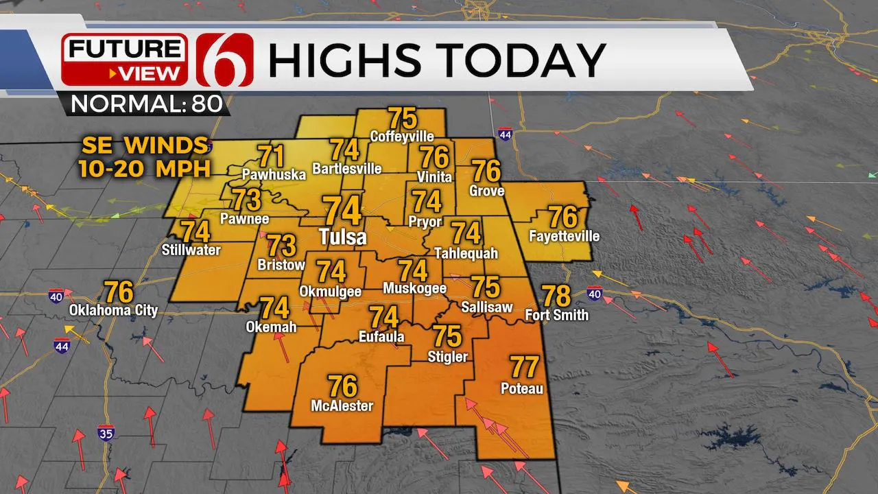
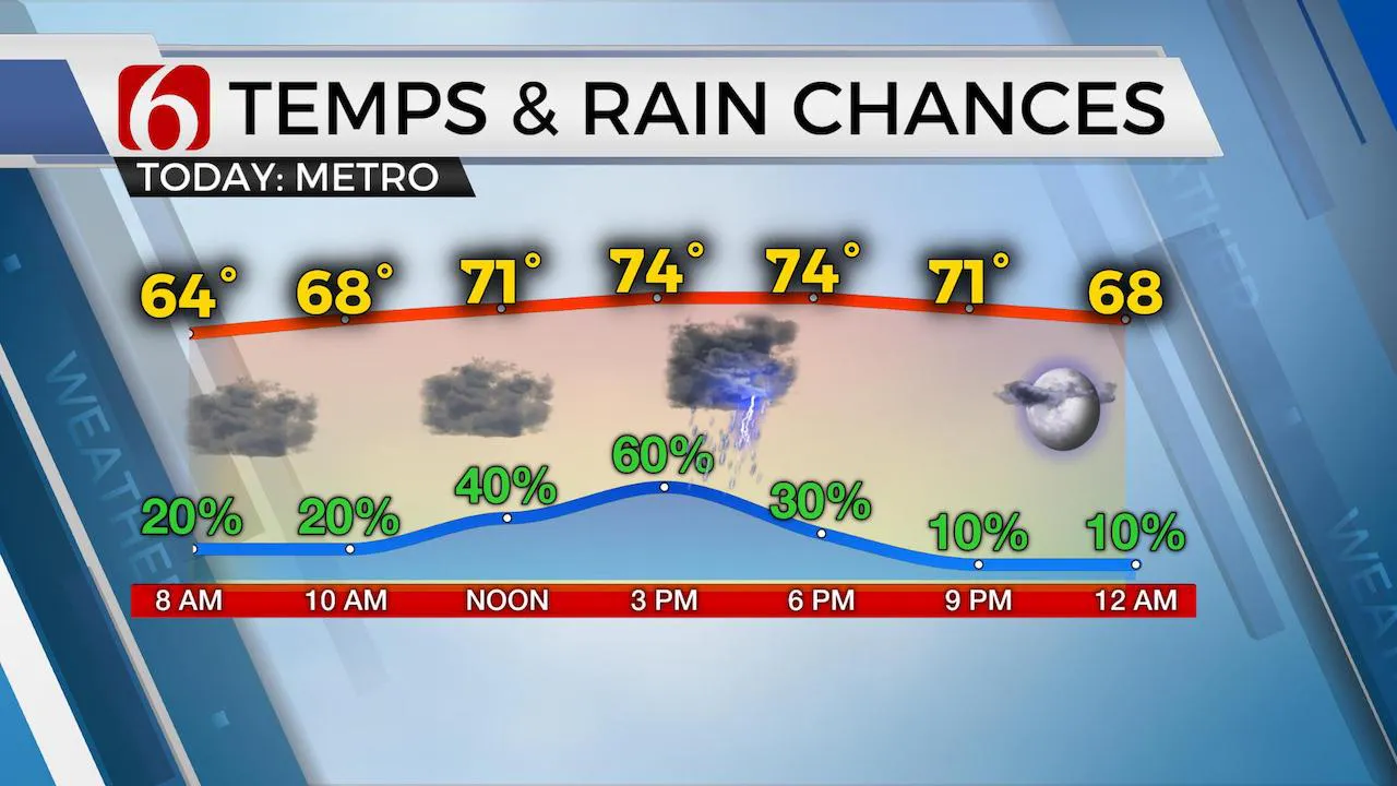
The pattern is changing. Warm and moist air will continue to slowly lift northward this morning as the mid-level ridge of high pressure has weakened and moved eastward. The main western U.S. trough will send a few disturbances around the base and enter part of Oklahoma periodically now through the weekend. The result will be occasional showers and storms. There will also be a few times for strong to severe storm chances, including pockets of moderate to heavy rainfall for some locations. This active pattern may continue for several days early next week. Temps are in the 60s this morning and will move back into the 70s this afternoon with southeast winds and increasing clouds. Exact timing and specifics regarding day to day timing will continue to be problematic and may hinge on the previous day’s activity.

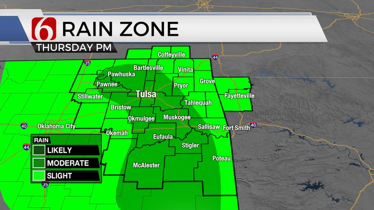
The convective forecast potential is complicated and rather messy this morning, but our main forecast summary continues to be supported by both observational and model data. The warm front is lifting north but will remain around the Red River for most of the day. A few showers or storms will attempt to develop along and well north of this zone for the next few hours, including the metro. This chance will remain somewhat low for most of the area for the early morning hours. Later this morning, most data support a disturbance moving across the Arbuckles that should trigger storms by midday into early afternoon that would move ENE. Outflows from early morning storms are now located across the DFW metroplex northward into southeastern OK and may lift northeast by midday to afternoon. These features will combine for our 2nd chance for storms for today. A few storms could be capable of producing small hail and heavy rainfall in a few locations with the potential for an isolated downburst of wind, yet the severe threats should remain very low. The third window will arrive later tonight into early Friday morning from the northwest, but not all data support this solution. Storms this afternoon are likely to develop across the high plains into Southeastern Colorado and the panhandle regions of Oklahoma and Texas. These storms will move east with time and may develop into a small mesoscale convective system ( MCS) and move across part of southeastern Kansas and possibly northeastern OK by early Friday morning. The exact trajectory of this possible MCS may change in the data, but for now, our chances will remain near the metro northward. Friday afternoon additional storms are likely to develop across part of eastern Oklahoma and southeastern Kansas as convective potential energy increases and bulk shear rates increase. No major triggering mechanism is directly over the state with better forcing north, and a layer of warm air aloft may suppress some activity, but conditions would support supercell storms Friday afternoon capable of producing all modes of severe weather. Later Friday evening, there may be an outflow boundary near or southeast of the metro that could activate with some storms late Friday night and Saturday morning. This complex may impact mostly areas southeast of Tulsa.

Saturday through the day appears very humid with dew pints temps reaching the upper 60s and lower 70s along with a chance for a few storms through the day. But the anticipated Friday night MCS may limit a more robust chance of showers and storms for northeastern OK for most of Saturday, yet we’ll need to keep mentions in the forecast. Daytime highs Saturday will reach the mid to upper 80s with heat index values near 92.

Sunday appears humid and dry for most of the day before another cold front approaches the area by evening with storms becoming likely. A few of these could be severe, but better forcing will remain slightly north, across the central plains Sunday into Monday. At this point, storms will be likely late Sunday night into early Monday morning.
Monday showers and storms will remain possible through the day as another cut-off low develops across central Texas keeping northeastern OK in a humid and slightly unstable airmass. But greater forcing will remain both well north and south of our immediate area. This will result in slow moving storms Monday with heavy rainfall potential along with possible precip loading winds in a few spots. The data diverge for the middle of next week, but for now, our persistent chance of showers and storms will remain through at least Wednesday.
Thanks for reading the Thursday morning forecast discussion and blog.
Have a super great day!
Alan Crone
More Like This
May 21st, 2020
August 8th, 2023
July 4th, 2023
May 8th, 2023
Top Headlines
December 11th, 2024
December 11th, 2024
December 11th, 2024
December 11th, 2024


