Windy Weather Arrives For Northeastern Oklahoma
Windy Weather Arrives For Northeastern OklahomaTuesday, June 9th 2020, 5:39 am
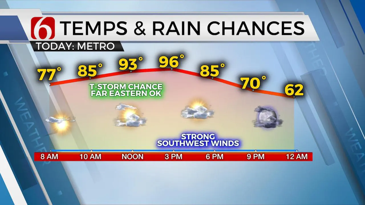
Another very warm afternoon is likely before some relief arrives Wednesday through the end of the week. Before this occurs, strong winds are likely to roll across the area later this afternoon and evening behind a dynamic storm system moving across the central U.S.

The tropical depression continues moving away from northern Arkansas this morning and will accelerate into the Midwest as a powerful upper trough swings out of the Rockies into the central plains. This trough will bring severe weather threats this afternoon to northeastern Kansas and some locations across the Midwest as both the trough and the tropical depression eject away from the southern plains. This same upper trough will bring very dynamic conditions across the state today.

A 992 mb surface low will crank out across southcentral Kansas by early afternoon and drive a pacific cold front-dry line across the state from the west to east by early afternoon. Southwest winds ahead of this feature will act to push most available moisture east before any significant showers or storms can develop but I’ll keep a very low probability across extreme northeastern OK and southeastern Kansas just in case one or two storms fire up.
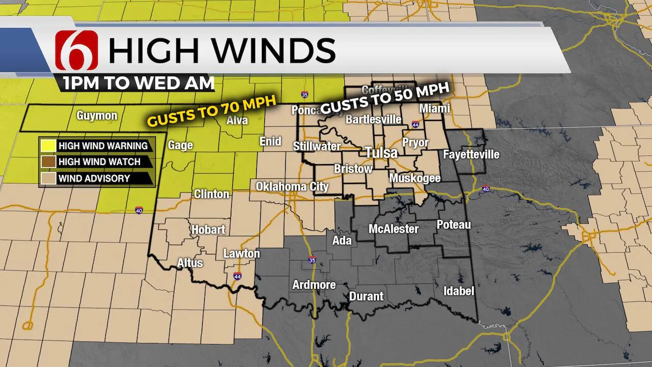
As the dryline-cold front moves over the state, much drier air will also quickly move from the west to east. Dew points will drop from the lower 70s into the 40s. Humidity values this afternoon will drop behind the front. The strong low-pressure area will also bring strong winds across the area this afternoon and tonight with speeds from 30 to 50 mph. Stronger gusts are possible along and west of I-35 where the fire danger will quickly ramp-up this afternoon. Western OK is extremely dry, and I anticipate a layer of dust that could be arriving near the metro around sunset tonight.

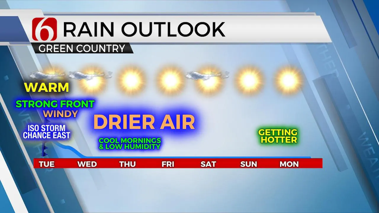
The good news from all of this will be pleasant weather Wednesday and Thursday with much lower humidity, plenty of sunshine and highs Wednesday in the lower 80s. Morning lows both Wednesday and Thursday will start in the 50s to near 60. Most data continue supporting the lower humidity values sticking around for most of the approaching weekend.
I’ll stick the EURO solution regarding the strength and position of the mid-level ridge. This means our forecast will remain dry for the remainder of the 7-day period along with increasing heat into early next week.
Thanks for reading the Tuesday morning weather discussion and blog.
Have a super great day!
Alan Crone
More Like This
June 9th, 2020
August 8th, 2023
July 4th, 2023
May 8th, 2023
Top Headlines
December 11th, 2024
December 11th, 2024
December 11th, 2024
December 11th, 2024


