Few Showers, High Heat Index For Tuesday
Once again, we're dealing with a few spotty showers this morning as a weak wave moves from the west to east across the area.Tuesday, July 14th 2020, 8:06 am
TULSA, Okla. -
Once again, we're dealing with a few spotty showers this morning as a weak wave moves from the west to east across the area.
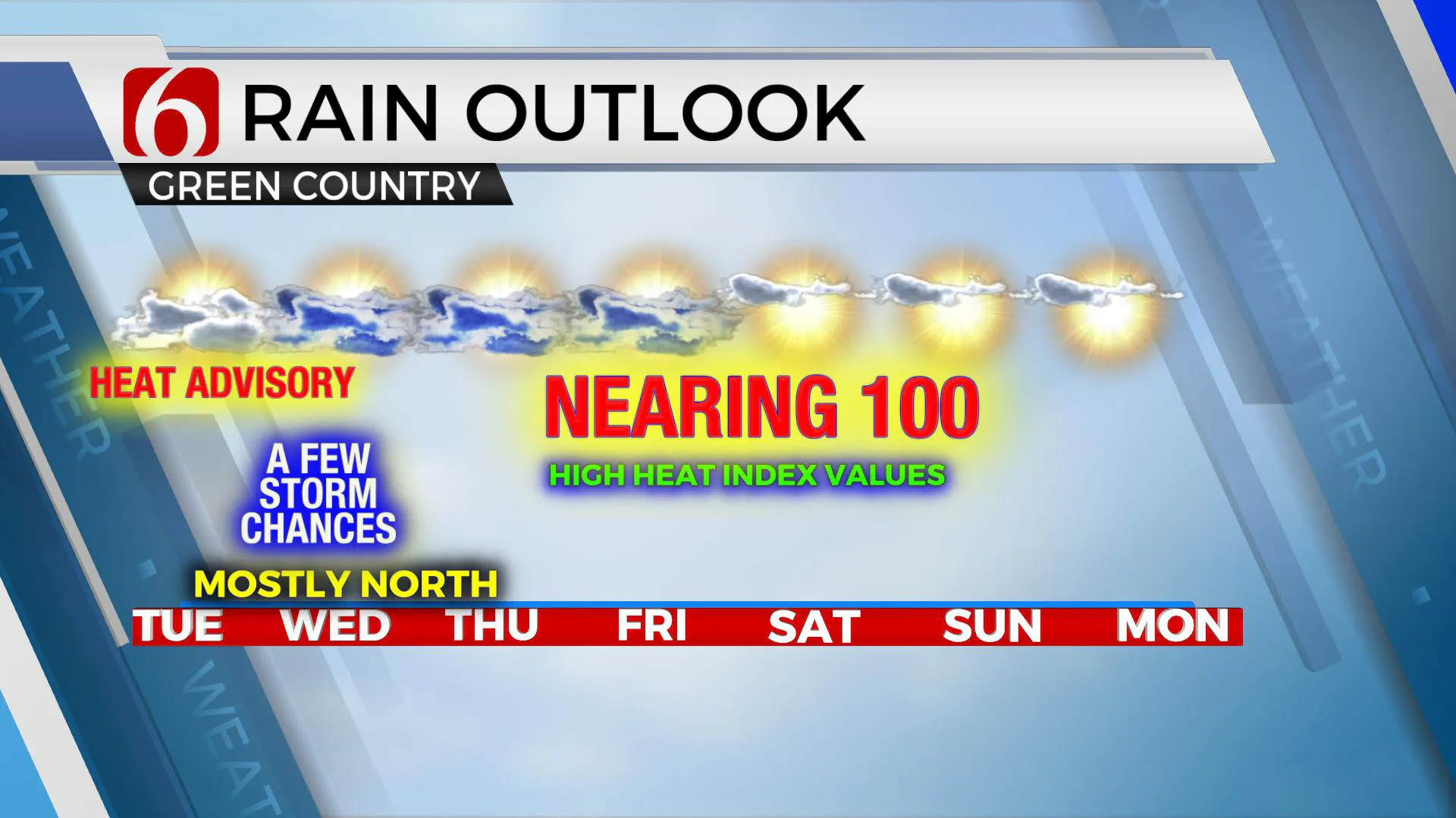
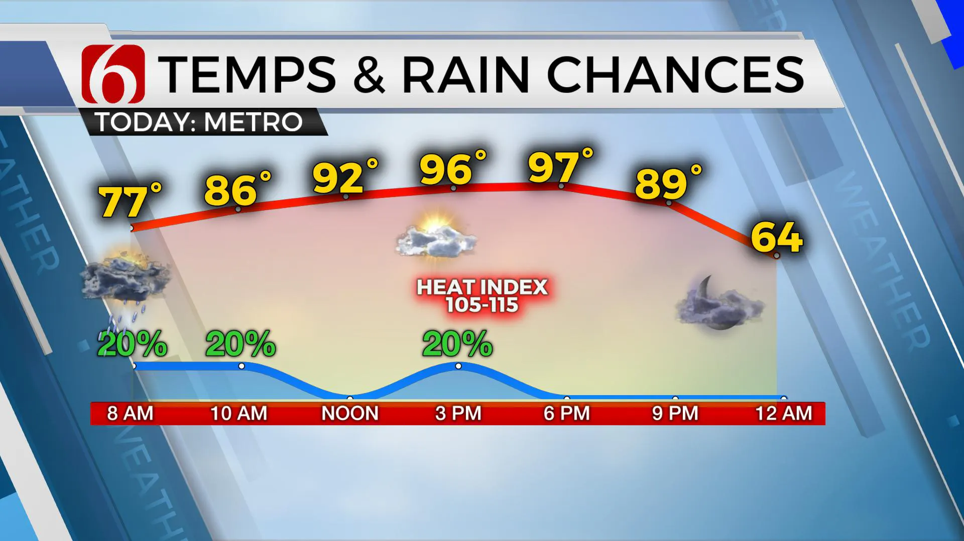
Unlike yesterday, forcing for this system is much weaker but a few showers will remain possible.Later this afternoon one or two isolated storms will be possible, but the main issue will be the heat and humidity.Highs will reach the upper 90s near Tulsa along with south winds from 15 to 25 mph with increasing heat stress through the afternoon. No major relief from the heat or humidity will occur for the next few days.

A heat advisory has been posted for most of eastern OK with heat index values anywhere from 105 to 115 this afternoon. Actual temps may stay in the mid to upper 90s with south winds from 15 to 25 mph and partly sunny conditions later this afternoon. The main synoptic pattern for the southern plains has not changed much as the ridge of high pressure simply has not expanded far enough north to keep precipitation chances out of the forecast.
Stronger forcing will arrive later tonight into Wednesday along the northern edge of the ridge with storms likely across the central plains. A few of these will brush southern Kansas and extreme northern OK late tonight into Wednesday morning as a weak boundary also attempts to sag southward into part of the state. This boundary should stay near or northwest of the metro Wednesday but may take the temps down a few degrees shy of 100 with a few additional storms near or north of the front. Many times, in this pattern, moisture will pool along and south of the boundary.This would greatly enhance the heat index values Wednesday across the southern sections of the area.

Plus, recent rainfall has given our vegetation a good drink with some additional greening and growing underway. This process will also pump moisture into the lower levels of the atmosphere with evapotranspiration and heat stress will continue. The boundary will either become diffuse or lift northward late Wednesday night into Thursday morning as the mid-level ridge once again attempts to expand northward taking the zonal flow slightly north of the state line region.Stronger forcing aloft may swing across the central plains with some strong to severe storms near or
north of the state line Wednesday evening into early Thursday morning but this activity would also quickly exit the region.
Friday through the weekend the ridge should be centered far enough north to keep precipitation chances out of the forecast except for extreme east-central OK and Western Arkansas.This weekend’s high will be near 100 or slightly below with high heat index values persisting.
Thanks for reading the Tuesday morning weather discussion and blog.
Have a super great day!
More Like This
July 14th, 2020
August 8th, 2023
July 4th, 2023
May 8th, 2023
Top Headlines
December 14th, 2024
December 14th, 2024
December 14th, 2024
December 14th, 2024


