Lower Heat Continues With Few Showers For Wednesday
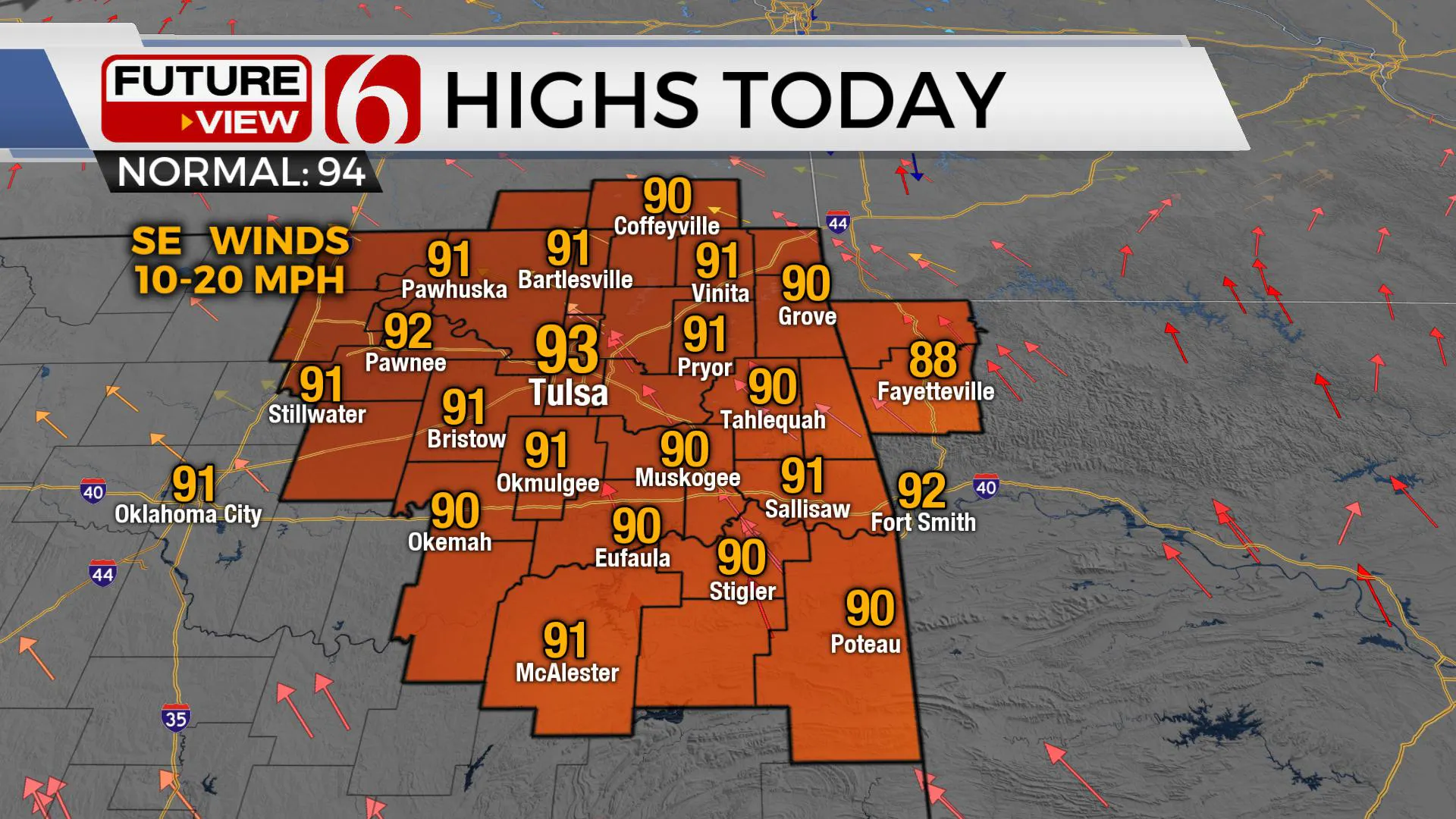
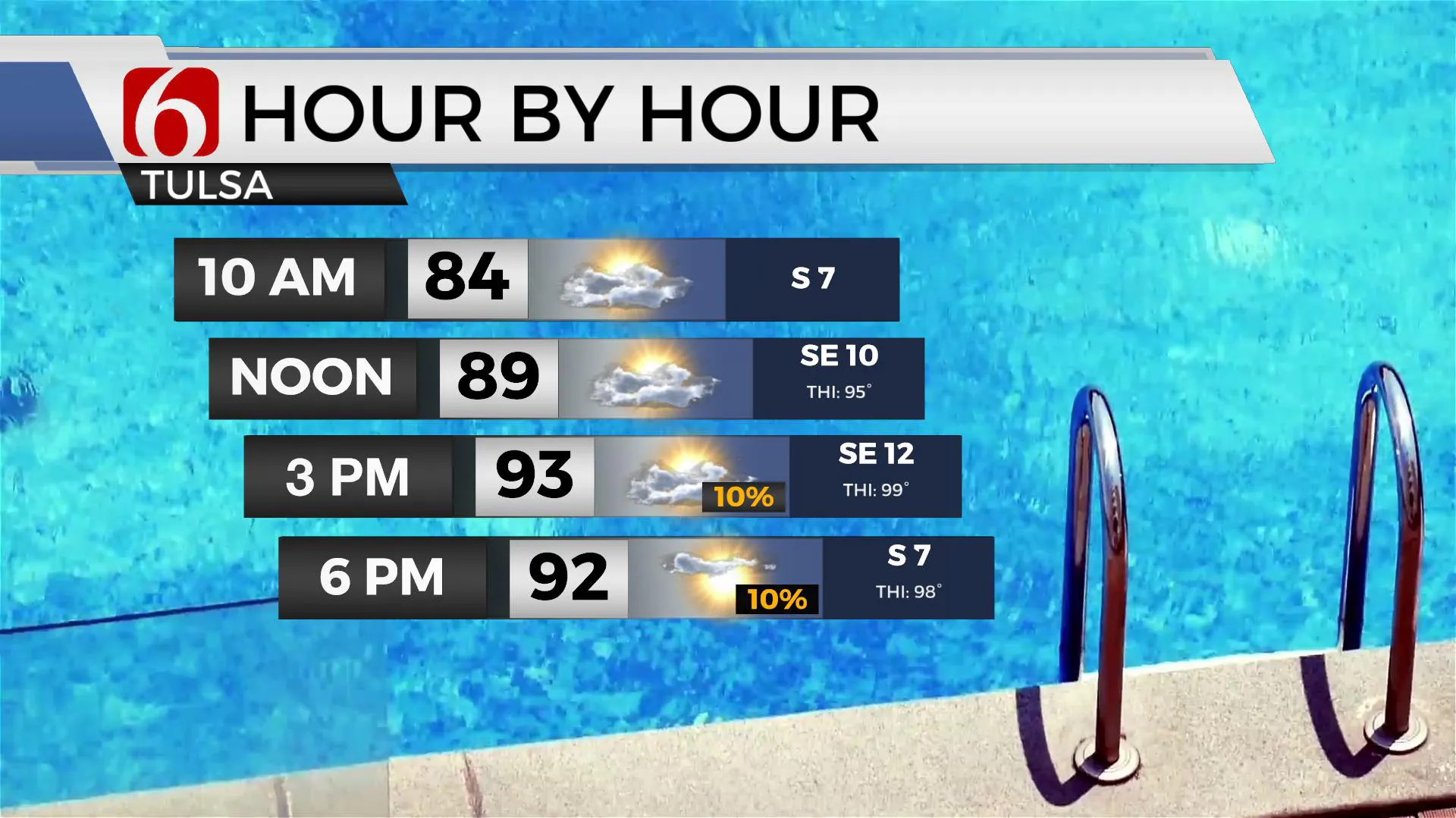
Day three of some “not as hot and muggy weather” for northeastern Oklahoma. Highs this afternoon will stay in the lower 90s with heat index values nearing 97 to 102.Wednesday, July 22nd 2020, 7:31 am
TULSA, Okla. -
Day three of some “not as hot and muggy weather” for northeastern Oklahoma. Highs this afternoon will stay in the lower 90s with heat index values nearing 97 to 102.
A few scattered showers and storms will remain for part, but not all the area today, as deeper moisture arrives from the south. A slightly better coverage of storms will stay across the southern third of the area. Just like yesterday, we must keep some pops for the Tulsa metro, but the chance will remain low. This same pattern presents yet another window for a few storms Thursday with a slightly better coverage before the storm chances dry-out and the temperatures slowly heat up.

Humidity values this weekend may also near heat advisory criteria, with heat indices near or slightly above 105.
The stalled boundary to our north is starting to slowly become diffuse. This boundary doesn’t appear to be a big player for our area for the rest of the forecast period but did provide a focus for some overnight rainfall. Some very local downpours resulted in high amounts.
A small wave across south Texas is pulling moisture up from the Gulf, and this surge of moisture may provide us with a few additional storms later today and even Thursday. Water values in the atmosphere would support pockets of moderate to heavy rainfall for those receiving storms. At times, wet microbursts can cause damaging winds in localized areas, but this threat is very low for the next two days.

The mid-level ridge of high pressure is currently centered southeast of northern OK but will begin expanding northwest soon. A developing tropical wave along the Texas Gulf Coastal region will become more prominent in the next 36 hours and eventually may block the deeper moisture flow from the Gulf into northeastern OK Friday and part of Saturday. This makes me question my heat index forecast for the weekend, but at this point, will keep these values near 105. As all of this occurs, the small window of zonal type flow will be pushed more northward into the central and northern plains as warm and mostly dry weather returns across most of eastern OK Friday through the weekend. The only chance for a storm or two this weekend should be around Sequoyah County eastward into western Arkansas.
This ridge may also weaken again next week allowing another boundary approaching northern OK Tuesday with a few additional storms, yet the data remains split. The EURO retros the ridge and allows a boundary all the way into southern OK. The GFS keeps this front well north. Climo would suggest the GFS gets the chicken dinner. We’ll intro a slight chance of a storm Tuesday but also keep the winds from the south. A compromise.
Thanks for reading the Wednesday morning weather discussion and blog.
Have a super great day!
More Like This
July 22nd, 2020
August 8th, 2023
July 4th, 2023
May 8th, 2023
Top Headlines
December 12th, 2024
December 12th, 2024
December 12th, 2024


