Typical Summer Pattern Sets In For Weekend
Looks like we're heading into the weekend with mostly dry and humid weather for most locations after a few isolated storms today.Friday, July 24th 2020, 8:24 am
TULSA, Okla. -
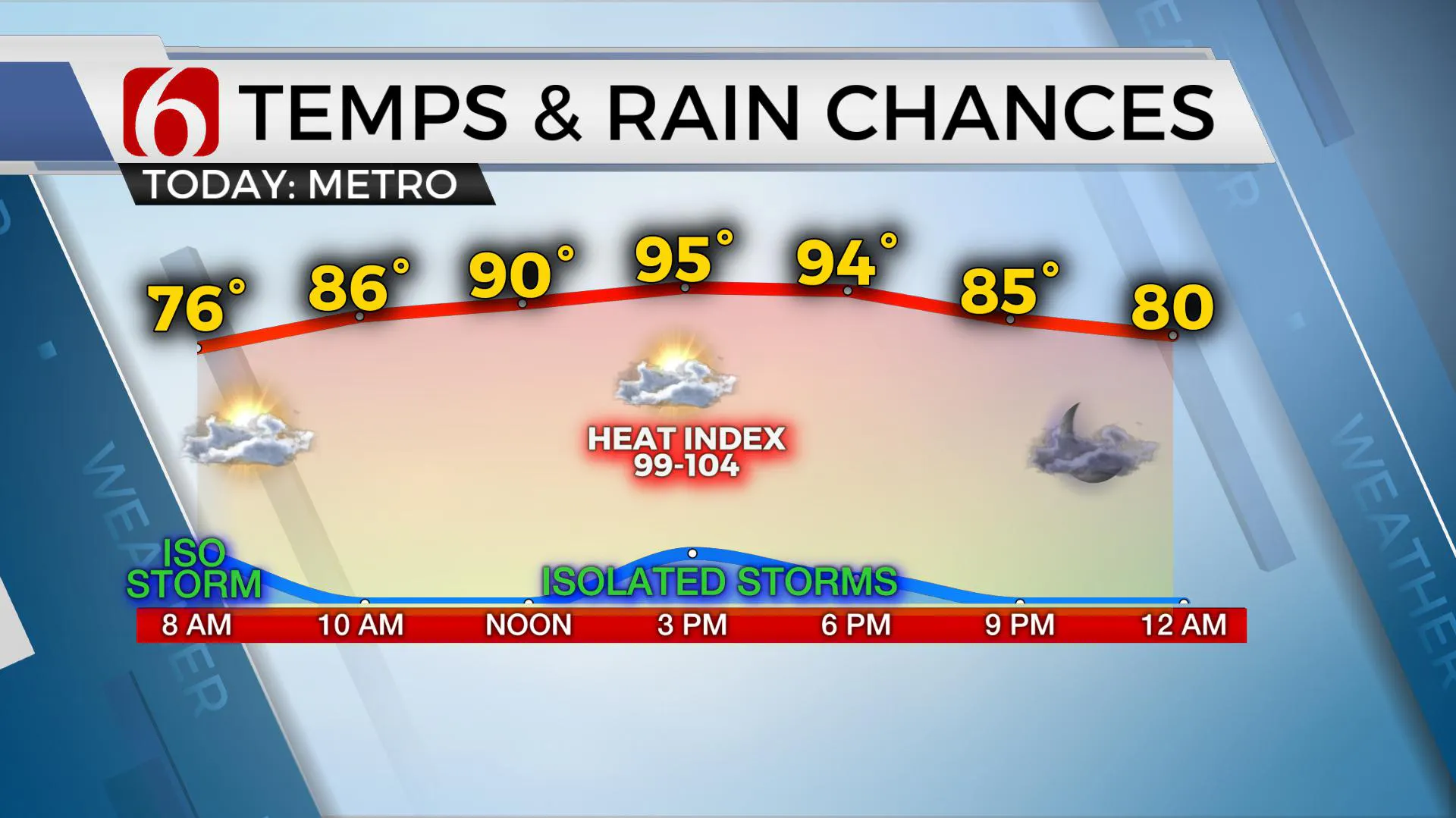
Looks like we're heading into the weekend with mostly dry and humid weather for most locations after a few isolated storms today.
The mid-level ridge of high pressure, centered to our southeast, will soon expand.
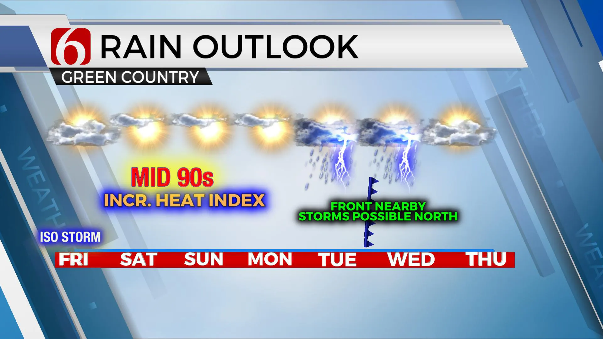
The net-impact will be to increase the temps a few degrees, shut-down most of the storm chances, and add to increasing heat index values for the next few days. Just as the pattern appears to become more like late July, the data continue suggesting the ridge will move west early next week allowing another period of northwest flow aloft to influence eastern OK.

This will bring additional storm chances nearby Tuesday and Wednesday along with another reduction in temperature. Most data also suggest this pattern may last into the first week of August, which would be highly unusual.
We'll keep low chances for a few storms today before the ridge expands across all the area. At this point, a few storms will be possible along or northwest of the metro this morning through midday, mostly along the I-35 corridor. This weekend, any storm activity would be highly isolated, and mostly across extreme east-central OK or western Arkansas.
I’m not sold on the EURO solution for next week. The data has been overly aggressive with most features the past month, but depicts a strong front nearing the area Monday evening into Tuesday with a modest reduction in temps and more convective potential.

The GFS offers this boundary nearing northern OK, stalling and moving northward Wednesday. This would be more believable for late July. But it’s 2020. Seems like anything can happen at this point! I’ll keep some pops for Monday night into Tuesday along with a minor reduction in temps. Once we get into next week, we’ll have a better confidence of the data.
We’re also tracking Tropical Storm Hanna in the Gulf, Hurricane Douglas in the Pacific, and soon to be hurricane Gonzalo in the Atlantic. Another wave has ejected off the African coastal region and may gain intensity in the next few days.
Thanks for reading the Friday morning weather discussion and blog.
Have a super great day!
More Like This
July 24th, 2020
August 8th, 2023
July 4th, 2023
May 8th, 2023
Top Headlines
December 11th, 2024
December 11th, 2024
December 11th, 2024
December 11th, 2024


