Warm, Muggy Weather Returns To Northeastern Oklahoma
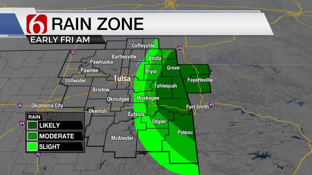
Our complex of storms this morning is located to the east of the metro and more focused closer to the Oklahoma and Arkansas state line region. A few of these storms have been severe again this morning with hail and damaging winds but heavy rainfall has been the main threat.Friday, August 14th 2020, 6:25 am
Our complex of storms this morning is located to the east of the metro and more focused closer to the Oklahoma and Arkansas state line region. A few of these storms have been severe again this morning with hail and damaging winds but heavy rainfall has been the main threat. A flash flood watch remains for the early morning hours across a small area of east-central Oklahoma where 2 to 6 inches of rainfall will be possible.

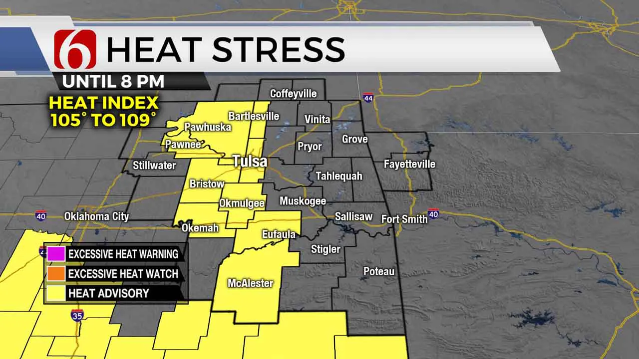
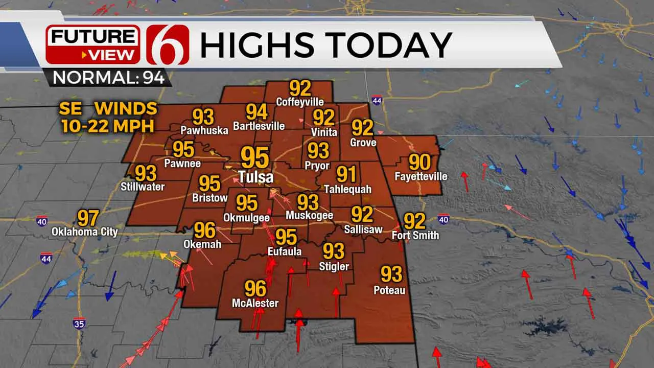
Storms should continue moving southeast away from the area through the morning hours with another warm-up quickly this morning as temps reach the lower to mid-90s this afternoon. Heat index values nearing 105 to 109 will remain likely southwest of the Tulsa area and heat advisories will be required for some locations. Warm and muggy weather will remain Saturday before a strong front approaches the state Sunday with a slight chance of storms followed by a noticeable reduction in both heat and humidity early next week. Daytime highs will stay in the 80s with much dryer air for a few days allowing morning lows starting in the 60s.

Extremely heavy rainfall has been ongoing this morning in those areas mostly east of the metro, where rainfall rates from 2 to 3 inches per hour have been common. A few cells have attempted to fire closer to the metro early this morning but most of the concentrated areas have remained to the east. Our window for precipitation will not last long this morning but extremely heavy rainfall will be possible in and near the flash flood watch area.
Later tonight, a wind shift associated with a pre-frontal trough will arrive across southeastern Kansas and far northern OK through early Saturday morning. A small cluster of storms will move from the central plains southward and may approach the OK-Kansas state line region pre-dawn tomorrow. This activity is not expected to survive into the metro Saturday morning.

While the initial wind shift from the north arrives Saturday, warm and muggy weather will remain with highs in the lower 90s and dew points in the 70s. Heat index values nearing 105 will remain likely. Much drier air will arrive Saturday night into Sunday morning bringing some relief from the muggy weather Sunday into several days next week. A few storms will be likely Sunday across southern OK, but should remain removed from our northeastern sections. Our lows will drop into the 60s early next week with daytime highs only in the mid to upper 80s. Northeast winds will reside across northeastern OK through the first half of the week before returning from the southeast by Thursday.
Thanks for reading the Friday morning weather discussion and blog.
Have a super great day!
Alan Crone
More Like This
August 14th, 2020
August 8th, 2023
July 4th, 2023
May 8th, 2023
Top Headlines
December 14th, 2024
December 14th, 2024
December 14th, 2024
December 14th, 2024


