Slow Warm-Up Into Next Week For Northeastern Oklahoma
Day Five of this wonderful weather pattern continues. South winds returned yesterday across most of northeastern Oklahoma, but we continue to forecast no major increase in low level moisture or heat index values today or this weekend.Friday, August 21st 2020, 6:32 am
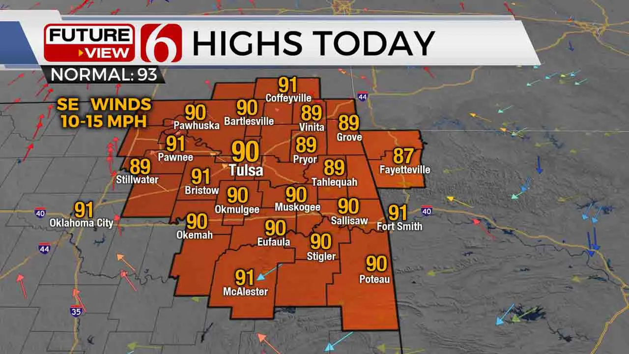
Day Five of this wonderful weather pattern continues. South winds returned yesterday across most of northeastern Oklahoma, but we continue to forecast no major increase in low level moisture or heat index values today or this weekend. Most data will suppress significant moisture to the southeast of the state until the middle of next week when dew points in the lower 70s will approach the eastern third of the state. Temperatures, however, will continue to slowly increase this weekend into early next week with highs reaching the lower 90s. Morning lows next week will start in the lower 70s. We see no major storm systems at this point for eastern sections of the state, but the pattern may bring a few showers near or west of the area today through Saturday morning.

The main upper level pattern hasn’t changed significantly compared to earlier this week. The mid-level ridge of high pressure is across the western third of the nation while a trough remains to our east. Most of eastern Oklahoma will remain between these two features keeping our weather relatively mild and uneventful. This ridge may expand slightly to the east later this weekend but remain mostly west of the region. The trough will continue to move eastward across the far northeastern U.S. and while another trough dives down the central plains. At this point, we continue to keep the forecast mostly dry, and void from any talk of any major storm systems nearing the state. There will be some spotty showers today slightly west of our immediate areas and a few showers extending into pre-dawn tomorrow along the I-35 region. As I have posted numerous times, this upper flow can be tricky and allow for a few surprise showers. I do have a slight chance today through early tomorrow for locations well west of the metro, but the chance remains near and less than 20%.

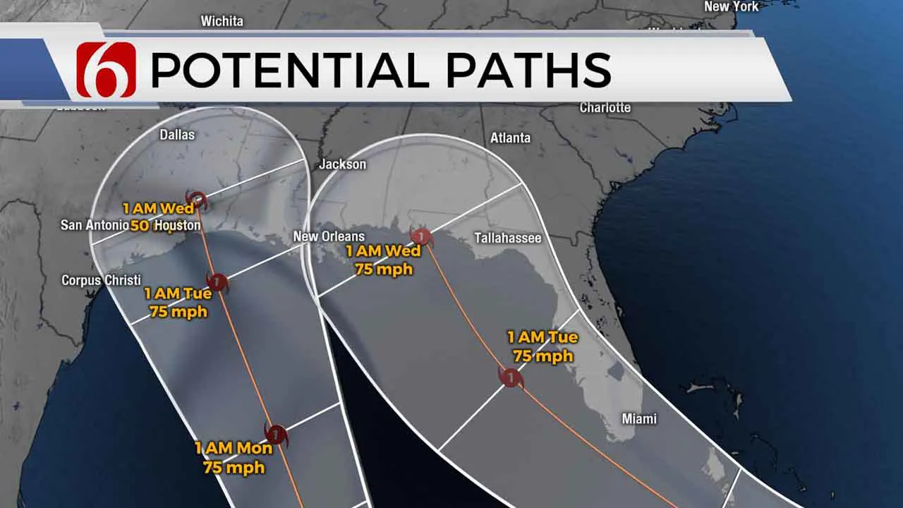
The tropical development this morning focuses on two systems, one in the Caribbean and the other in the Atlantic. Both systems may be impacting part of the United States next week. Official NHC forecast tracks bring two hurricanes into the Gulf. The remnant of what is currently identified as tropical depression 14 could have an impact across part of north Texas and eastern OK by Wednesday as the moisture moves near the region. Again, this would be either in remnant form or possibly just tropical moisture. We have included a low probability for showers or storms Wednesday and Thursday based on this scenario. The next two names on the list will be Laura and Marco. The first system to develop defined tropical storm status will become Laura and the 2nd Marco.
Thanks for reading the Friday morning weather discussion and blog.
Have a super great day!
Alan Crone
More Like This
August 21st, 2020
August 8th, 2023
July 4th, 2023
May 8th, 2023
Top Headlines
December 11th, 2024
December 11th, 2024
December 11th, 2024
December 11th, 2024


