Passing Showers Before Hot, Dry Weather Returns To Northeastern Oklahoma
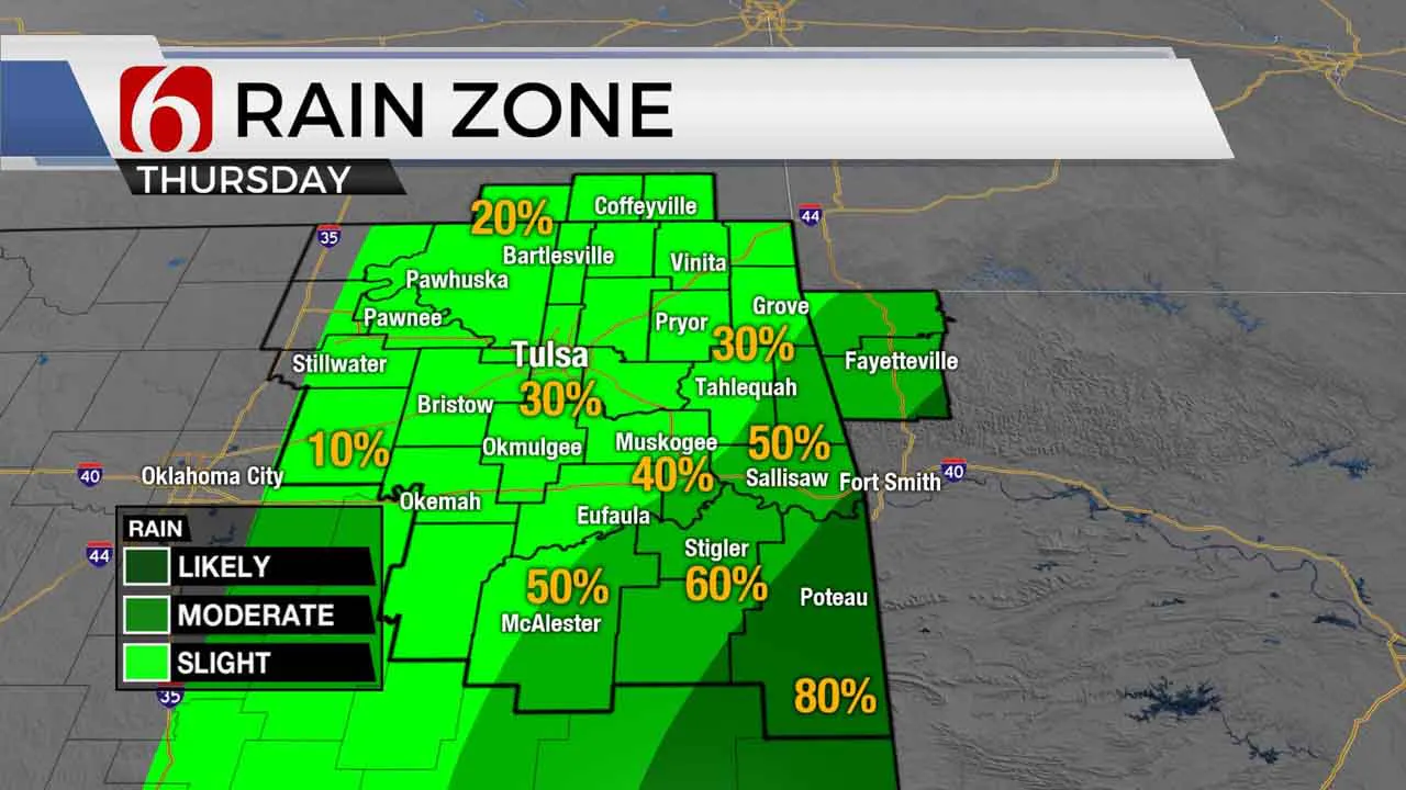
A few passing showers or storms will be possible across northeastern Oklahoma today, but the main impacts of Hurricane Laura will remain well to the southeast of our main area of concern.Thursday, August 27th 2020, 8:22 am
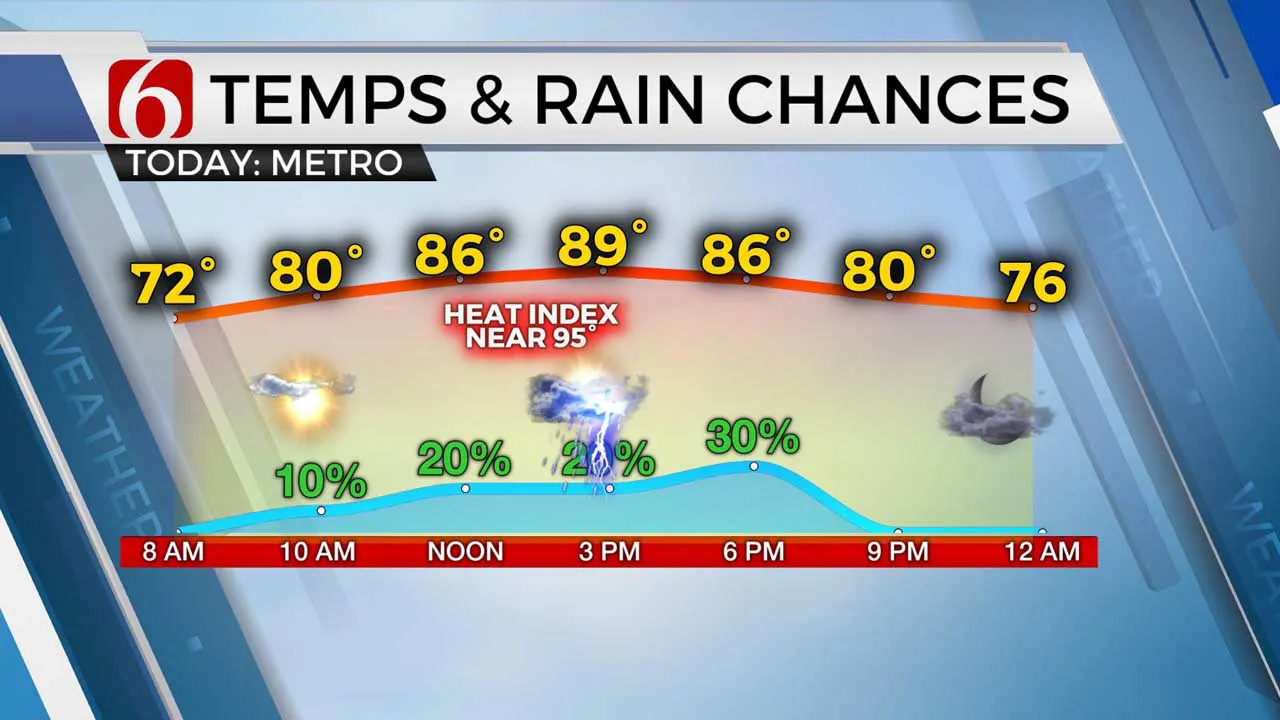
A few passing showers or storms will be possible across northeastern Oklahoma today, but the main impacts of Hurricane Laura will remain well to the southeast of our main area of concern. Highs this afternoon will reach the mid to upper 80s along with heat index values in the mid-90s. Locally rain-cooled air will be possible by the afternoon in some locations. Hot and dry weather is likely Friday before a series of storm systems will bring storm chances back across the state late this weekend into next week.

Hurricane Laura made landfall earlier this morning along the southern Louisiana coastline as a major category four hurricane. A life-threatening storm surge of 10 to 15 feet has inundated low lying areas of southwestern Louisiana with catastrophic flooding underway along with extremely high winds surrounding the center of the storm. This historic hurricane will continue moving northward through the day, approaching Shreveport by early afternoon as a strong tropical storm. Based on current trajectory, the Tulsa metro will remain with a passing shower or storm chance but locations across southeastern OK into the OK-Arkansas state line region will experience heavy rainfall and gusty winds. Highs this afternoon will stay in the mid-80s across the far eastern sections with the metro nearing 89. This system will exit our areas of concern shortly after midnight with improving weather Friday and most of Saturday. A pocket of dry air Friday may allow daytime highs to reach the mid and upper 90s with mostly sunny conditions. We’re tracking at least two fronts that will near the state beginning this weekend into early next week bringing some rain and thunder chances to part of northern Oklahoma.

The data has been inconsistent on some important features, but we’re continuing with probabilities beginning Saturday evening through Sunday morning for a few thunderstorms, and then Monday evening into Tuesday morning. For several days model data has hinted at a strong front moving across the area either Tuesday or Wednesday. But the lack of run to run consistency leads to a low confidence forecast regarding the magnitude of the cool-down. Earlier model runs suggested highs Tuesday or Wednesday would drop into the 70s. We’re not ready to place those numbers on the big map at this point, but its possible we’ll be experiencing at least a day or two of “not as hot” air next week. A much stronger looking upper level system may also near the area by the middle to end of next week bringing a much strong front through the state. Fall is not too far away.
Temperatures this weekend will stay in the lower 90s Saturday and Sunday and the upper 80s early next week. Low level moisture will remain pooling near the area with heat index values in the mid to upper 90s.
Thanks for reading the Thursday morning weather discussion and blog.
Have a super great day!
Alan Crone
More Like This
August 27th, 2020
August 8th, 2023
July 4th, 2023
May 8th, 2023
Top Headlines
December 11th, 2024
December 11th, 2024
December 11th, 2024
December 11th, 2024


