Rain Chances Continue For Tuesday
Moisture from Tropical Storm Beta is now moving northward into southern and eastern Oklahoma this morning.Tuesday, September 22nd 2020, 6:35 am
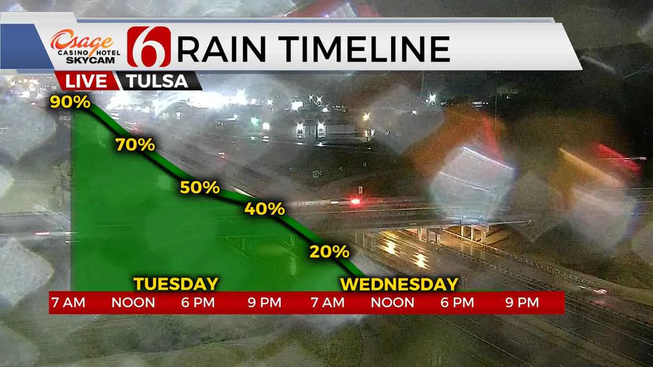
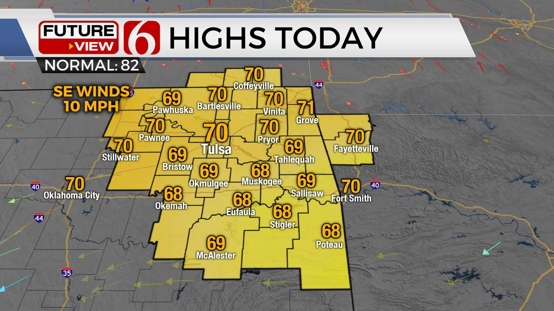
Moisture from Tropical Storm Beta is now moving northward into southern and eastern Oklahoma this morning. We’ll continue to see rain chances for the metro this morning through midday. Pockets of locally moderate to heavy rainfall will be possible, but mostly across the southern third of the area. The additional cloud cover combined with some rain cooled air will keep us today only in the upper 60s to lower 70s. A nice taste of fall weather is expected today and tomorrow and just in time: The Autumnal equinox is this morning.
 Image Provided By: Alan Crone
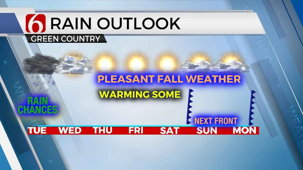
Once we see the moisture from Beta moving eastward early Wednesday morning tomorrow afternoon may continue to feature mostly cloudy and cool weather with highs in the lower 70s. But Thursday afternoon through Saturday should support slowly increasing temps along with more sunshine and dry conditions with lows in the upper 50s to lower 60s and highs reaching the lower to mid-80s.
The main upper air flow is characterized by a strong northern jet positioned across the far northern sections of the nation extending into the upper Midwest and southern Canadian region. The stronger upper air flow will remain north of the state, but a weak upper disturbance is likely to develop across eastern OK or western Arkansas later today due to interactions from Beta to the south and a small short wave north. This feature will get a little stronger Wednesday evening into Thursday but should be positioned to our east across the southern Missouri Valley region. Saturday night into Sunday morning another stronger disturbance in the northern stream will drag a trough across the state. Its this feature that will bring the next front across our area Sunday morning before either stalling or retreating north before a stronger front arrives late Monday night into Tuesday. At this point, the upper air flow will be transitioning with a deep trough located across the Great Lakes and a northwest flow regime moving across the central plains. This will bring some fall like temps into the state next week.
This weekend should be fine regardi Image Provided By: Alan Croneng weather for most locations, but the cold front will near the state sometime Saturday night or Sunday morning. The data is not consistent about the frontal passage, but our forecast will keep a small window for a few storms Sunday morning. Saturdays highs should reach the mid-80s while Sundays readings may drop into the upper 70s or lower 80s.
 Image Provided By: Alan Crone
Thanks for reading the Tuesday morning weather discussion and blog.
Have a super great day!
Alan Crone
KOTV
More Like This
September 22nd, 2020
August 8th, 2023
July 4th, 2023
May 8th, 2023
Top Headlines
December 14th, 2024
December 14th, 2024
December 14th, 2024
December 14th, 2024


