Warmer Weather Making Its Way Back To The State
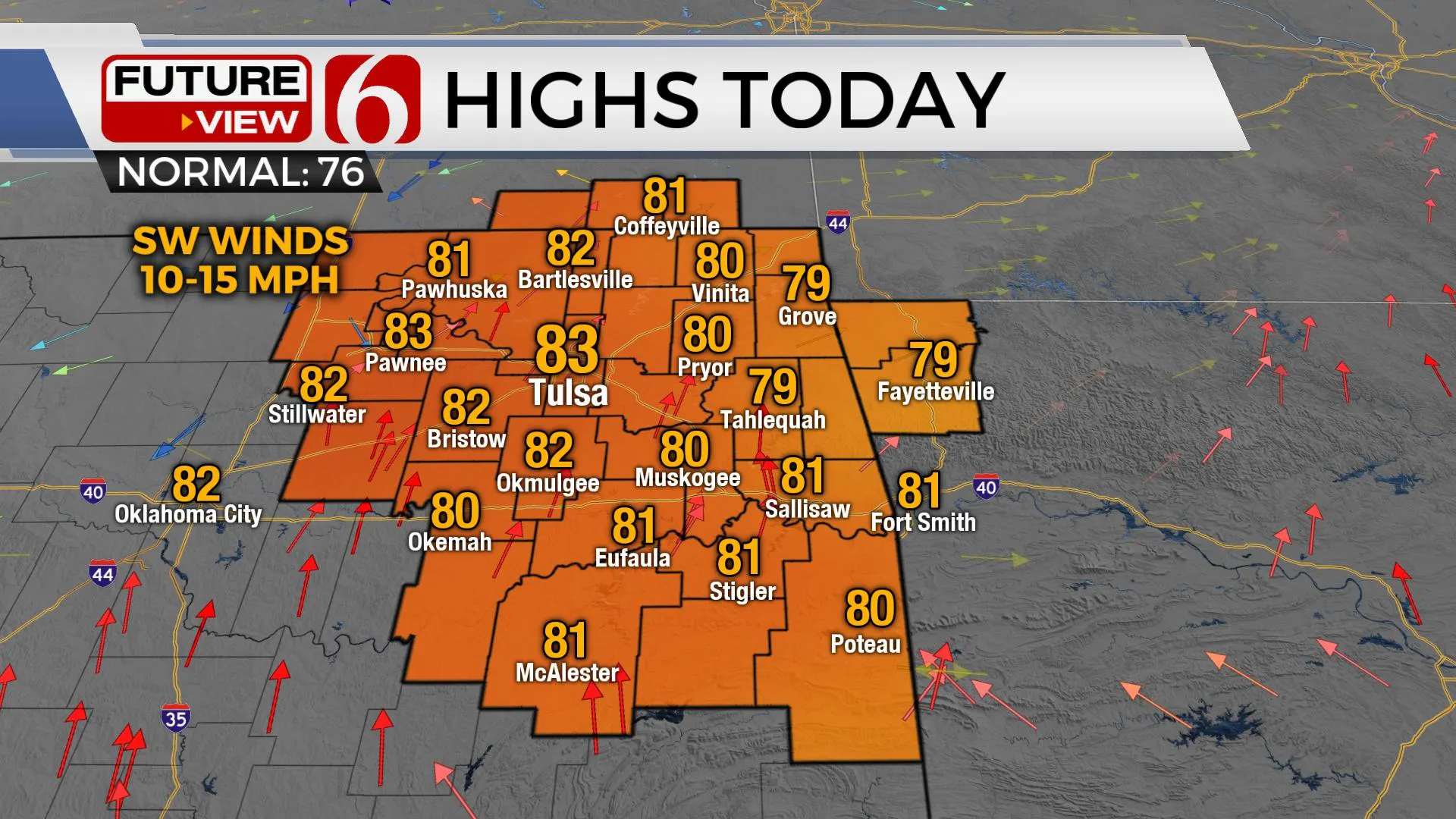
Not a lot of change compared to yesterday’s update. The mid-level ridge of high pressure that’s been west of the state for the past few weeks will slowly expand eastward. This will bring warmer weather back across most of the state with lower 80s today and near 90 Wednesday from Tulsa west.Tuesday, October 6th 2020, 6:24 am
Not a lot of change compared to yesterday’s update. The mid-level ridge of high pressure that’s been west of the state for the past few weeks will slowly expand eastward. This will bring warmer weather back across most of the state with lower 80s today and near 90 Wednesday from Tulsa west. This pattern of warmer weather will remain for the entire week with morning lows mostly in the lower 60s Thursday and Friday and highs in the mid-80s. A weak front arrives today across northwestern OK before becoming diffuse with no sensible weather impacts.
 Image Provided By: Alan Crone
The upper air pattern will continue to change. A broadscale trough will be developing across the Pacific soon and will advance eastward into the western U.S. Friday into the weekend. This brings a chance for some much-needed relief into part of California and the pacific northwest with some spotty rain and cooler weather. This trough will advance eastward, nearing the Rockies Sunday with pressure falls across the southern plains. Strong south winds are likely Sunday with 20 to 30 mph gusts and highs reaching the upper 80s. Either Monday or Tuesday this trough will eject into the central plains and shove a pacific front across the state bringing a return of seasonal fall weather to Eastern Oklahoma. Rain chances will remain very low as most data support low level moisture being shoved eastward in advance of this system.
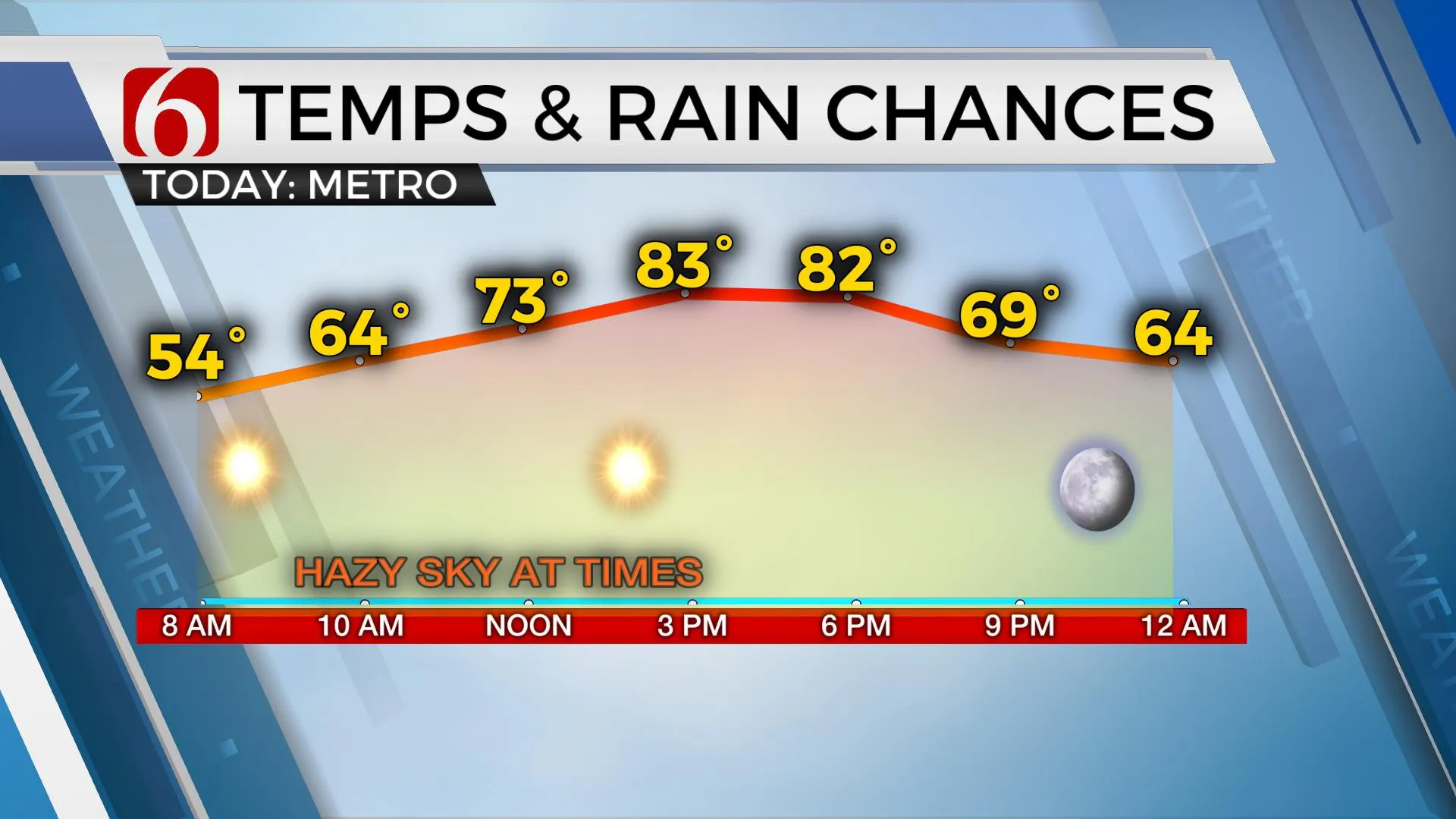
Our temps start mostly in the lower 50s this morning reaching the lower 80s this afternoon along with more sunshine and southwest winds nearing 10 to 15 mph in the metro. A weak front brings a northwest wind along and northwest of I-44 later this afternoon few hours before the boundary becomes diffuse.
 Image Provided By: Alan Crone
Delta will be a major hurricane soon with warnings up for part of the Yucatan Peninsula before emerging into the gulf as a category three or four storm. Landfall is anticipated later this week along the U.S. southern coastal regions, currently centered upon southern Louisiana. Any impacts on Oklahoma remain out of the forecast for now, but a few showers would be possible across far southeastern OK if the system moves slightly more west of the current forecast track.
Thanks for reading the Tuesday morning weather discussion and blog.
Have a super great day!
Alan Crone
KOTV
Check out my daily weather podcast.
“ Weather Out The Door” is a quick update regarding the forecast, patterns and trends for Eastern OK. You’ll find it on most podcast providers.
For Apple users: You may need to search for NewsOn6, and then load the current updated file.
https://soundcloud.com/user-884643387/weather-out-the-door-953368923
More Like This
October 6th, 2020
February 14th, 2022
January 26th, 2022
January 25th, 2022
Top Headlines
December 13th, 2024
December 13th, 2024
December 13th, 2024
December 13th, 2024


