Morning Fog With Mild Temperatures
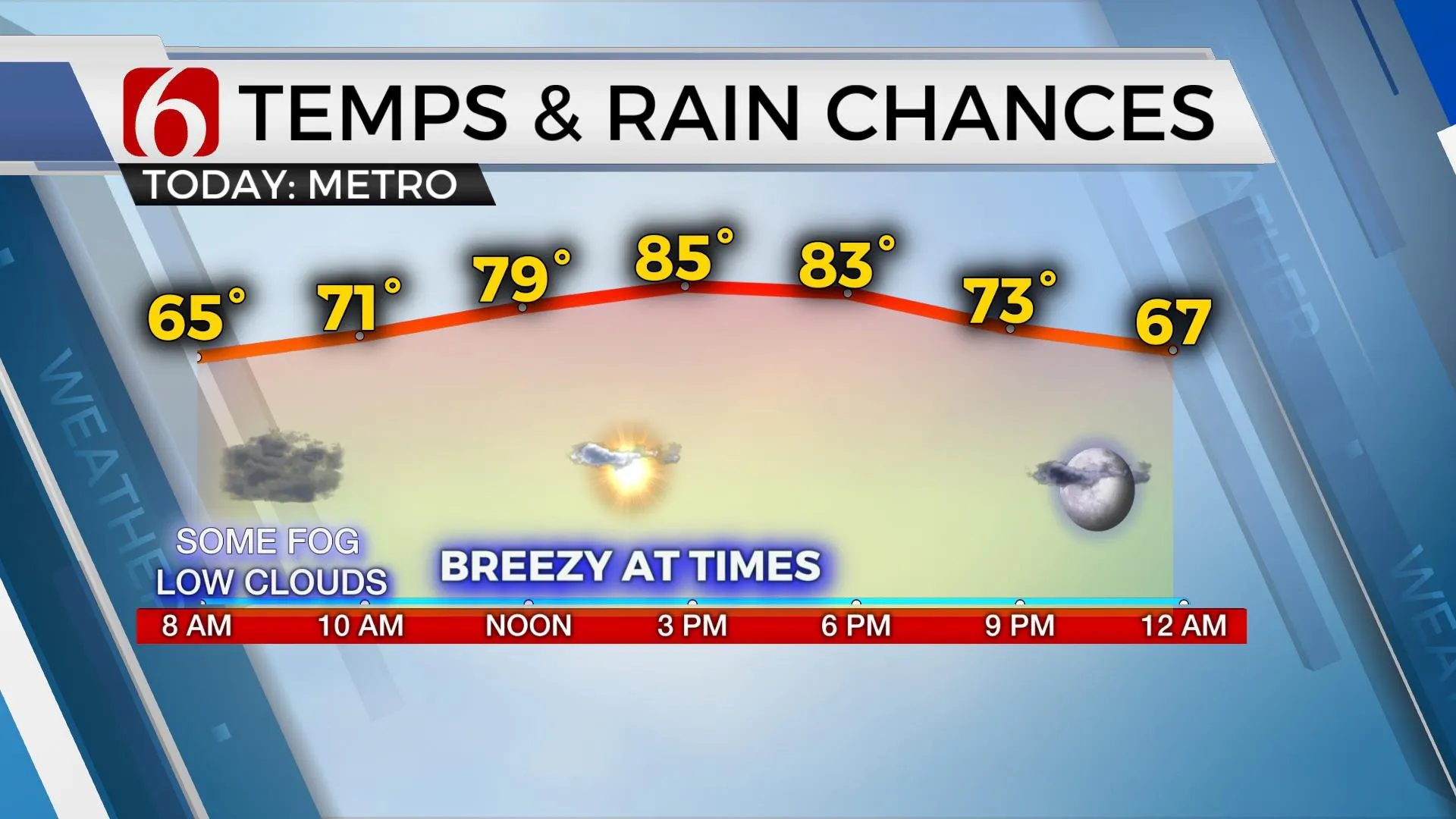
We’re tracking some clouds and fog this morning along with mild temperatures across the area. We continue with a warm forecast into the weekend before a front arrives Monday morning bringing cooler weather back to northeastern Oklahoma.Friday, October 9th 2020, 6:11 am
We’re tracking some clouds and fog this morning along with mild temperatures across the area. We continue with a warm forecast into the weekend before a front arrives Monday morning bringing cooler weather back to northeastern Oklahoma.

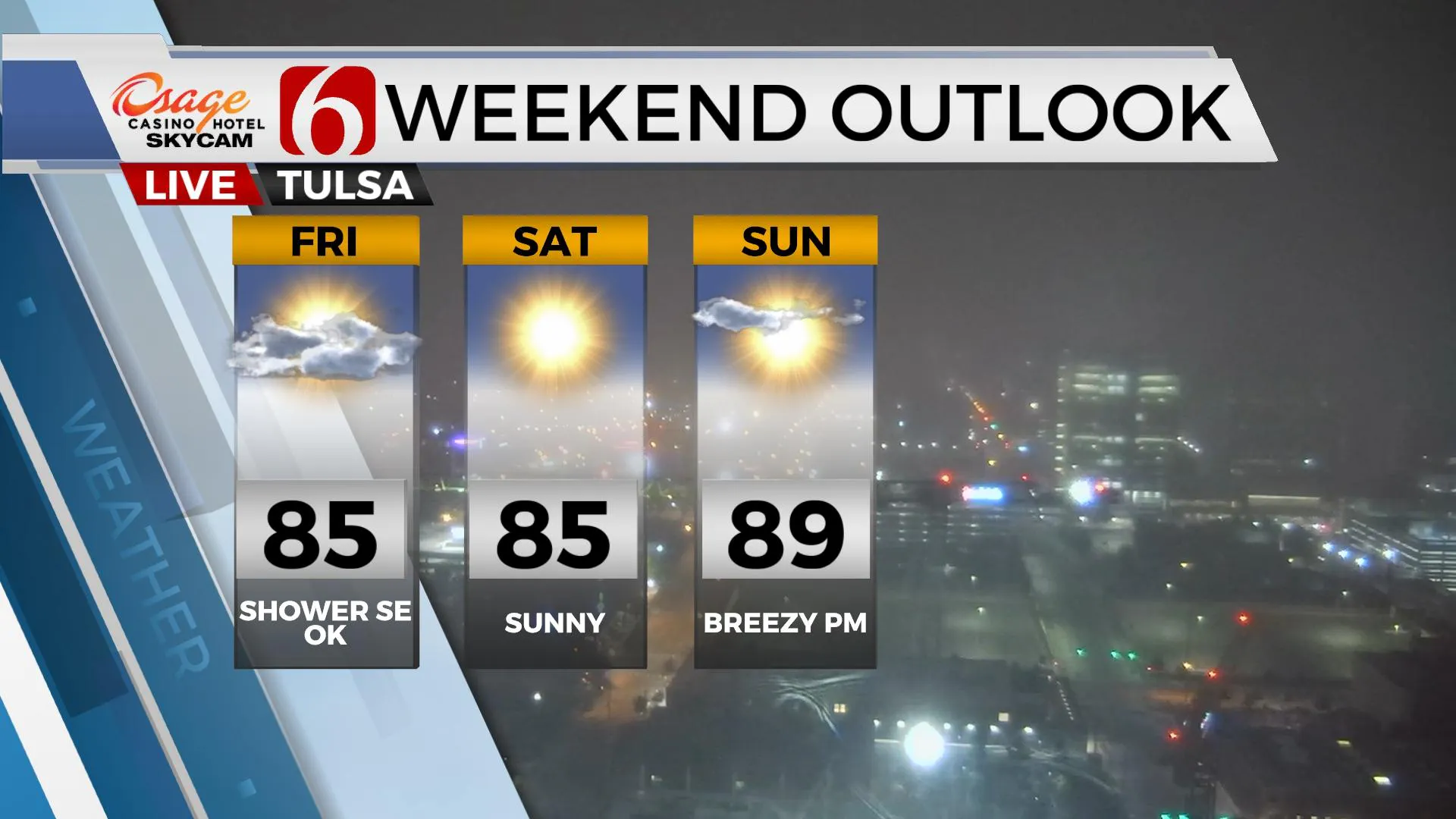
Delta will make landfall in the U.S. this evening across southern Louisiana as a very strong or major hurricane. The trajectory of the system may bring a few showers or sprinkles across extreme southeastern or far eastern OK, but model output is keeping the entire state dry. We’ll keep this very low mention for a few showers in the forecast for extreme southeastern OK. The system will bring more low clouds near Tulsa for the first half of the day. Locations along and northwest of I-44 should break-out into more sunshine later this afternoon while locations across southeastern and far eastern OK could remain mostly cloudy through the day. Temperatures near Tulsa will rebound near 84 to 86 while far southeastern OK remains in the upper 70s to lower 80s. As the storm exits the general region, northeast winds return to the metro Saturday morning through midday with highs reaching the mid-80s before south winds return Saturday evening in advance of our next upper level storm system nearing from the west. This system brings a pacific front across the state late Sunday night into Monday morning but unfortunately, rain and storm chances appear to be out of the works for northeastern OK. Gusty winds will also return behind the front Monday from 20 to 30 mph but with more fall-like temperatures early next week.
Monday should feature highs at least in the mid to upper 70 for Monday afternoon. Tuesday morning will start with lows in the upper 40s and lower 50s along with sunshine and highs nearing the upper 70s. The pattern appears to support at least two more fronts nearing the state for the 2nd half of next week that may bring even cooler, or colder air to the area. The first arrives Thursday. This should keep highs mostly in the 70s Friday and Saturday. The 2nd and stronger front will near next Sunday and could be our first strong fall cold front of the year bringing some Canadian air southward.

In the short term, precipitation remains hard to come by at this point. Any shower activity today more than likely remains well removed from the state, but we’ll keep the low chance for extreme southeastern OK just in case Delta moves more westward than anticipated. And if we don’t begin picking up some rain soon, the fire danger will continue to increase over the next two weeks. The first signal of increasing fire danger arrives Sunday with warm and breezy weather across most of the state and may continue into early next week.
Thanks for reading the Friday morning weather discussion and blog.
Have a super great day!
Alan Crone
KOTV
If you’re into podcasts, check out “Weather Out the Door” my new, daily forecast podcast updated every morning. Search for NewsOn6 on your favorite podcast provider and load the updated file, or click HERE to listen on SoundCloud.
More Like This
October 9th, 2020
December 3rd, 2024
November 28th, 2024
November 28th, 2024
Top Headlines
December 12th, 2024
December 12th, 2024
December 12th, 2024
December 12th, 2024


