Frost Advisory Across Parts Of Northeastern Oklahoma
A cool Friday before another rollercoaster ride into the weekend.Friday, October 16th 2020, 5:07 am
A cool Friday before another rollercoaster ride into the weekend.
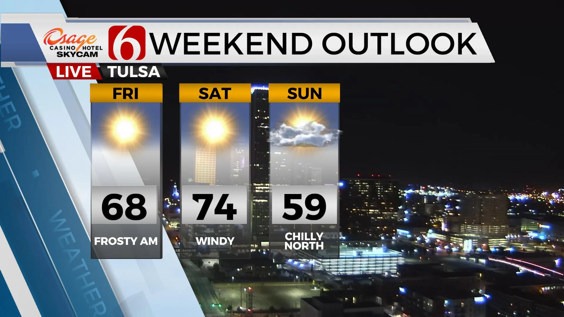
A frost advisory is underway this morning across part of northeastern OK and southern KS through 9 a.m. but some mid-level clouds have persistently been moving across northern OK overnight. This has kept temperatures up a few degrees from the previous forecast. Where the clouds have thinned at times, temps have dropped into the mid-30s with some very light patchy frost possible. Regardless, it’s a chilly start. A surface ridge of high pressure near the area this morning will move east by afternoon allowing north winds and a sunshine-cloud mix today as highs reach the mid to upper 60. South winds return later tonight and signals the return of warmer weather Saturday before our next storm system nears the state early Sunday morning. Before this occurs, gusty strong south winds will roll across the state as a strong pressure gradient develops. A high fire danger will exist Saturday due to the strong winds, dry air and drying vegetation. You should avoid outdoor burning Saturday. Sunday a strong front will attempt to move into the state by early Sunday morning that could bring a few showers along with a variation of temps depending upon your exact location. This boundary has been highly problematic in the data.

This may be a fluke, but this morning we finally have some consistency from model to model.
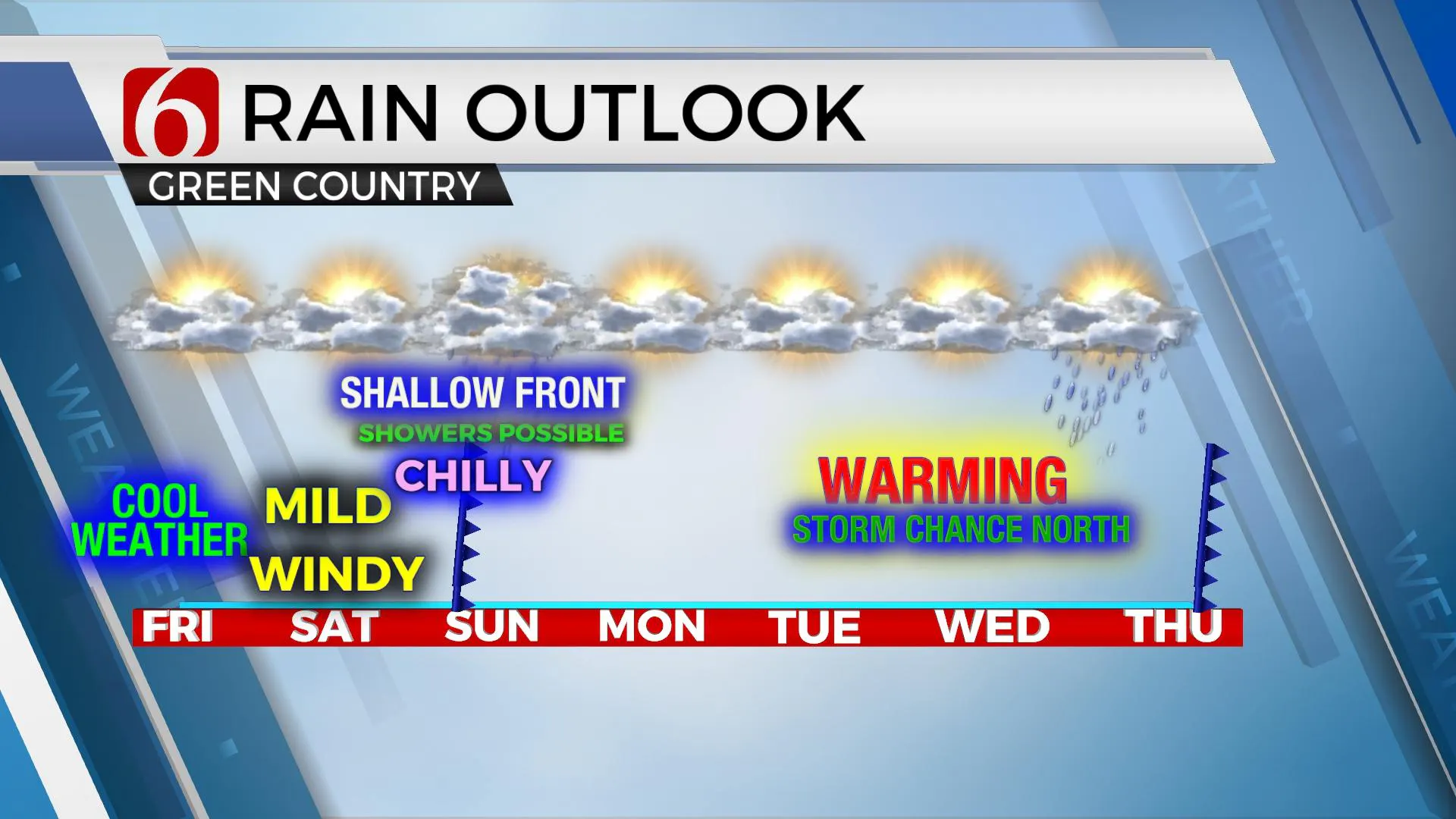
GFS-NAM-both 12 and 3k, and now EURO and GEM all bring the shallow front into the state early Sunday morning to midday with falling temps from the 60s into the 50s midday and lower 50s by afternoon. The NAM, which usually handles these shallow fronts better compared to the others has been hinting at temps in the 40s by Sunday afternoon. Today, the temps have trended slightly higher, mostly in the 50s for Sunday afternoon. Data this morning also drops the front all the way south through southern OK by late Sunday afternoon, which is a change from previous data. GFS and EURO also now hold the chilly weather through Monday but bring the warm sector southward Tuesday through Thursday before the next strong front approaches Thursday night into Friday morning of next week with thunderstorm chances.

My Sunday forecast will favor an intrusion of chilly air for the northern third of the state while keeping southeastern and east-central sections in the mild weather for most of the day before temps drop by afternoon. Temps should start in the 60s Sunday morning while dropping into the lower 50s north through afternoon. A few showers or storms will be possible near and behind the boundary Sunday midday to early afternoon. Southern OK may stay in the lower 70s through noon but then experience a drop into the 50s by late afternoon. This front will retreat northward early next week with advancing warmer weather returning through the middle of the week along with some storm chances along the OK-KS state line region Wednesday before another stronger upper level impulse drives the front southward again late next week.
Thanks for reading the Friday morning weather discussion and blog.
Have a super great day!
Alan Crone
KOTV
If you’re into podcasts, check out my daily “Weather Out The Door” on your podcast provider. Just search for NewsOn6 and load the latest updated file. Or you can find it on SoundCloud here.
More Like This
October 16th, 2020
February 14th, 2022
January 26th, 2022
January 25th, 2022
Top Headlines
December 13th, 2024
December 13th, 2024
December 13th, 2024
December 13th, 2024


