More Heavy Rains And Mid-Week Flooding Concerns For Green Country
The potential for wintry precipitation has ended for Green Country, but a lot more rain is still on the way for our Wednesday. Rain will be scattered and a bit stop-and-go this morning with some dry periods for some of us, but that rain will eventually become more widespread by mid-day into our Wednesday afternoon. Some locally heavy rains are expected. Temperatures once again will stay quite chilly, with highs only nudging up into the 40s around the Tulsa metro with a brisk north breeze.Wednesday, October 28th 2020, 10:16 am
The potential for wintry precipitation has ended for Green Country, but a lot more rain is still on the way for our Wednesday.
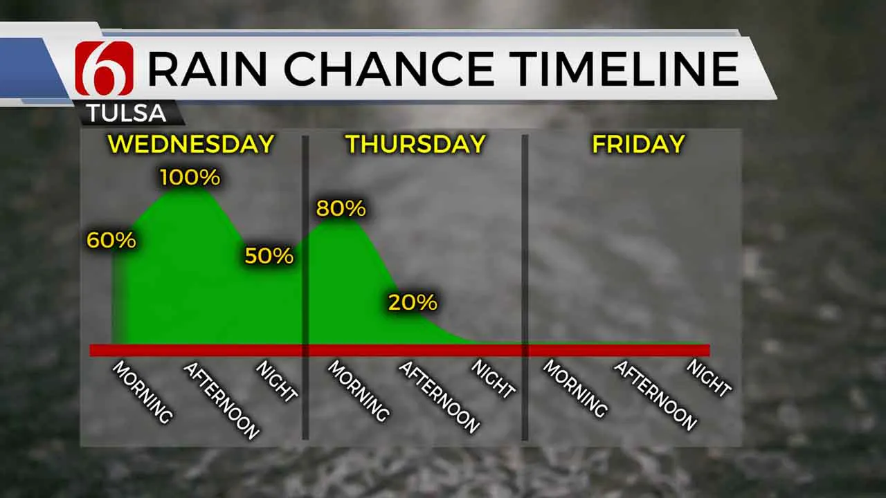
Rain will be scattered and a bit stop-and-go this morning with some dry periods for some of us, but that rain will eventually become more widespread by mid-day into our Wednesday afternoon. Some locally heavy rains are expected. Temperatures once again will stay quite chilly, with highs only nudging up into the 40s around the Tulsa metro with a brisk north breeze.

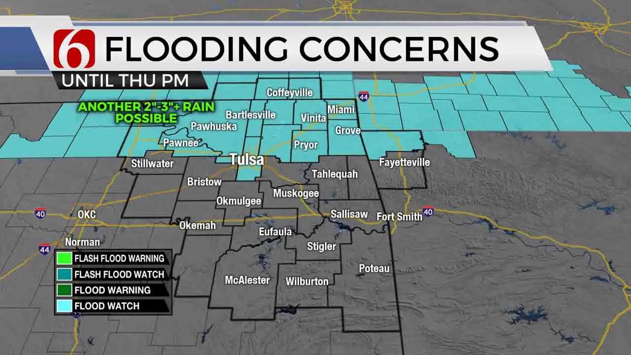
Areas from Tulsa to the north are under a Flood Watch, as localized flooding is a concern as rain moves back in. We’ve already had upwards of 3” to 4” rain this week, and another 2” to 3”+ rain is possible by Thursday. Watch out for those typical flood-prone areas, especially from Wednesday night into Thursday morning.
The last gasp of this several-day rain event moves in Thursday morning, as showers again roll across eastern Oklahoma along with gustier northwest winds. Rain looks to stick with us through mid-day Thursday, but we should finally see some clearing by Thursday afternoon!

Dry weather finally returns to end the week. Some dense fog could be a problem Friday morning, but that will be followed by some sunshine Friday afternoon with cool fall temperatures. And we’re set up for nice weather just in time for the holiday weekend, with sunshine and highs back into the 60s on Halloween Saturday!
I hope you have a great Wednesday, Green Country! You can also follow me on Twitter @StephenNehrenz as well as my Facebook page Meteorologist Stephen Nehrenz to stay up to date with the very latest.
More Like This
October 28th, 2020
February 14th, 2022
January 26th, 2022
January 25th, 2022
Top Headlines
December 13th, 2024
December 13th, 2024
December 13th, 2024
December 13th, 2024


