Morning Lows In The 50s With Mid-Day Highs In The 70s
The system that brought a few clouds to the mix yesterday is now moving east of the state and we’re in great shape for the rest of the week with mostly sunny and mild weather for the afternoon periodsThursday, November 5th 2020, 4:22 am
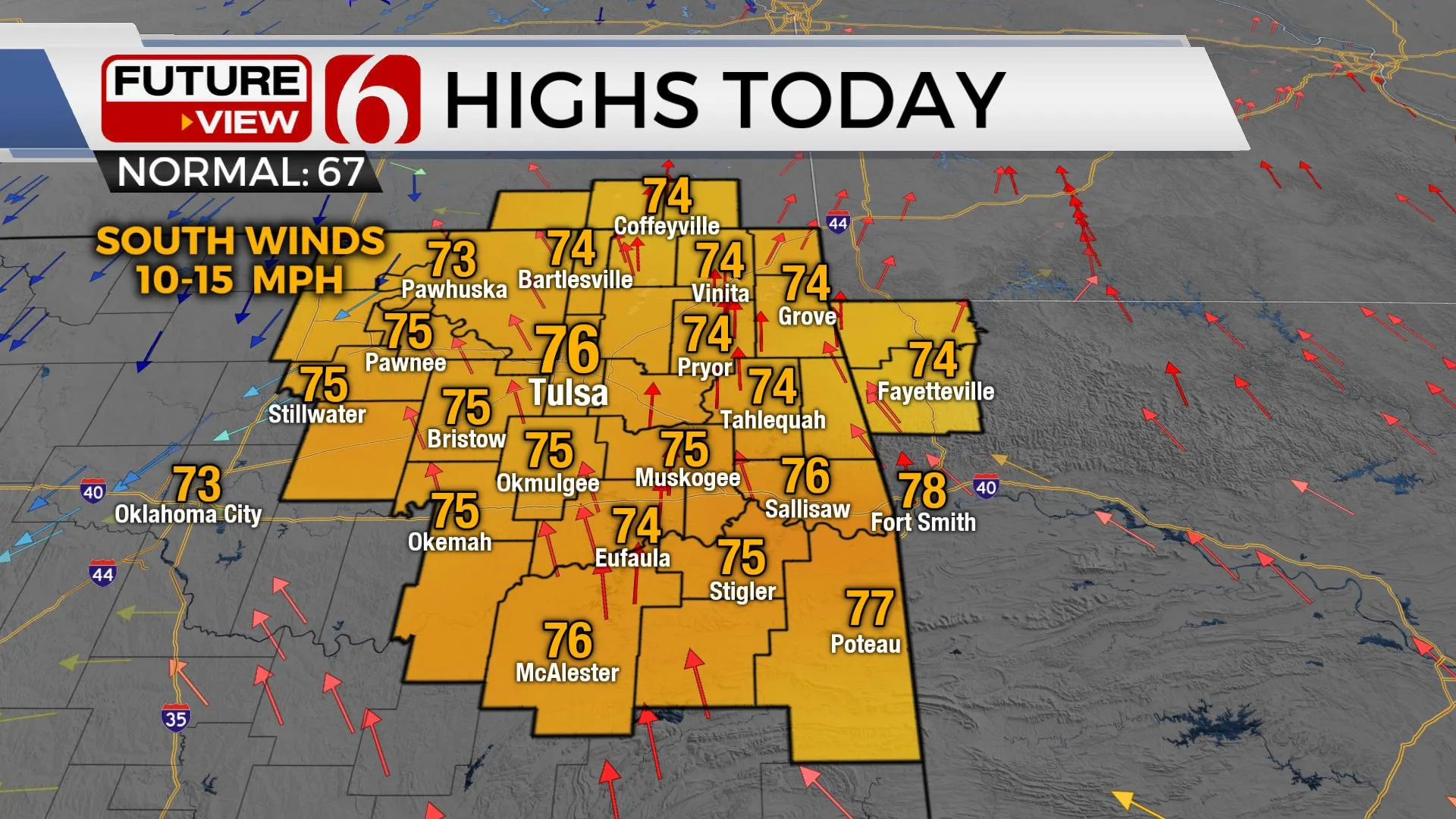
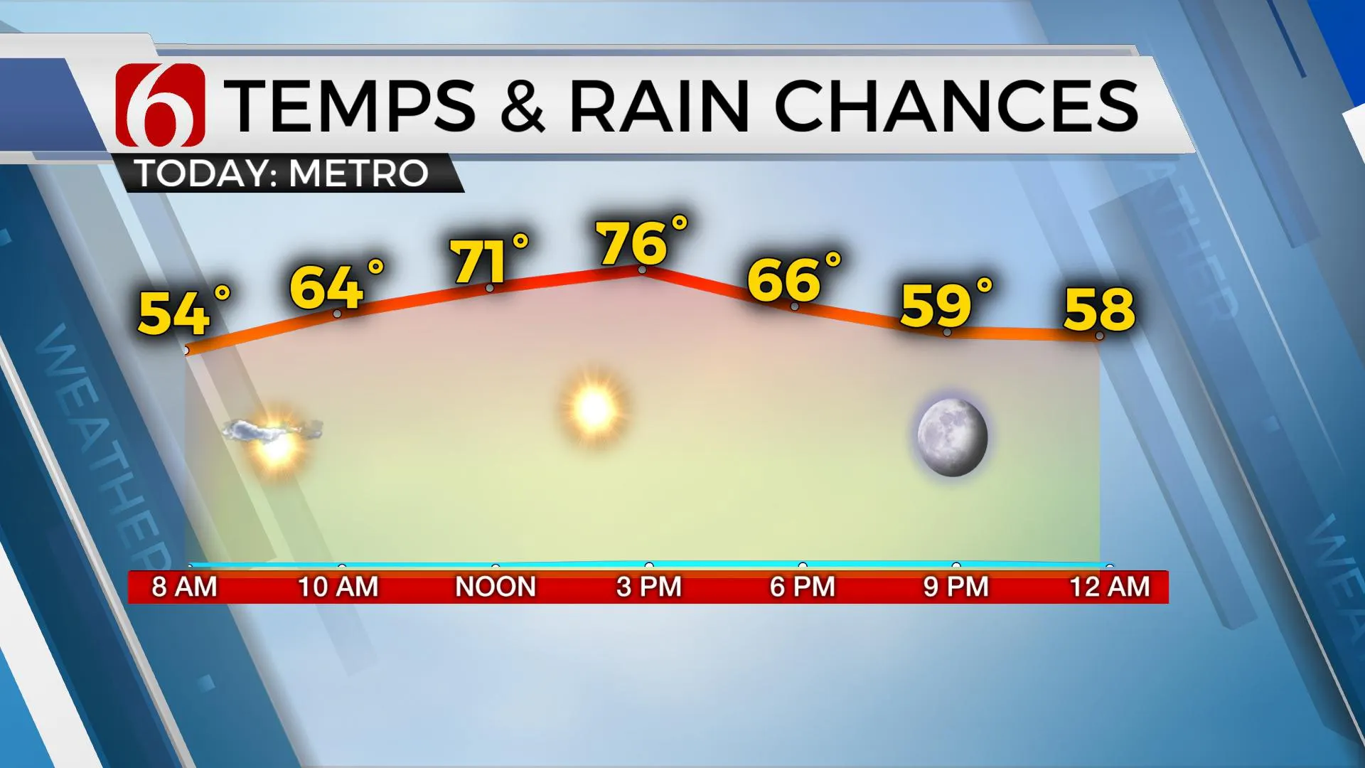
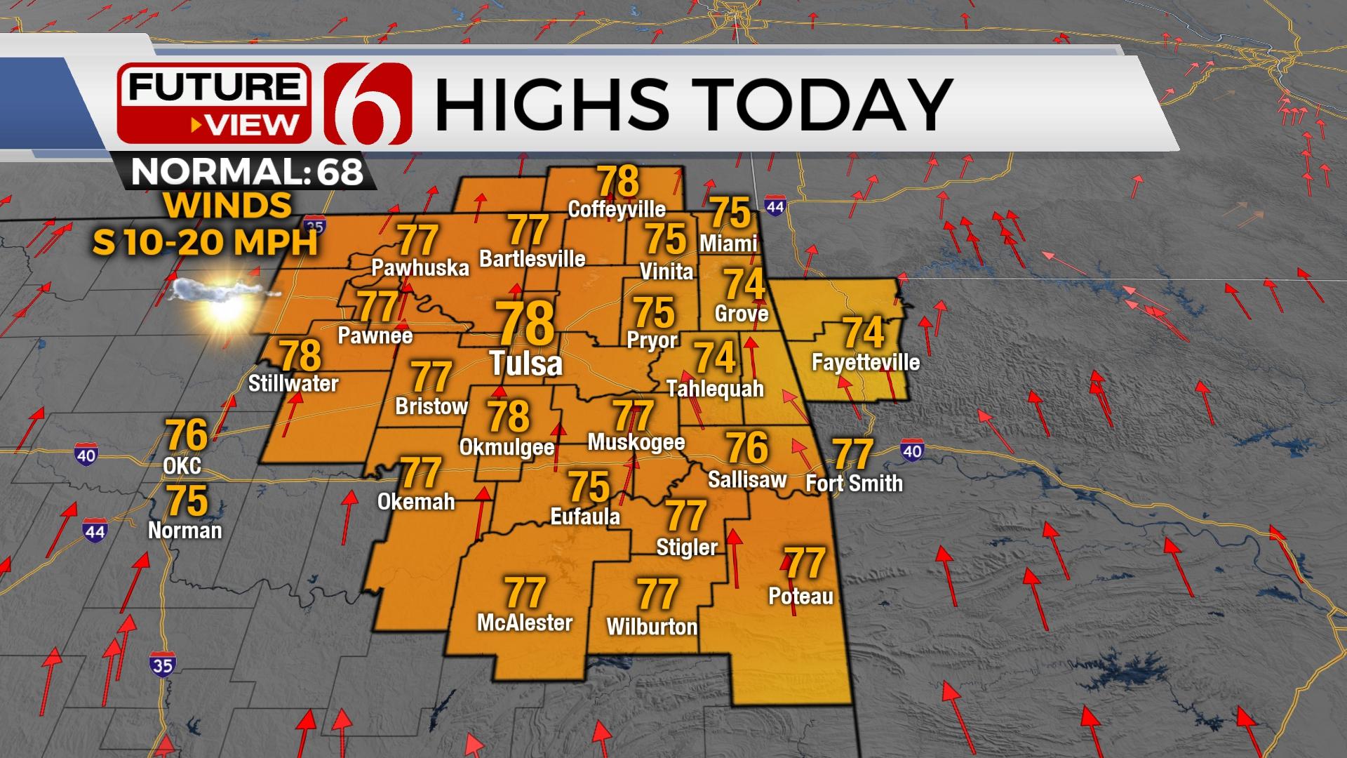
The system that brought a few clouds to the mix yesterday is now moving east of the state and we’re in great shape for the rest of the week with mostly sunny and mild weather for the afternoon periods. Looks like a Six Star Weather pattern this afternoon. Lows this morning will start in the 40s and 50s with highs in the mid-70s both today and Friday. The weekend pattern begins to change but the main noticeable feature will be the strong and gusty south winds from 20 to 30 mph along with a few passing clouds. The fire spread rate could increase Saturday but we’re also tracking increasing low-level moisture that will off-set the potential for the higher spread rates. Some model soundings suggest we could have some drizzle or patchy fog early Friday and Saturday morning, but I’ll hold off inserting this into the forecast at this point. We may not be totally saturated the next few mornings regardless of some model suggestions. Our next system will eventually shove a cold front southward early next week bringing a round of showers and storms followed by a minor cool-down. The current timing supports this boundary moving across the northeastern OK region either late Monday night or sometime early Tuesday with some rain and thunder. There remains a small possibility of a few strong to severe storms with this system, but the severe weather threat remains uncertain at this point.

The pattern change is occurring today across the Pacific but our weather will not reflect any big changes until we notice the gusty winds returning this weekend as the pressure falls across the Rockies and our winds increase from the south. Our friends and neighbors across the intermountain regions will experience another major winter storm this late this weekend into early next week with blizzard conditions possible from Montana into southern Canada Sunday into Monday. This will occur with the lead wave ejecting around the base of the western U.S. trough early this weekend. The main trough will not pass our immediate area until either Monday night or Tuesday and that’s when the surface cold front will bring increasing chances for showers and storms, followed by temps dropping from the 60s into the 50s Tuesday afternoon with stout north winds. Most of the really colder weather will remain north of the state for the middle of next week. I also anticipate more active weather with additional storm systems arriving about every three to four days for the next two weeks.
Tropical Depression Eta remains across central America this morning but is expected to approach the southern Florida Keys early next week as a strong tropical storm.

Thanks for reading the Thursday morning weather discussion and blog.
Have a super great day!
Alan Crone
KOTV
Be sure and check out my daily weather, mini podcast. Search for NewsOn6 and “Weather Out The Door” on Spotify, The Tune-In Radio app, Stitcher, Apple podcasts, and right here at SoundCloud.
More Like This
November 5th, 2020
November 30th, 2022
November 1st, 2022
August 26th, 2022
Top Headlines
December 14th, 2024
December 14th, 2024
December 14th, 2024
December 14th, 2024


