Windy Weather, Storm Chances Arrive For Tuesday
Windy weather and storm chances will arrive today, including the threat for a few strong to severe storms later this evening as the main storm system nears the state.Tuesday, November 24th 2020, 5:39 am
Tulsa -
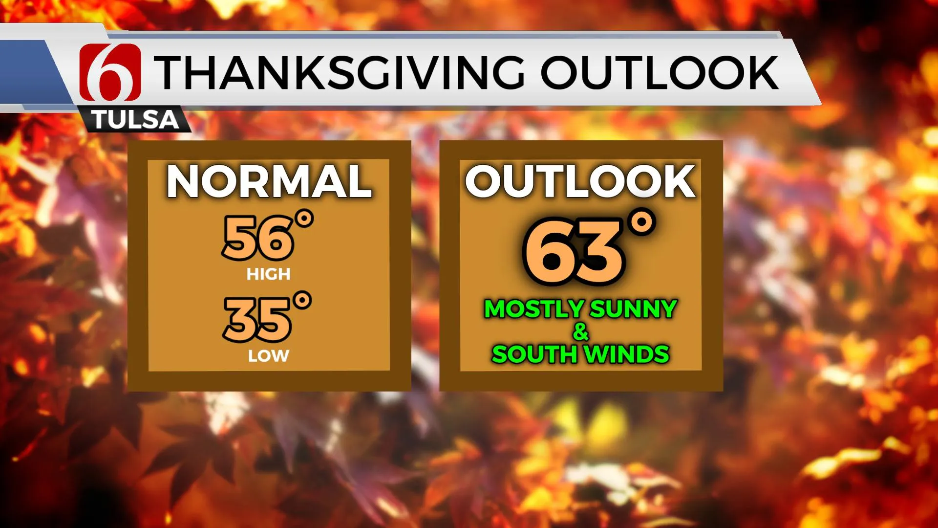
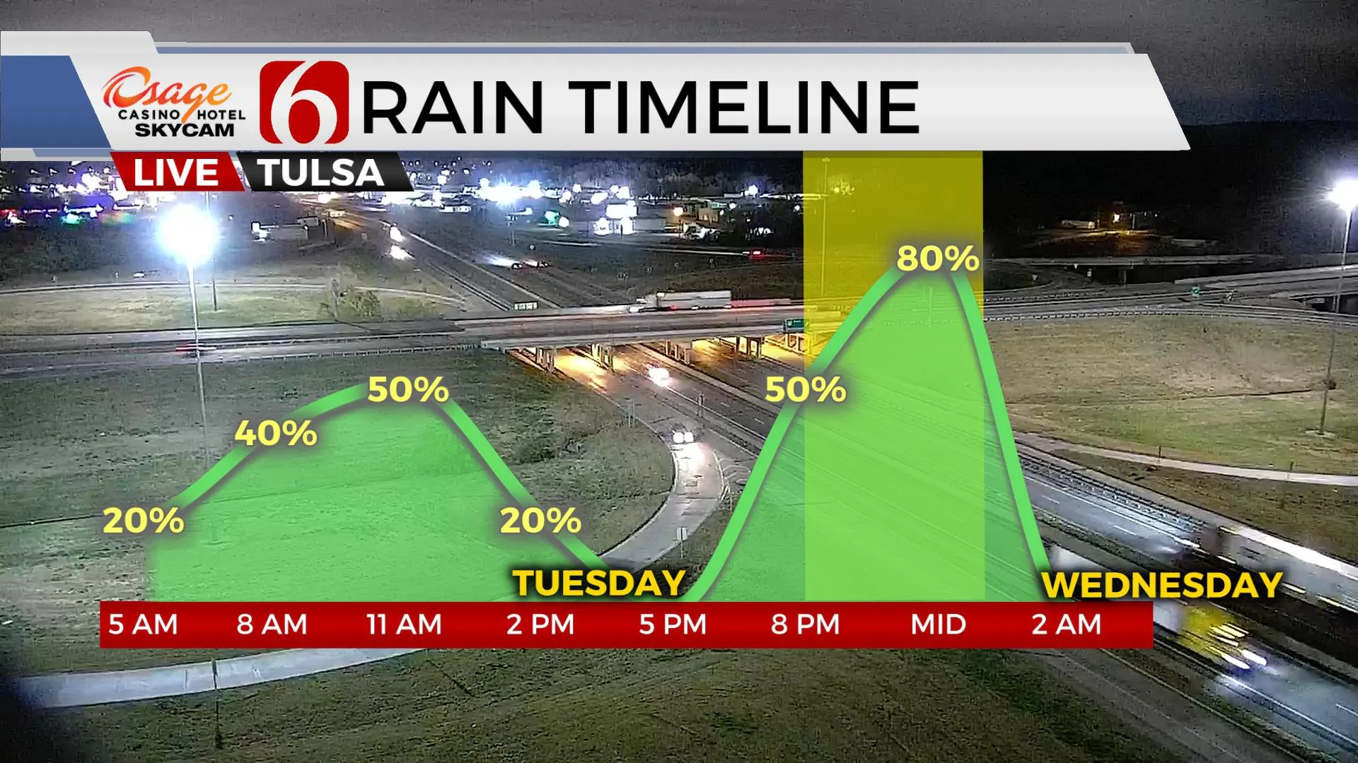
Windy weather and storm chances will arrive today, including the threat for a few strong to severe storms later this evening as the main storm system nears the state. A few scattered showers and storms will occur this morning through the first half of the day as low-level moisture rapidly returns across part of the state. This activity is not expected to be severe. Gusty south winds will be likely through the afternoon with speeds increasing from 20 to 30 mph along with mostly cloudy conditions and highs nearing the lower 60s. The front passes the area later this evening ushering in chilly yet pleasant fall weather Wednesday with highs in the mid-50s. Thanksgiving appears good with mostly sunny sky and highs reaching the lower or mid-60s with south winds before our next system quickly brushes the state Thursday evening into Friday morning with a few showers or storms across far southeastern OK. The weekend remains highly uncertain in the data and may result in chilly and wet conditions for part of the state Sunday, but we’re continuing with low chances for precipitation at this point in the forecast.

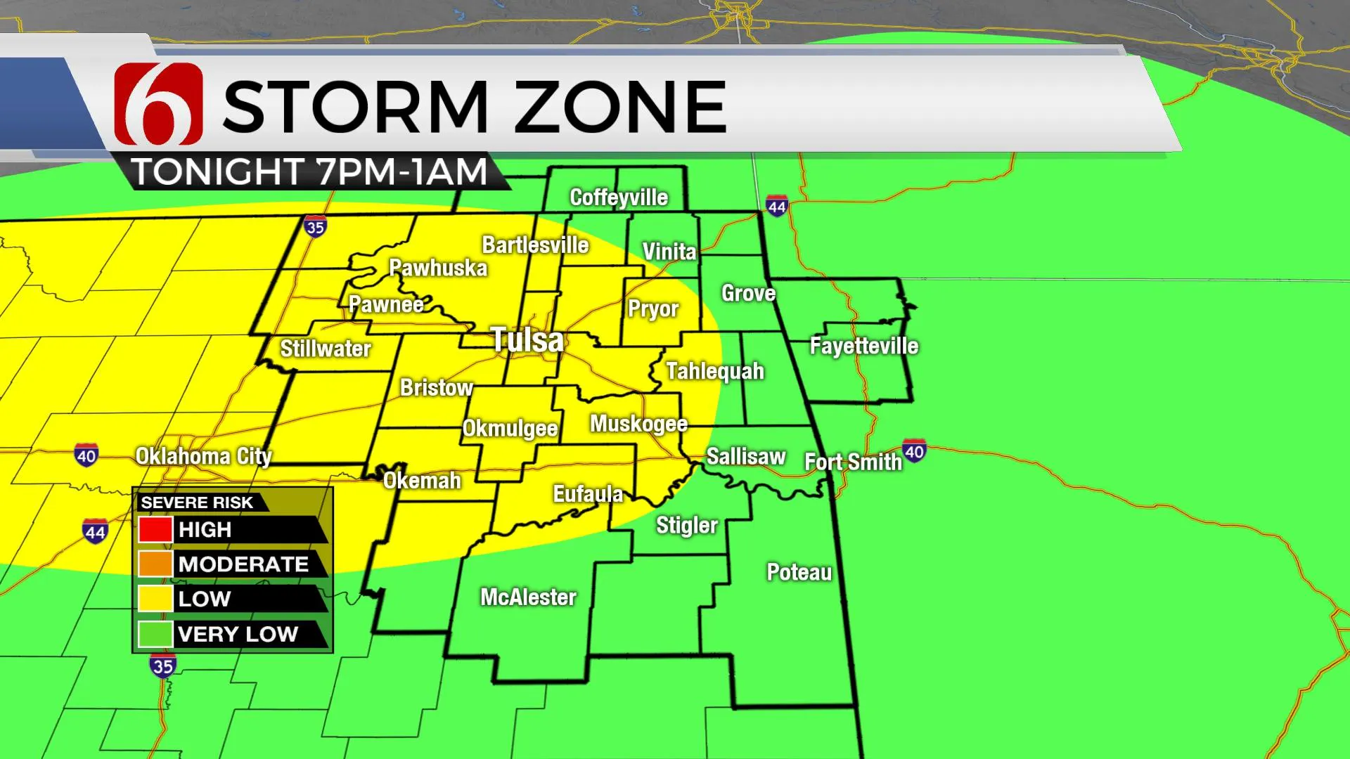
Showers and a few storms will remain possible through the first half of the day but not for all locations. The coverage will represent a decent chance for a few storms near and north of the metro this morning through noon, but our main window for strong to severe storms seems to be increasing this evening between 8 p.m. and 1 a.m. as the main upper-level low swings across the area bringing a pacific front-dry line east. The main threats will be hail and winds. If low-level moisture increases more than anticipated, the potential could be realized for a small window for a tornado or two across the region. This is a low but not zero probability. Wed and Thu will be fine.

The weekend remains highly uncertain. We’re not locked into any solution due to inconsistencies in the data. We know a strong looking upper trough will near the region this weekend. The EURO and a handful of other models suggest a cut-off low across the southwestern U.S., while the GFS is more progressive for most of the trip for this feature. The differences are big. EURO is wet and cold Sunday. GFS is dry and cool. There really is no compromise middle ground at this point, but we’ve elected to not go “all-in” on any solution to avoid some confusion and flipping into an important travel weekend across the state. Just remain aware that a system will be nearing this weekend. We’ll continue to adjust the forecast as data offers more confidence. The pattern next week also remains active and would support some of the coldest air of the season early next week.

Thanks for reading the Tuesday morning weather discussion and blog.
Have a super great day!
Alan Crone
If you would rather listen for the update, try my mini-podcast. Search for NewsOn6 and ‘ Weather Out The Door” on most podcast providers. Or you can find it here on Spotify.
More Like This
November 24th, 2020
June 21st, 2023
June 19th, 2023
June 13th, 2023
Top Headlines
April 25th, 2024
April 25th, 2024
April 25th, 2024


