Morning Lows In The Upper 20s, Afternoon Sunshine With Highs In The Mid 40s
Some of the coldest air of the season will be across the region for the next 24 hours allowing for our morning lows dropping into the mid to upper 20s in the metro with lower 20s in the valleys of eastern sections of the state. SunshineMonday, November 30th 2020, 6:43 am
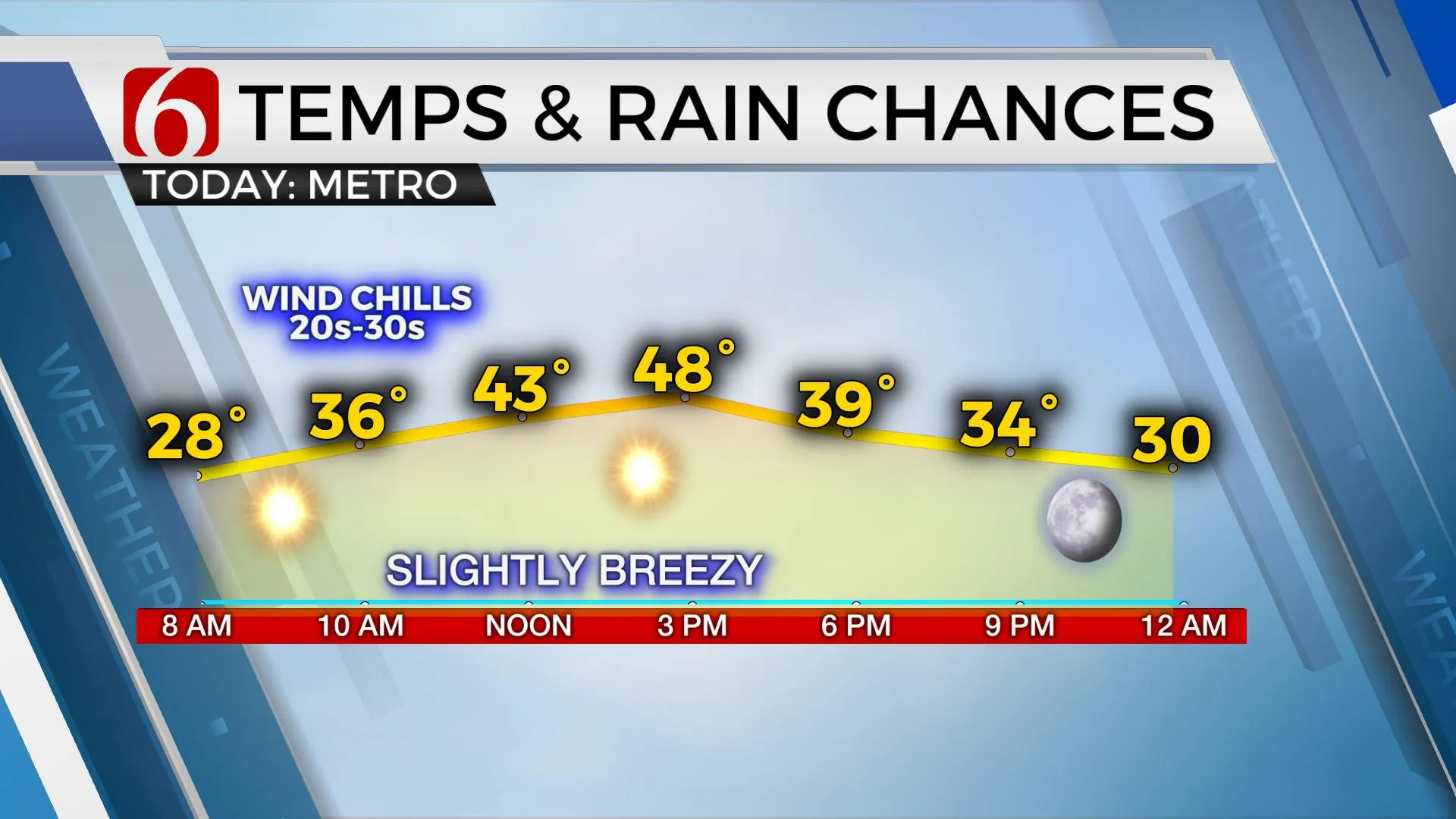
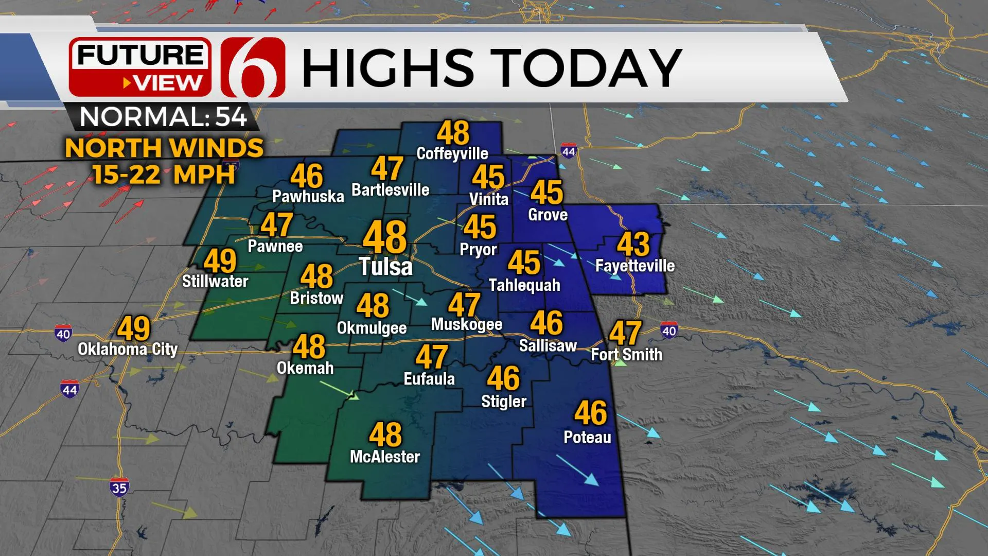
Some of the coldest air of the season will be across the region for the next 24 hours allowing for our morning lows dropping into the mid to upper 20s in the metro with lower 20s in the valleys of eastern sections of the state. Sunshine and highs in the mid to upper 40s will be likely this afternoon and into the mid-50s Tuesday before another strong upper level low and surface boundary will move across the area Wednesday into early Thursday with additional chances for some precipitation, including a mention for rain changing to snow for some locations. Once this system passes the area, dry and cool weather will persist into the weekend with mostly sunshine and highs in the lower 50s.

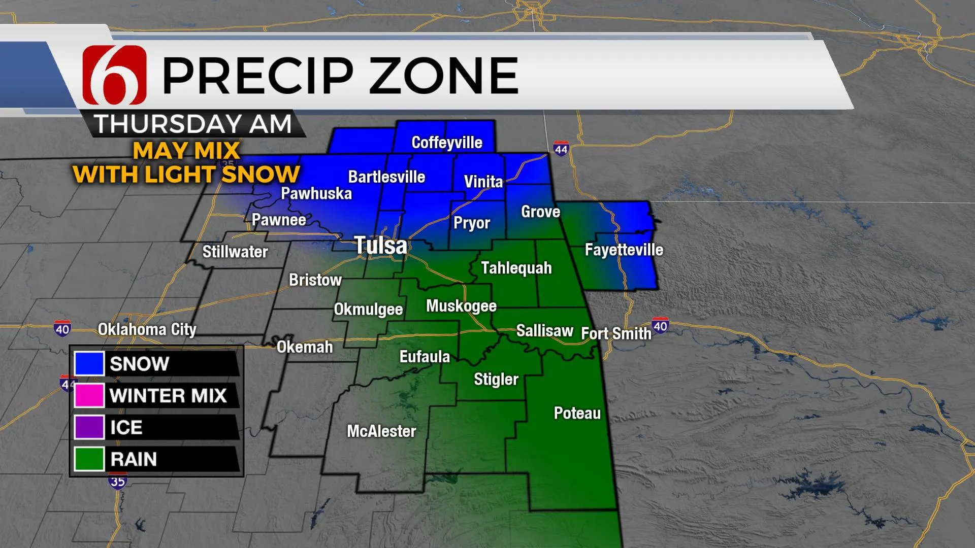
The upper airflow will be from the northwest and highly amplified for the week. Two separate upper troughs will drop down from the northern plains into the southern U.S. The first trough consolidates into a closed low near the state Wednesday and another system passing the state this weekend. The first low will move across the area Wednesday night into Thursday and could change some light rain into wintry weather directly under the cold core low. Wednesday late evening into Thursday morning will be a period to watch for some light rain that could possibly mix with or change to some snow before the feature pulls away from the state. Temp changes by just a few degrees could alter our forecast significantly. Any wintry impacts appear minimal for our immediate area as of now.

Outside of this middle of the week system, we should experience some sunny but cold weather. Highs today will reach the mid to upper 40s with north winds near 15 to 20 mph this morning before wind speeds level-off near 10 mph for the day. Wind chill values will drop into the teens and lower 20s this morning and stay in the upper 30s and lower 40s for the afternoon. Tuesday morning starts near 28 in Tulsa and colder in the valleys with highs rebounding Tuesday afternoon into the mid and upper 50s. Wednesday features north winds and highs in the mid-40s with rain developing through the day before possibly changing or mixing with snow late evening into early Thursday. Thursday afternoon highs will only reach the upper 30s and lower 40s before weekend highs rebound into the 50s.

Thanks for reading the Monday morning forecast discussion and blog. Have a super great day!
Alan Crone
KOTV
My daily weather briefing is up and running.
Find it on most podcast providers, including Apple, Stitcher, Tune-In, SoundCloud and here on Spotify.
More Like This
November 30th, 2020
February 14th, 2022
January 26th, 2022
January 25th, 2022
Top Headlines
December 13th, 2024
December 13th, 2024
December 13th, 2024
December 13th, 2024


