Chilly Temperatures, Damp Conditions
The upper-level trough is moving across northeastern OK today but will begin shearing some and weakening. A dry slot continues to develop with drier air moving into the southwestern sections of the region as the surface low moves across central OK. This dry air will eventually wrap into the system causing the precipitation to end.Thursday, December 3rd 2020, 6:02 am
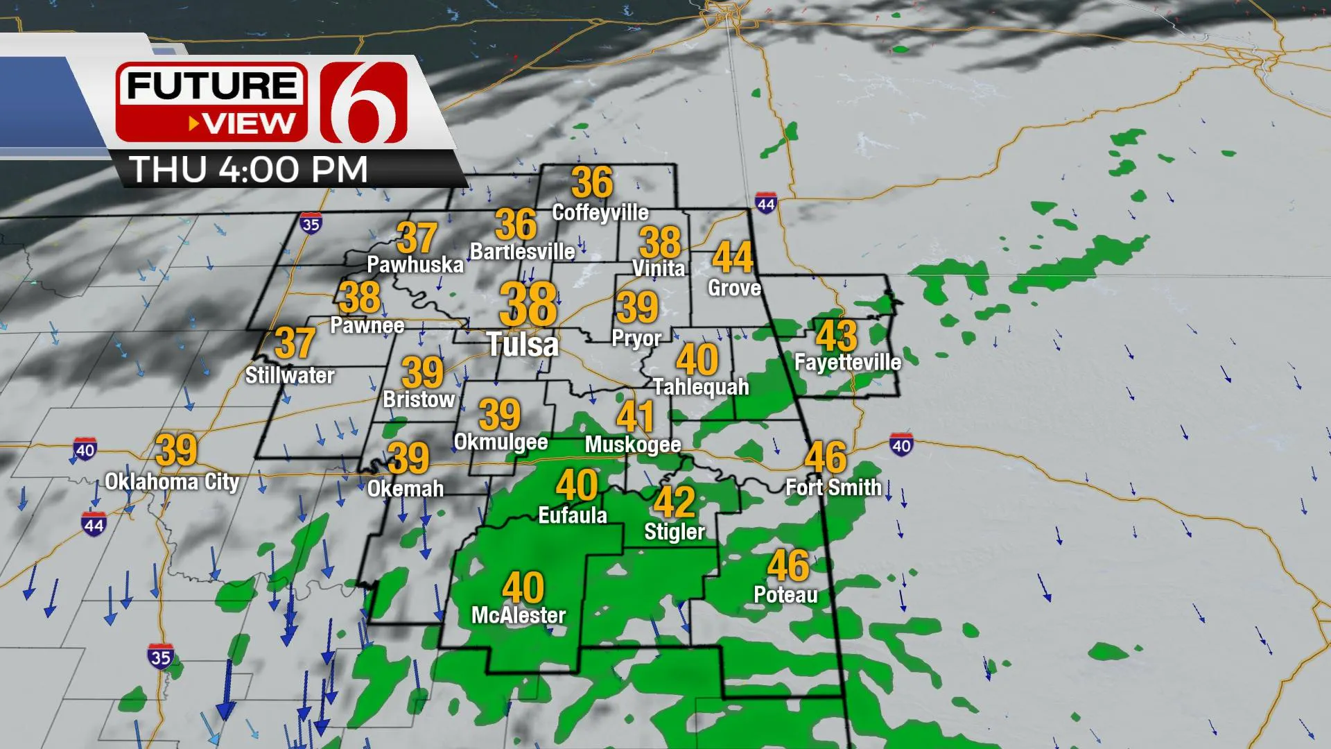
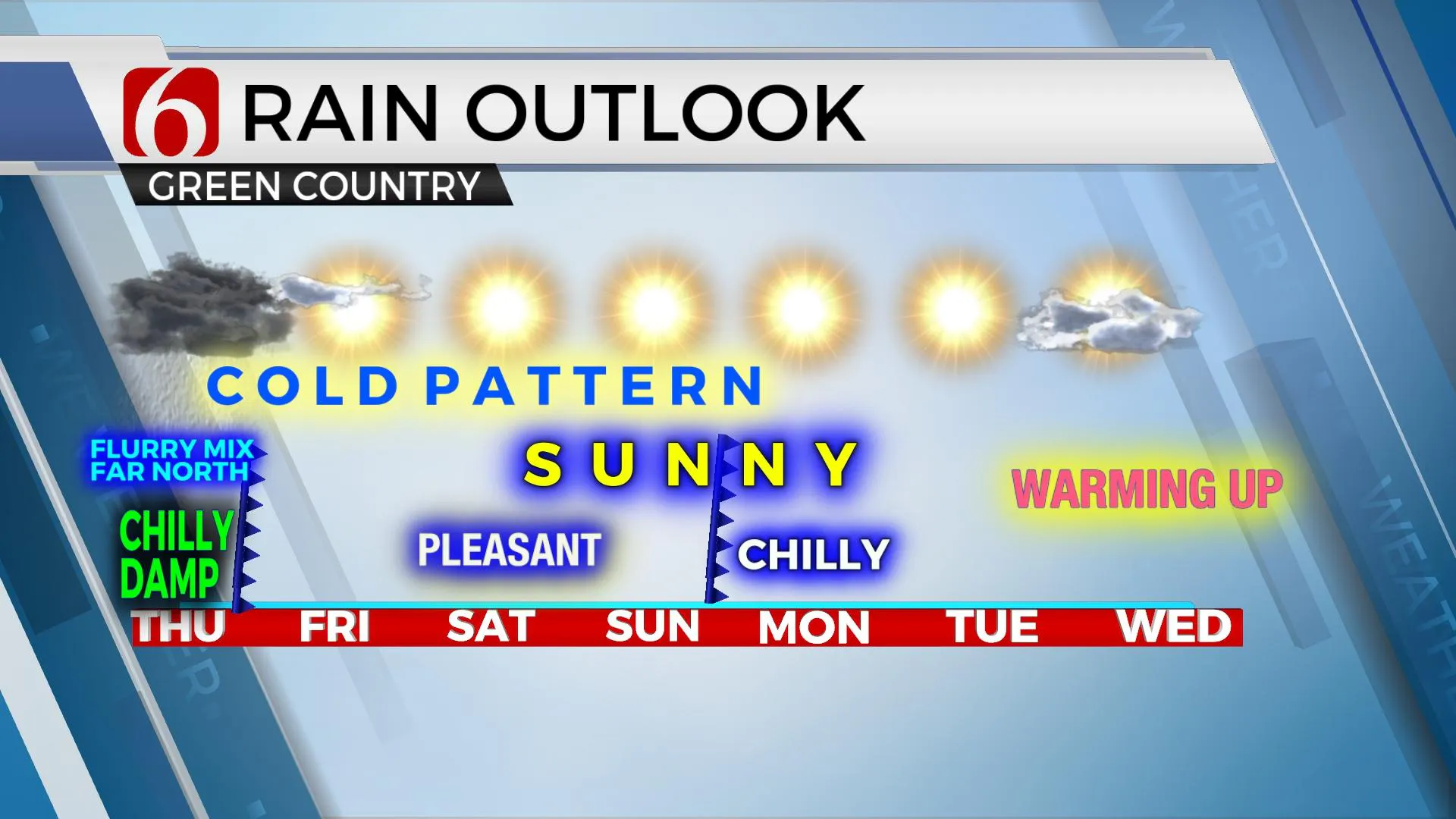
The upper-level trough is moving across northeastern OK today but will begin shearing some and weakening. A dry slot continues to develop with drier air moving into the southwestern sections of the region as the surface low moves across central OK. This dry air will eventually wrap into the system causing the precipitation to end. We continue with a very low chance of a few snowflakes nearby, but most, if not all locations will remain liquid variety. Any dusting, which seems unlikely at this point, would be confined to extreme northwestern Osage County or southern Kansas. No watches, warnings or advisories will be in effect for our immediate area today. Some rain and snow mix will be possible across the Boston Mountains of Northwestern Arkansas on the ridgetops. Afternoon readings are expected to range from the upper 30s and lower 40s along with clouds and northwest winds near 10 to 20 mph. Clouds will attempt to clear later tonight into part of Friday morning and could allow for temps dropping into the upper 20s and lower 30s with fog forming in some locations. This may create a small window for freezing fog during the Friday morning commute, but this also remains a low possibility. Friday afternoon features sunshine and highs nearing the lower 50s along with northwest winds near 10 to 15 mph. The rest of the weekend appears rather pleasant, yet another front moves into the state Sunday evening or Monday morning bringing a minor reduction in temps before a warming trend begins through the middle of next week as daytime highs approach the lower 60s. Our next stronger system should arrive during the latter half of next week or next weekend.

Northwestern OK was in the bullseye for this winter storm with 7 to 14 inches of snow reported across this region of the state. Another 2 to 3 inches may be possible early this morning in these same areas before quickly ending. As the cold core upper low moves near the metro this morning, the lowest level of the atmosphere will remain too warm for anything other than some drizzle or rain. The air aloft through the lower levels will be cooling dynamically later this afternoon. This is something that could result in a fast production of snow in a few spots, but this seems unlikely for most of the area except extreme northern sections near the Oklahoma-Kansas state line region. And even this potential remains very low. By the time the lower levels cool some this afternoon, most of the precip should be finished across northeastern OK or waning across southern sections.
Thanks for reading the Thursday morning weather discussion and blog.
Have a super great day!

Alan Crone
KOTV
More Like This
December 3rd, 2020
February 14th, 2022
January 26th, 2022
January 25th, 2022
Top Headlines
December 13th, 2024
December 13th, 2024
December 13th, 2024


