Mild, Sunny Thursday Ahead
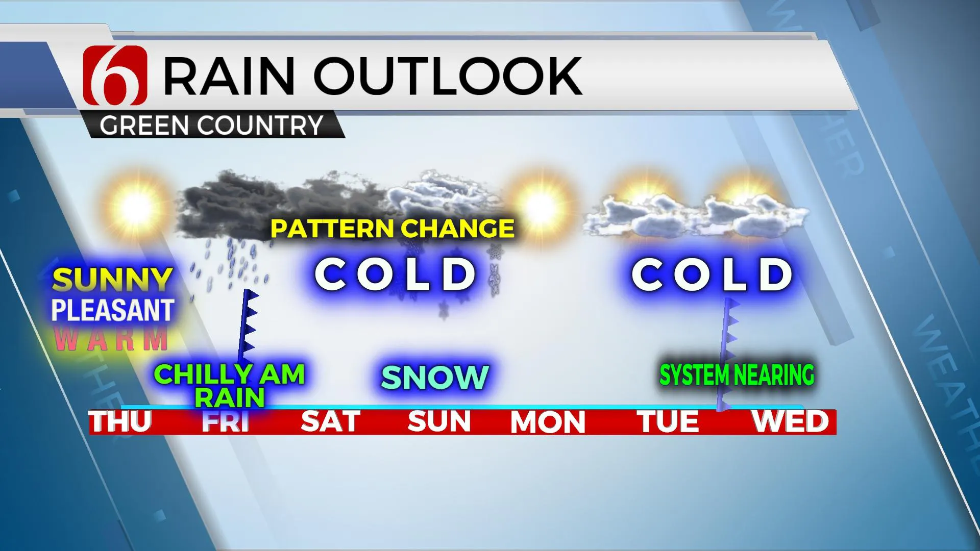
Another mild and sunny day is ahead of us before winter makes a return Friday into the weekend. A chilly rain is likely Friday morning with colder air invading the state for the weekend. Solutions have started converging on another strong upper-level trough approaching Sunday that may produce accumulating snowfall across part of the state, including the Tulsa metro. Data has been suggesting a system moving across the region but has not been consistent regarding moisture and thermal profiles. TheThursday, December 10th 2020, 5:46 am
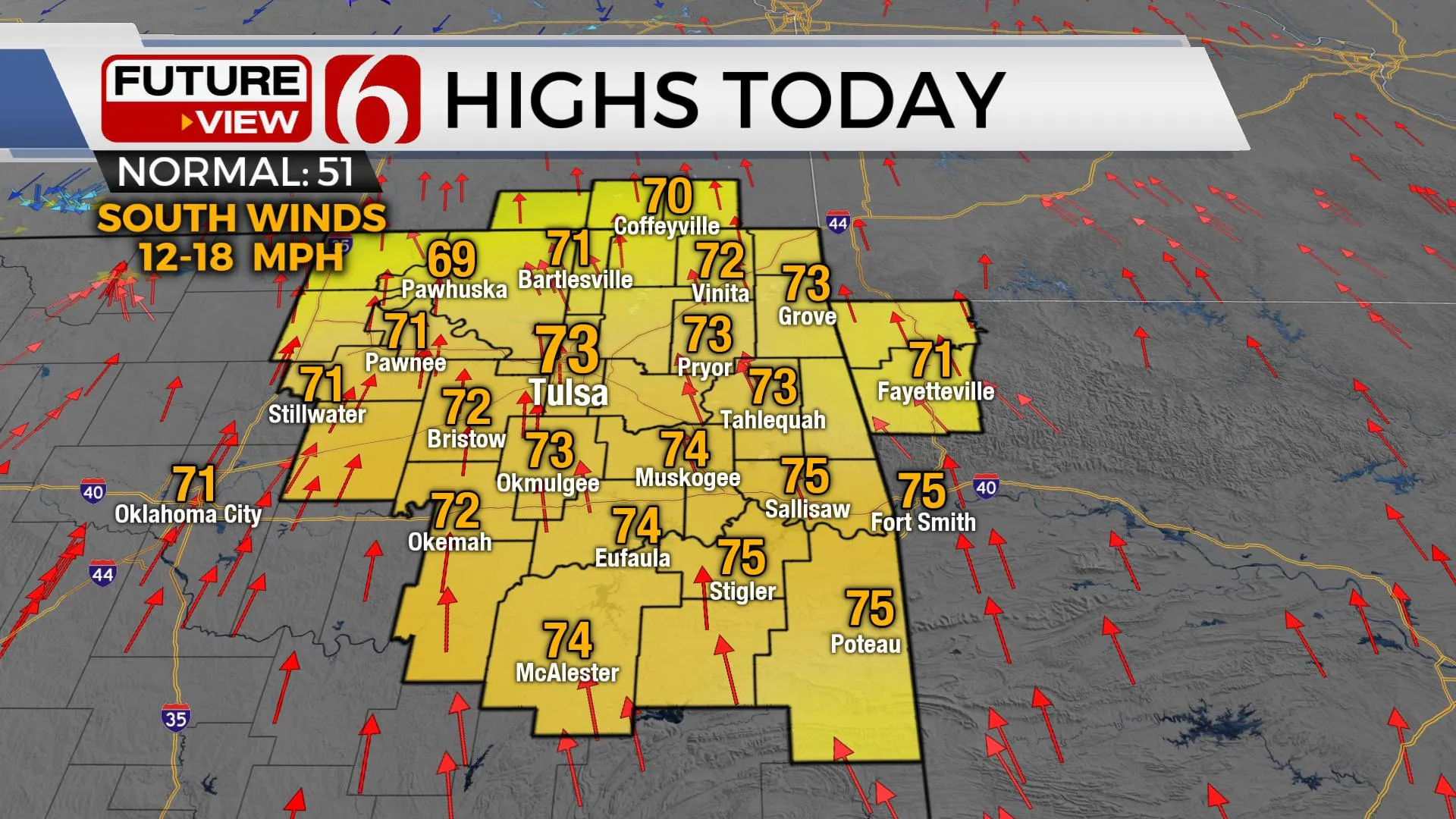
Another mild and sunny day is ahead of us before winter makes a return Friday into the weekend. A chilly rain is likely Friday morning with colder air invading the state for the weekend. Solutions have started converging on another strong upper-level trough approaching Sunday that may produce accumulating snowfall across part of the state, including the Tulsa metro. Data has been suggesting a system moving across the region but has not been consistent regarding moisture and thermal profiles. The last few runs have shown some consistency, not only run to run but also in different models. We’ll be increasing chances for snow Sunday based on these data but will continue a slow and steady approach regarding amounts. Before all of this arrives, it's back to near-record highs today.

A mid-level ridge of high pressure nearby will begin breaking down as our first upper-level system near southern California gets a kick and begins moving east today. Before this arrives later tonight and early Friday morning with rain and some thunder, highs this afternoon will reach the upper 60s and lower 70s, along with a mostly sunny sky until tonight. South winds may increase some, but the overall weather conditions will continue to remain very mild and pleasant for December.

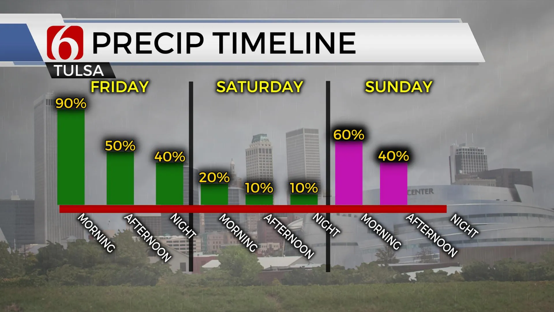
Later tonight, showers will develop across southwestern OK and quickly spread northeast reaching the metro early Friday morning with temps in the upper 40s to lower 50s north and lower 60s across far southeastern OK. A surface low will pass and bring a cold front quickly southeast early tomorrow morning with northwest winds increasing speeds near 15 to 25 mph along with temps falling into the 40s by the afternoon. Instability remains low. No severe weather is expected in our region but a few strong to severe storms could develop along the Red River into Northeast Texas. Most of the thunder will be confined to southeastern OK with this system.

Saturday morning some showers remain possible along the far northern OK state line region as this first wave quickly moves east. Snow is likely across part of Kansas early Saturday morning but will remain north of our area. Highs Saturday will remain in the mid-40s with north winds. The next strong upper-level trough will quickly drop through the Rockies and move across western OK into north TX Sunday with a surface low forming in these same regions moving southeast. Snow will begin developing early Sunday morning across northwestern OK and spread southeast, reaching the north-central OK region Sunday morning, and extending as far east as the Tulsa metro. This wave will move southeast out of the state by Sunday afternoon with temps remaining in the 30s along with north winds around 15 to 20 mph. A swath of accumulating snow seems likely based on the last few runs of data, but we will continue broad mentions for Sunday snow for now as minor changes in the thermal profile and trajectory will have major changes in accumulations and exact locations. Another clipper may brush northern Ok Tuesday night into Wednesday
Thanks for reading the Thursday morning weather discussion and blog.
Have a super great day!
Alan Crone
KOTV
Check out my mini-podcast update. Search for NewsOn6 ‘ Weather Out The Door ‘ on most podcast providers, including Apple, Stitcher, Soundcloud, Tune-In and here on Spotify.
More Like This
December 10th, 2020
February 14th, 2022
January 26th, 2022
January 25th, 2022
Top Headlines
December 12th, 2024
December 12th, 2024
December 12th, 2024
December 12th, 2024


