Frosty Morning, Afternoon Highs In The Upper 50s, Lower 60s
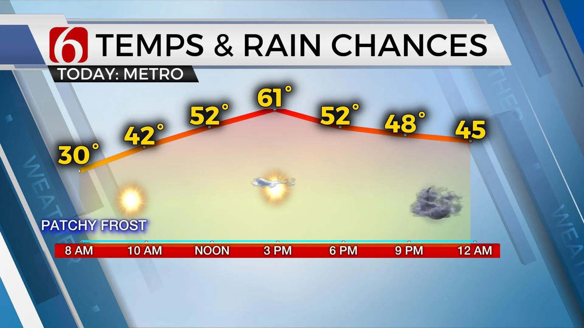
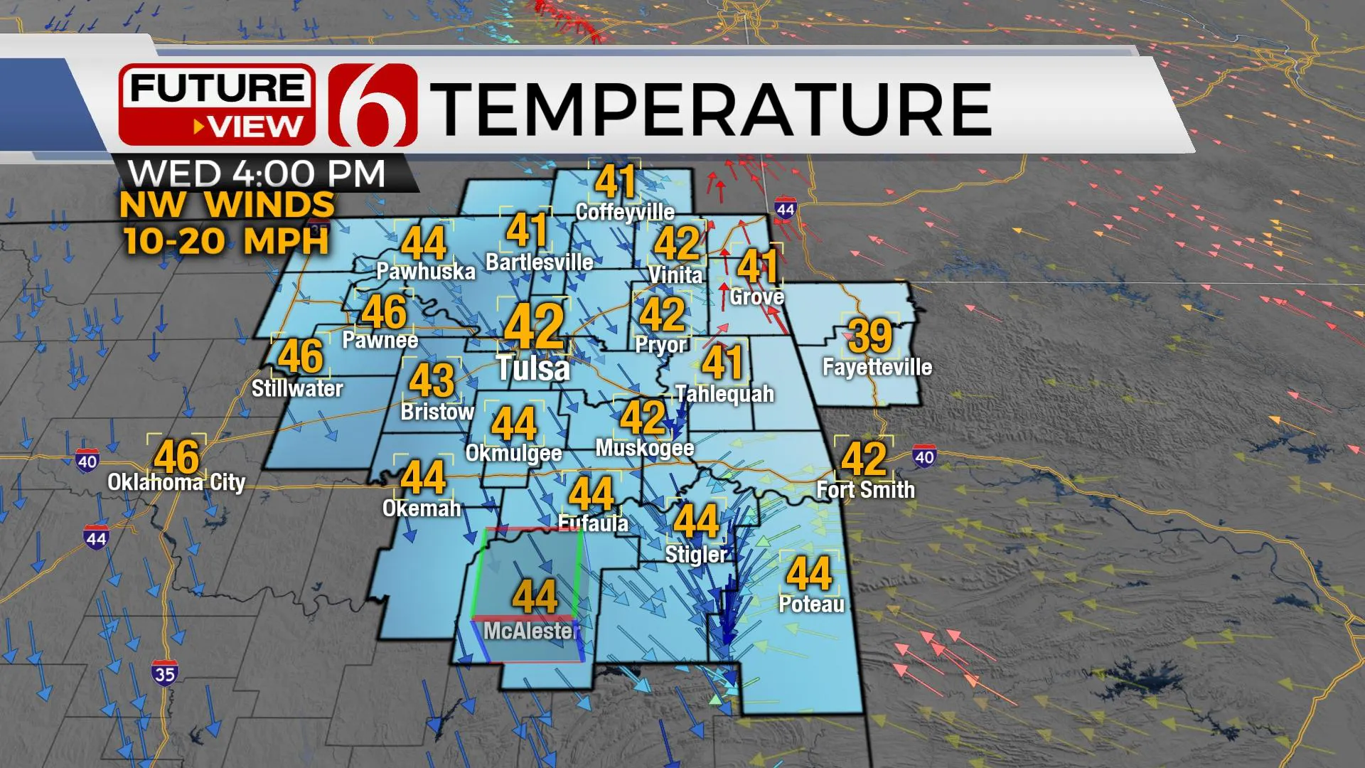
After a frosty start in the 20s this morning, we’re expecting more sunshine along with a few clouds and the return of southerly breezes this afternoon. This will bring afternoon highs into the upper 50s and lower 60s before our next storm system quickly invades the area early tomorrow morning with a few showers for some, but not all locations. Temps tomorrow will stay in the lower 40s north and mid-40s south as colder air returns to Eastern Oklahoma.Tuesday, January 5th 2021, 5:11 am
After a frosty start in the 20s this morning, we’re expecting more sunshine along with a few clouds and the return of southerly breezes this afternoon. This will bring afternoon highs into the upper 50s and lower 60s before our next storm system quickly invades the area early tomorrow morning with a few showers for some, but not all locations. Temps tomorrow will stay in the lower 40s north and mid-40s south as colder air returns to Eastern Oklahoma.

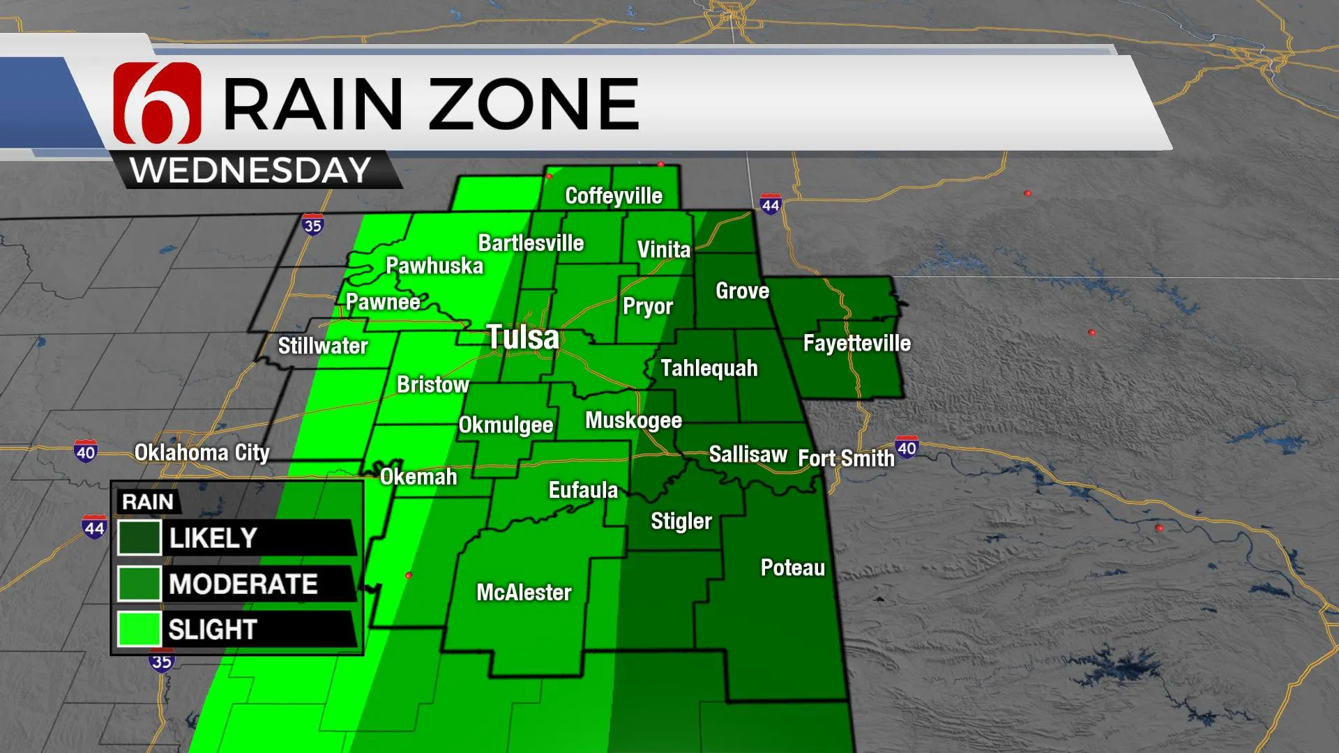
The upper airflow will bring the next system across the Rockies today and into northern OK early Wednesday morning. A few showers will be possible near or east of the metro with higher chances confined to far southeastern and extreme eastern sections of the area. As this first system begins to pivot away from the state, colder air aloft will attempt to transition some of the showers into snow across extreme northeastern OK, southeastern Kansas and northwestern Arkansas where a dusting to near 1 inch may occur on grassy areas. This window will remain very small and mostly for a few hours pre-dawn to early Thursday morning with highs staying in the upper 30s and lower 40s Thursday afternoon.

This system also brings more cold weather back to the state and will stick around through the weekend as yet another stronger upper-level system nears the plains. We continue to have some controversy regarding the exact track of the upper trough, but our forecast will continue to support a low chance for some rain into winter mix Saturday night into Sunday morning. Some data keeps this system well south with any impacts located south of the Red River while other data brings a decent chance of some wintry precip across part of the area. I’ll keep the chances rather low to avoid any big flips in the forecast until we discover some higher confidence in the system and its track.

The system arriving early tomorrow will bring colder weather back to the area lasting through the weekend. Enjoy the relatively warmer weather this afternoon because after today we’re back to big coats for the rest of the 7-day planner.
Thanks for reading the Tuesday morning weather discussion and blog.
Have a super great day!
Alan Crone
KOTV
Check out my daily weather update and mini-podcast. Search for NewsOn6 and ‘Weather Out The Door’ on most podcast providers, including here on Spotify.
More Like This
January 5th, 2021
February 14th, 2022
January 26th, 2022
January 25th, 2022
Top Headlines
December 13th, 2024
December 13th, 2024
December 13th, 2024
December 13th, 2024


