Gusty Winds Return Ahead Of Weekend Showers
Gusty winds return today and tomorrow as a storm system brings Saturday morning showers and storms to northeastern Oklahoma.Friday, January 29th 2021, 5:27 am
Gusty winds return today and tomorrow as a storm system brings Saturday morning showers and storms to northeastern Oklahoma.

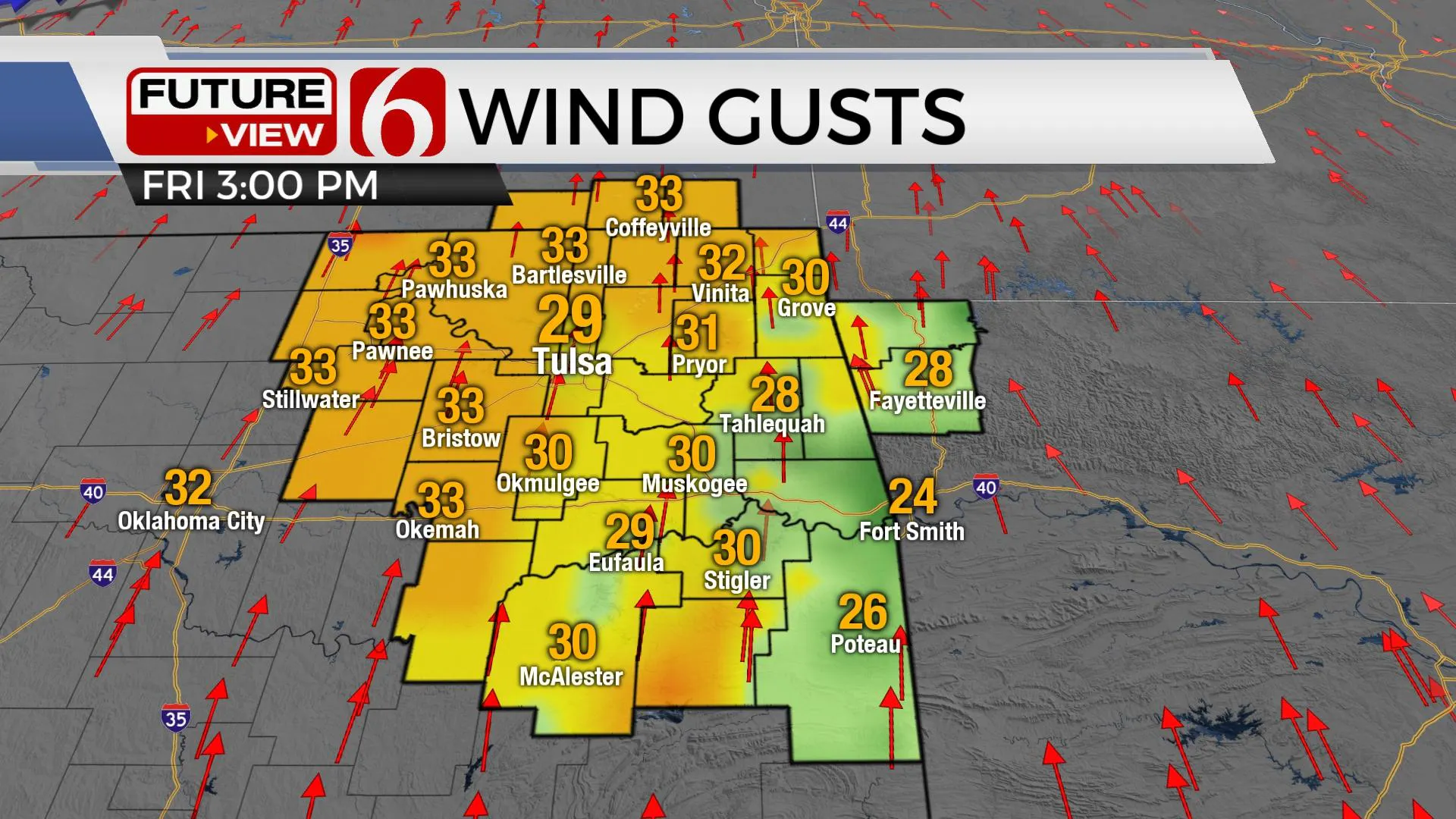
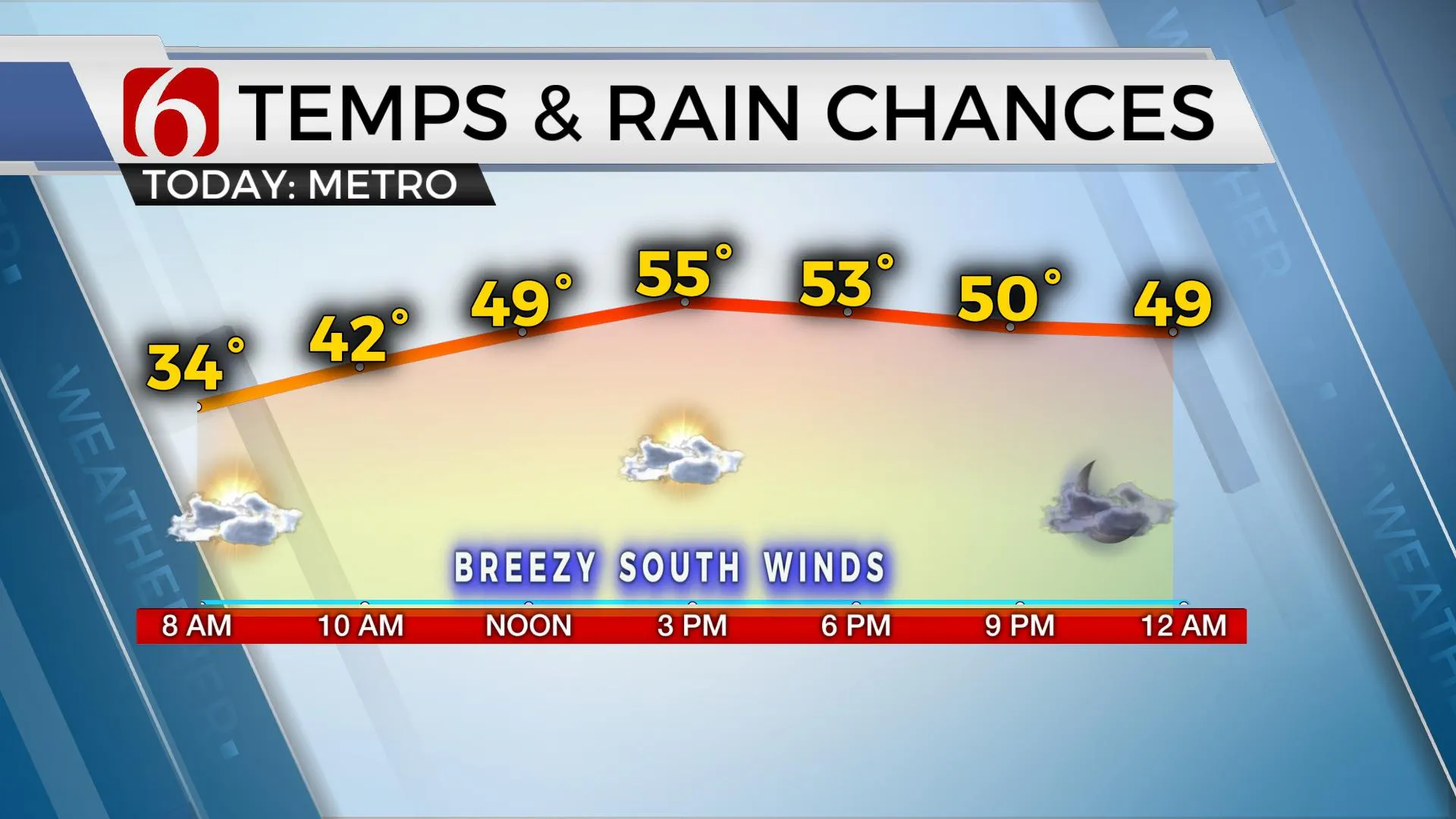
Another cool morning is underway with most locations in the 30s. But we finally get some minor warming this afternoon with highs reaching the mid-to-upper 50s along with partly sunny skies and gusty south winds. This will occur as pressure falls along the Lee of the Rockies ahead of our next storm system, currently across the southwestern U.S. This will bring showers early Saturday morning along with very windy weather for much of Saturday before turning colder Saturday evening into Sunday. We will track another system for the middle to end of next week.

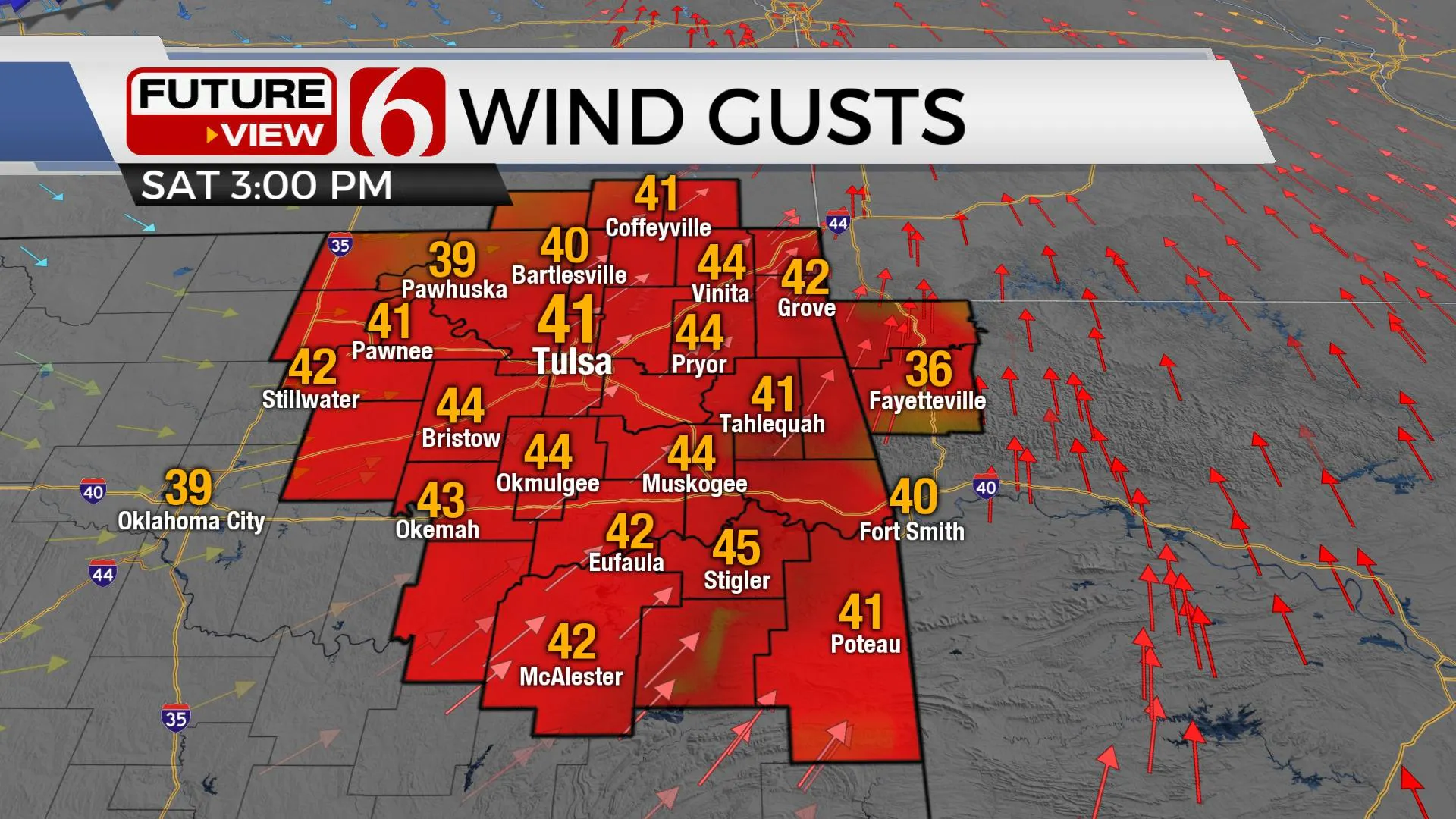
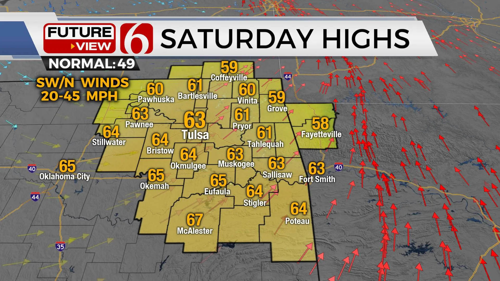
Our main issue remains the amount of cloud cover again today and impact on afternoon highs before our next storm system arrives early tomorrow bringing showers and some thunder quickly into Eastern Oklahoma. We’re keeping highs today into the mid-50s with a sun-cloud mix but south winds will increase from 20 to near 30 mph, so you will still need a jacket or even a coat due to the wind. Rain chances ramp up pre-dawn on Saturday and should exit the region late Saturday morning through midday with decreasing clouds and very windy weather Saturday afternoon. Southwest winds from 20 to 45 mph will be likely before veering from the northwest by afternoon. There will be a small window from 2 p.m. to 4 p.m. across extreme northeastern OK for a very narrow line of low-topped thunderstorms. Our system is a very dynamic and potent storm system with high shear values. Thankfully, moisture and instability will be limited and severe weather threats are not expected.

Temperatures will start in the upper 40s Saturday morning and should move into the lower 60s Saturday afternoon behind the departing system but late Saturday evening with colder air bringing Sunday's temps back down with lows in the 30s and highs in the upper 40s with gusty northwest winds. Then we’re back on the roller coaster early next week with highs moving into the mid-50s Monday and upper 50s Tuesday before another strong storm system nears the region Wednesday with increasing rain and thunder chances Wednesday evening into Thursday. Most data suggest another surge of colder air will follow the midweek system and will be prevalent next weekend

Thanks for reading the Friday morning weather discussion and blog.
Have a super great day!
Alan Crone
KOTV
Be sure and check out my daily podcast weather update Here on Spotify, and most other podcast providers.
More Like This
January 29th, 2021
February 14th, 2022
January 26th, 2022
January 25th, 2022
Top Headlines
December 13th, 2024
December 13th, 2024
December 13th, 2024
December 13th, 2024


