Spring-Like Weather Makes A Return To Start The Week
Welcome to a preview of spring-like weather for the first part of the week. The pattern will remain quite progressive for the foreseeable future. This means we’ll continue to track several systems across the southern plains soon. But we’ll enjoy the great weather in the short term with sunshine and much warmer temps compared to the deep freeze from the last two weeks. South to southwest surface winds gusting from 15 to 25 mph will be likely early this week, but other than slightly breezy conditiMonday, February 22nd 2021, 6:13 am
TULSA, Okla. -
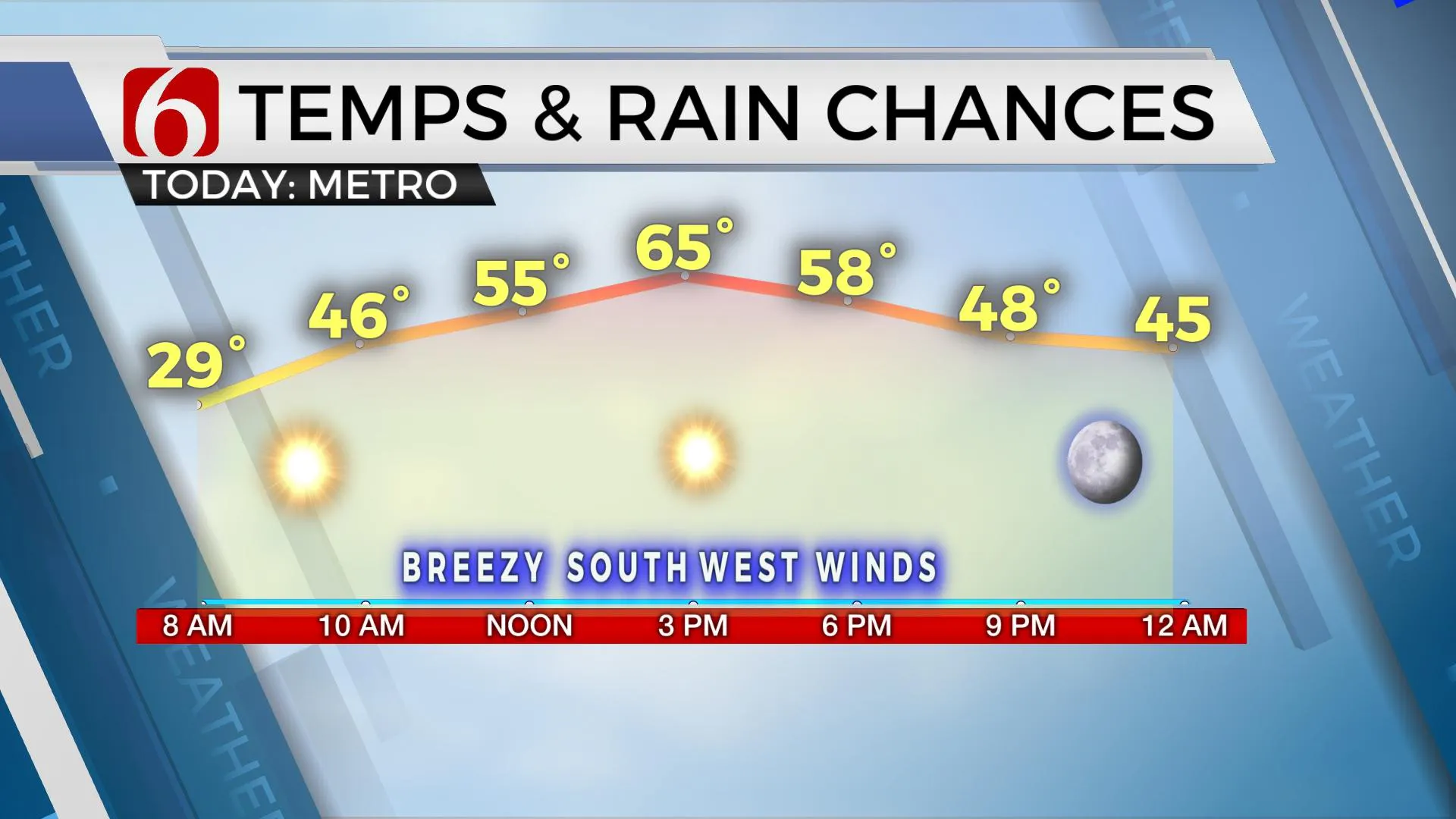
Welcome to a preview of spring-like weather for the first part of the week. The pattern will remain quite progressive for the foreseeable future. This means we’ll continue to track several systems across the southern plains soon. But we’ll enjoy the great weather in the short term with sunshine and much warmer temps compared to the deep freeze from the last two weeks. South to southwest surface winds gusting from 15 to 25 mph will be likely early this week, but other than slightly breezy conditions, we’re good to go in the short term.

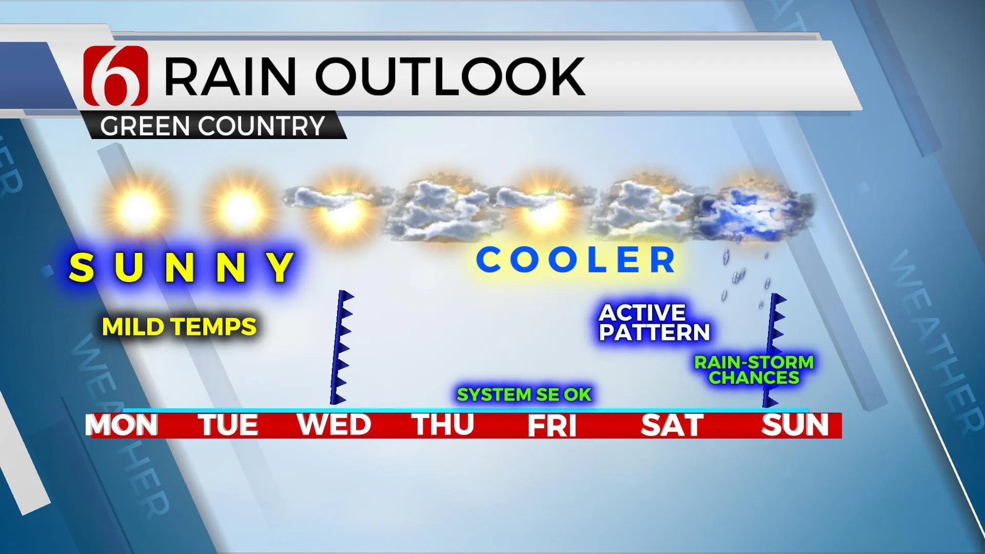
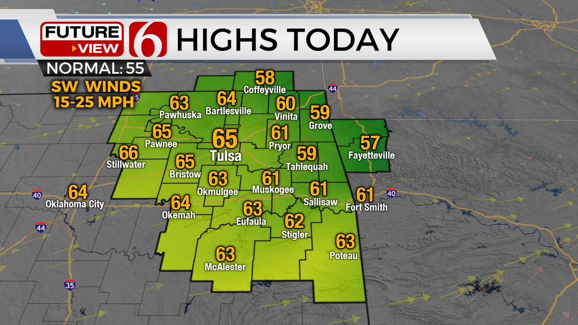
The remaining snowpack will gradually fade away as we grow with sunshine and warmer weather both today and tomorrow. Afternoon temps are expected well above the seasonal norms with many locations reaching the mid-60s today and the lower 70s Tuesday. A mid-level ridge of high pressure will be the dominant feature for the next 48 hours along with pleasant conditions for most of the state. After experiencing some springlike conditions both today and tomorrow, Wednesday will feature a weak boundary arriving with north winds and a few clouds. The airmass behind this boundary is not arctic and will be mild compared to last week. Morning lows for the second half of the week will stay in the 30s and 40s with afternoon highs reaching the 40s and lower 50s. The upper-level flow will be from the west to east allowing a weak disturbance to approach the area Wednesday along with another noticeably cooler air mass arriving for the second half of the week. Later this week, the flow will be mostly from the southwest and most data support a stronger system impacting the southern plains this weekend that could bring more wet and cold conditions back to the state.

The mid-week system appears mostly moisture-starved, and our rain chances will remain very low. A fast-moving wave will bring some rain to North Texas Thursday night into Friday morning with a low mention for northeastern yet high likelihoods for southeastern sections of the state. But a strong-looking upper-level wave could near our area next weekend with another good chance for rain and thunder across southeastern OK with some 30% probabilities for northeastern OK. Some data brings cold weather into the region behind this system for late next weekend into early next week, but we’ll hold-off any big advertisements at this point and enjoy the spring-like weather for the short term.

Thanks for reading the Monday morning weather discussion and blog. Have a super great day.
Alan crone
KOTV
Check out my daily podcast update. Search for NewsOn6 and ‘Weather Out The Door’ on most podcast providers including Here on Spotify.
More Like This
February 22nd, 2021
February 14th, 2022
January 26th, 2022
January 25th, 2022
Top Headlines
December 13th, 2024
December 13th, 2024
December 13th, 2024
December 13th, 2024


