Spring-Like Weather Returns To Green Country
We’re starting in the upper 20s and lower 30s this morning and will experience a mostly sunny day with highs nearing the mid to upper 50s before our weekend weather system finally clears the area Tuesday.Monday, March 1st 2021, 10:14 am
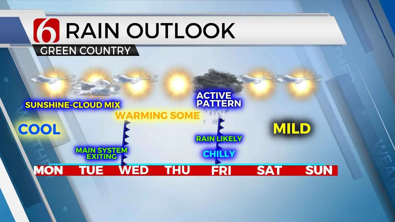
We’re starting in the upper 20s and lower 30s this morning and will experience a mostly sunny day with highs nearing the mid to upper 50s before our weekend weather system finally clears the area Tuesday. This will bring mild weather Wednesday and Thursday with highs in the mid to upper 60s before our next weather maker arrives Friday. If all goes as planned, this weekend will be pleasant, spring-like weekend with lows in the lower 40s and highs in the lower 60s.

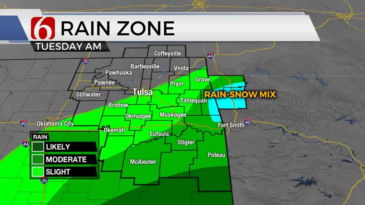
The main upper-level system that has been driving our weather for the past few days remains west of the state this morning but will finally get a kick and move eastward tonight into Tuesday. A few spotty showers will remain possible this morning across southeastern OK but with little impact before the main upper-level system draws closer to the area later tonight.

The latest trajectory suggests this closed low will move slightly more southward compared to previous runs and will mostly impact the Red River Valley locations with another chance of showers late tonight into pre-dawn Tuesday. Some activity could spread northward and I’ll continue to keep a small chance for showers for the metro due to the proximity of the system. The thermal profile could support some rain-snow mix but mostly across higher terrain areas of extreme east central OK and northwestern Arkansas Tuesday midmorning. As this low ejects, pleasant weather will remain for the remainder of the midweek period with some mid-level ridging south of the state and a northwest upper air flow for a few days, good enough to bring us some sunshine and mild temperatures. The highly progressive pattern churns out another strong looking system arriving Friday with additional rain or thunder chances for part of the state. The current trajectory of this system may keep strong to severe parameters southward across Texas but will need to be monitored carefully for any changes in the short term. As most data supports now, low level moisture will not have enough time to surge northward ahead of the system Thursday evening into Friday to support anything other than general rain or t-showers. This system will clear the area Friday evening and we may get a decent weekend with sunshine and temps in the lower 60s.
Thanks for reading the Monday morning weather discussion and blog.
Have a super great day!
Alan Crone
More Like This
March 1st, 2021
August 8th, 2023
July 4th, 2023
May 8th, 2023
Top Headlines
December 11th, 2024
December 11th, 2024
December 11th, 2024
December 11th, 2024


