Calm Tuesday Before Storm Chances Move In
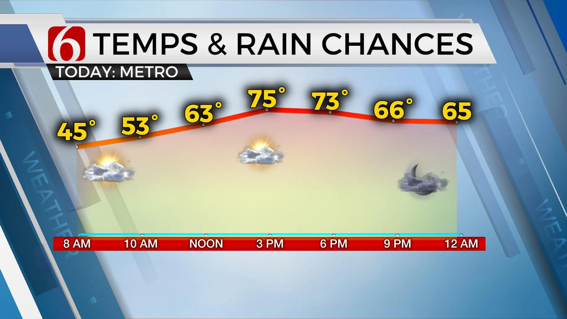
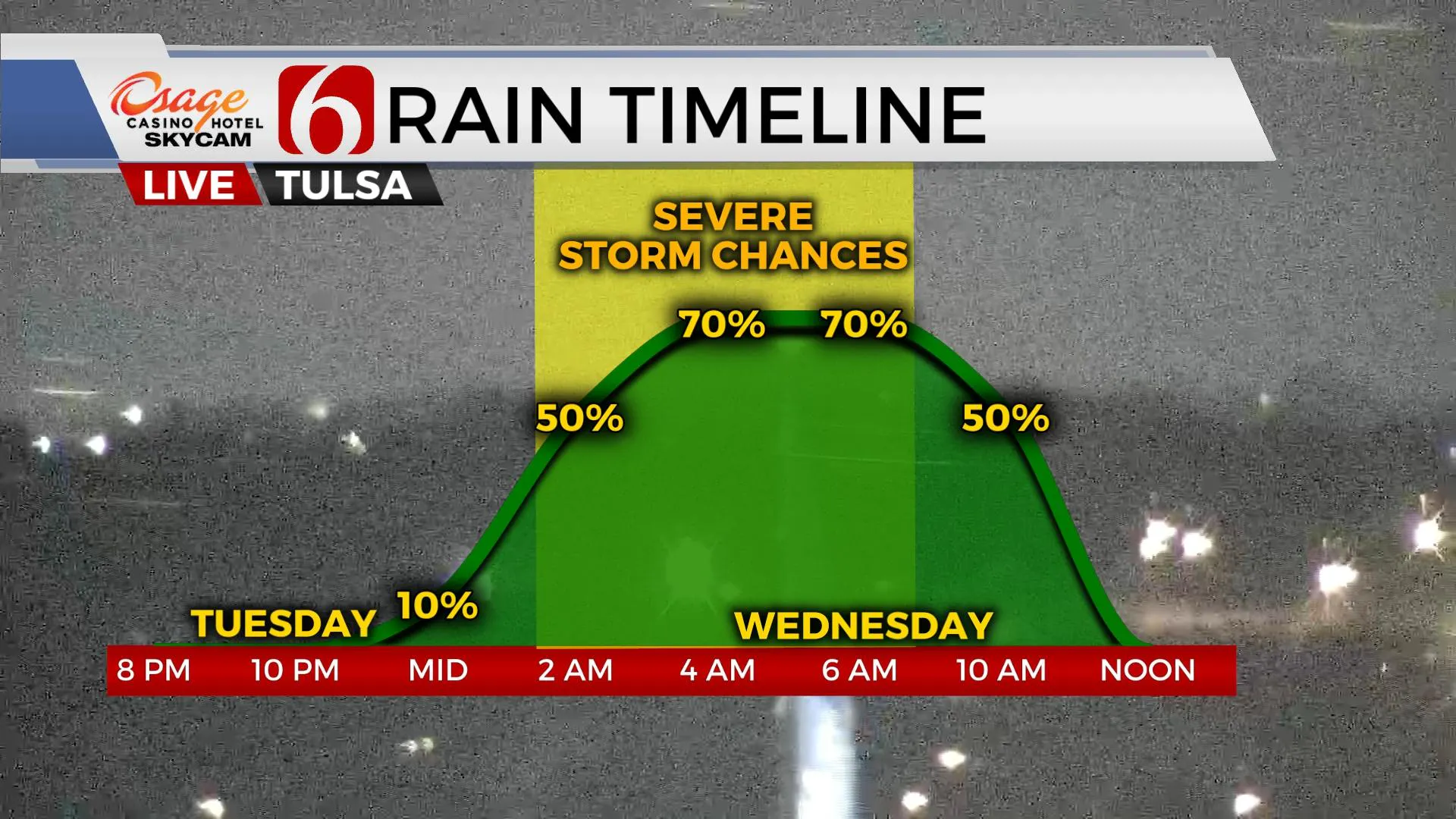
Most of today will be fine, but we continue to monitor late tonight, mostly early Wednesday for thunderstorms, including severe weather threats. Our incoming system features abundant shear needed for tilted updrafts and severe storms, but the question regarding the exact amount of low-level moisture and the positioning of this moisture holds the key to the types of severe weather threats with this system. To simplify, all modes of severe weather will remain possible early Wednesday. The main thrTuesday, March 16th 2021, 4:42 am
TULSA, Okla. -
Most of today will be fine, but we continue to monitor late tonight, mostly early Wednesday for thunderstorms, including severe weather threats. Our incoming system features abundant shear needed for tilted updrafts and severe storms, but the question regarding the exact amount of low-level moisture and the positioning of this moisture holds the key to the types of severe weather threats with this system. To simplify, all modes of severe weather will remain possible early Wednesday. The main threats will be hail and wind. But the tornado threat is not zero.

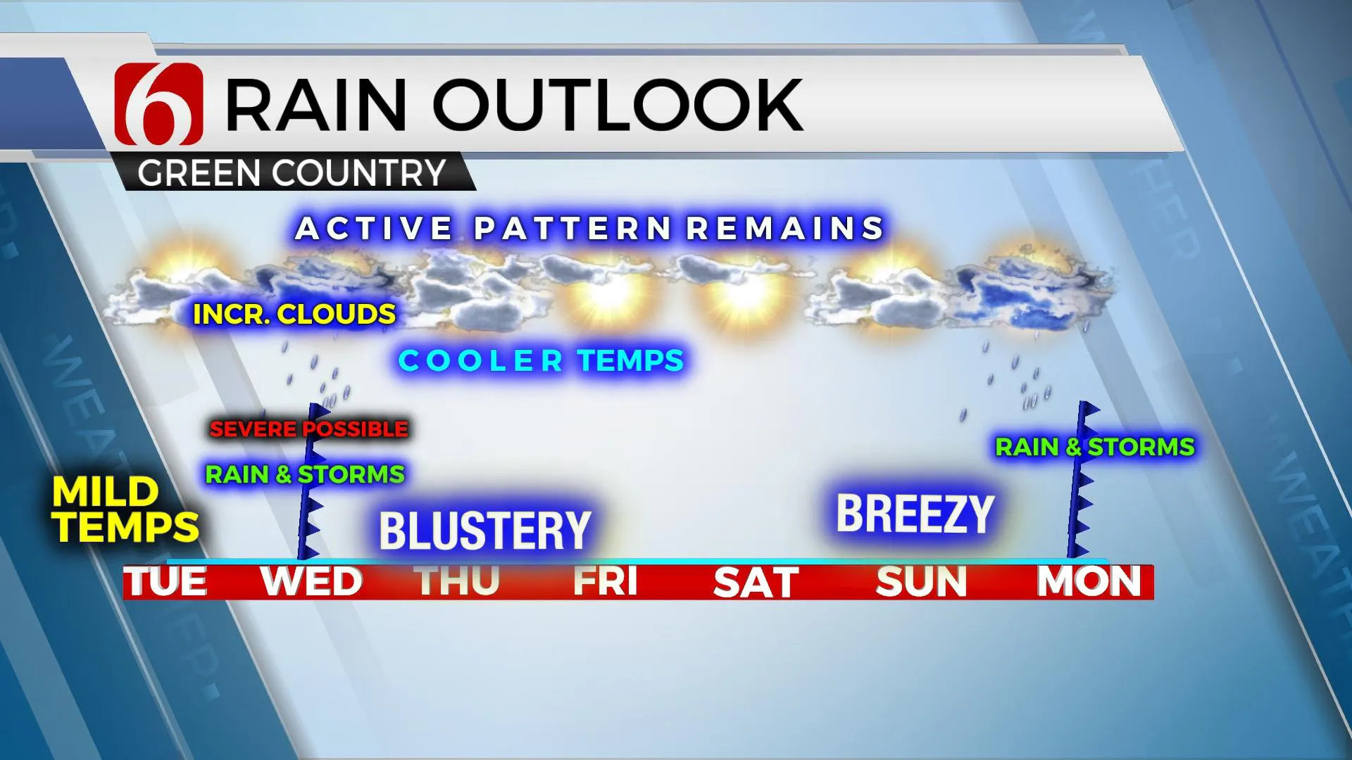
Our main window remains near around 1 a.m. through 10 a.m. Wednesday for strong to severe storms for the region. Additional strong to severe storms may redevelop around noon on the OK-Arkansas state line region and race eastward. The main upper-level cold-core low will not clear our immediate area until Wednesday late evening into early Thursday morning, and a few showers with embedded lightning will redevelop under this cold-core during this period along the OK-KS state line region but should be exiting by pre-dawn Thursday.

Blustery weather returns Thursday with gusty northwest winds from 20 to 35 mph and highs remaining in the lower 50s. We slowly climb out of the cooler weather Friday with lows in the 30s and highs in the upper 50s. The weekend looks good, but with gusty south winds Sunday as highs reach the mid to upper 60s. Our next system will arrive early next week with additional storm chances Monday evening.
Lower moisture content air remains this morning with dew points in the 40s. But with a low dewpoint depression, there will be some dense fog developing across southeastern Kansas for the next few hours but should remain north of our immediate region. We’re starting with north winds, but southeast winds should return by midday and rapidly transport warm and moist air northwest into central OK by tonight, directly into the developing surface low. If a more robust moisture return occurs than projected, the severe weather threats could increase even more due to the expected amount of shear and instability in the atmosphere. The main window for most of our part of the state will be from 2 a.m. Wednesday through 10 a.m.

Thanks for reading the Tuesday morning weather discussion and blog.
Have a super great day!
Alan Crone
KOTV
If you’re into podcasts, check out my daily weather update below. Search for NewsOn6 and ‘Weather Out The Door’ on most podcast providers, including Apple, Stitcher, Tune-In and down below on Spotify.

More Like This
March 16th, 2021
June 21st, 2023
June 19th, 2023
June 13th, 2023
Top Headlines
December 14th, 2024
December 14th, 2024
December 14th, 2024
December 14th, 2024


