Early Morning Storm Chances, Evening Temperatures In The 50s
The update will be brief as a strong front is moving across the area this morning. A layer of warm air aloft is suppressing most surface-based activity this morning, yet some elevated storm activity is likely for the next few hours. Even so, a few storms may produce gusty winds and hail and one or two may still trigger severe thunderstorm warnings. Our main concern will be for any cellWednesday, April 7th 2021, 3:58 am
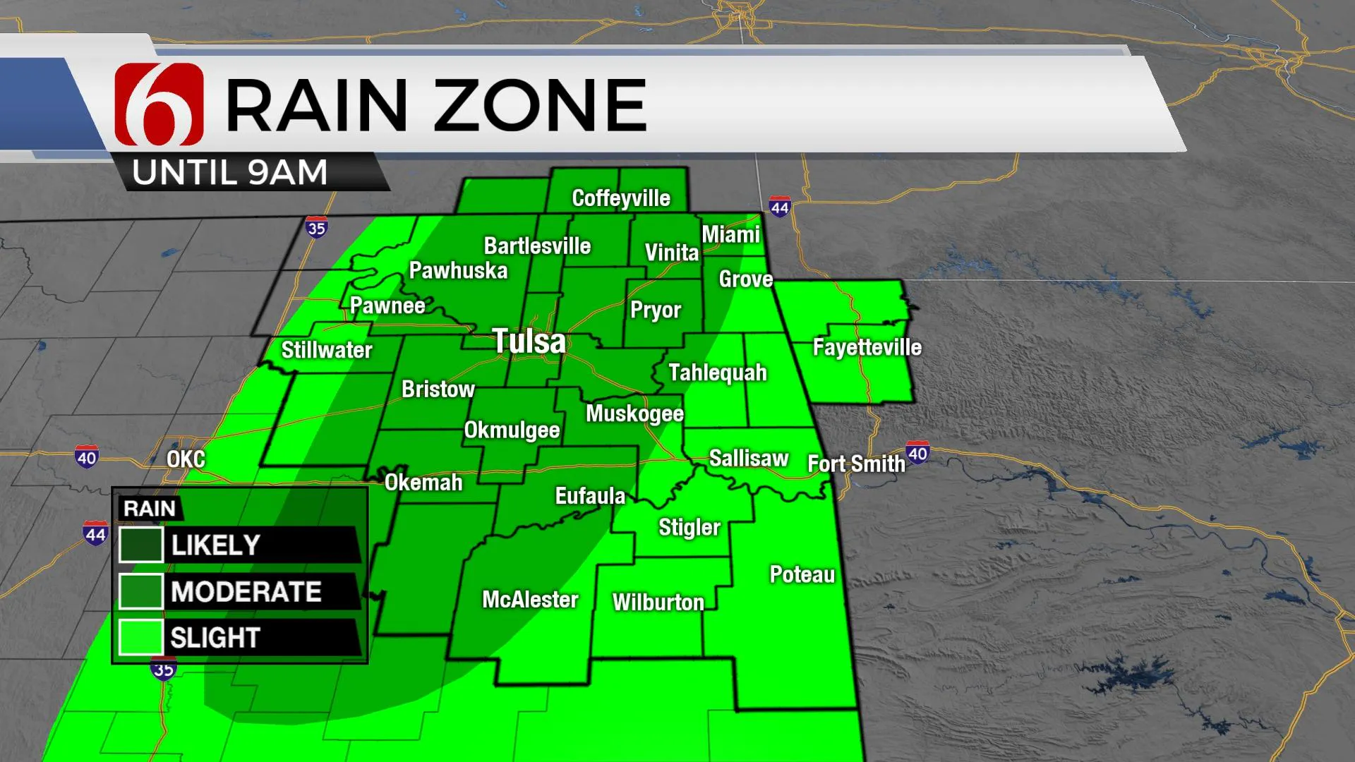
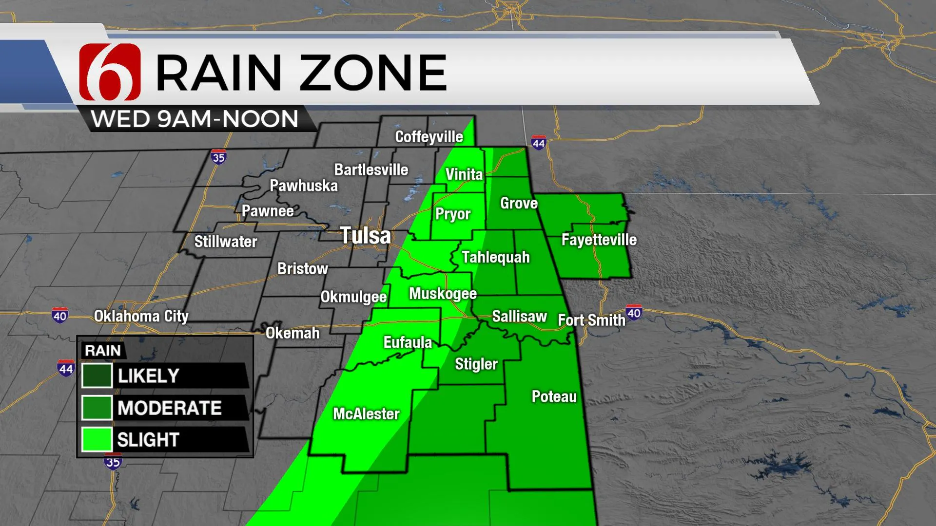
The update will be brief as a strong front is moving across the area this morning. A layer of warm air aloft is suppressing most surface-based activity this morning, yet some elevated storm activity is likely for the next few hours. Even so, a few storms may produce gusty winds and hail and one or two may still trigger severe thunderstorm warnings. Our main concern will be for any cells developing well ahead of the cold front, across far eastern OK during the next few hours. If storms do develop, the severe threats would be higher, including all modes of severe threats. We’re banking on the CAP keeping our activity mostly sub-severe near the metro. The front should clear eastern OK into the western Arkansas region between 11 a.m. and noon. As the boundary enters this region, storms may quickly strengthen and eventually become severe in along the OK-Arkansas state line region eastward.

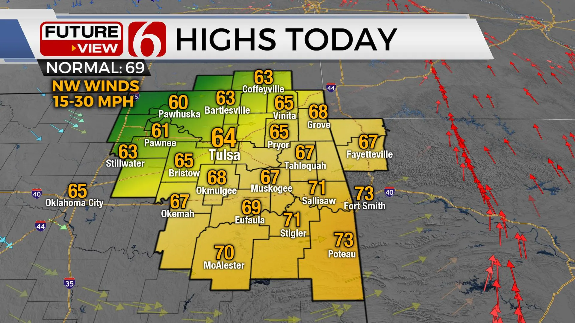
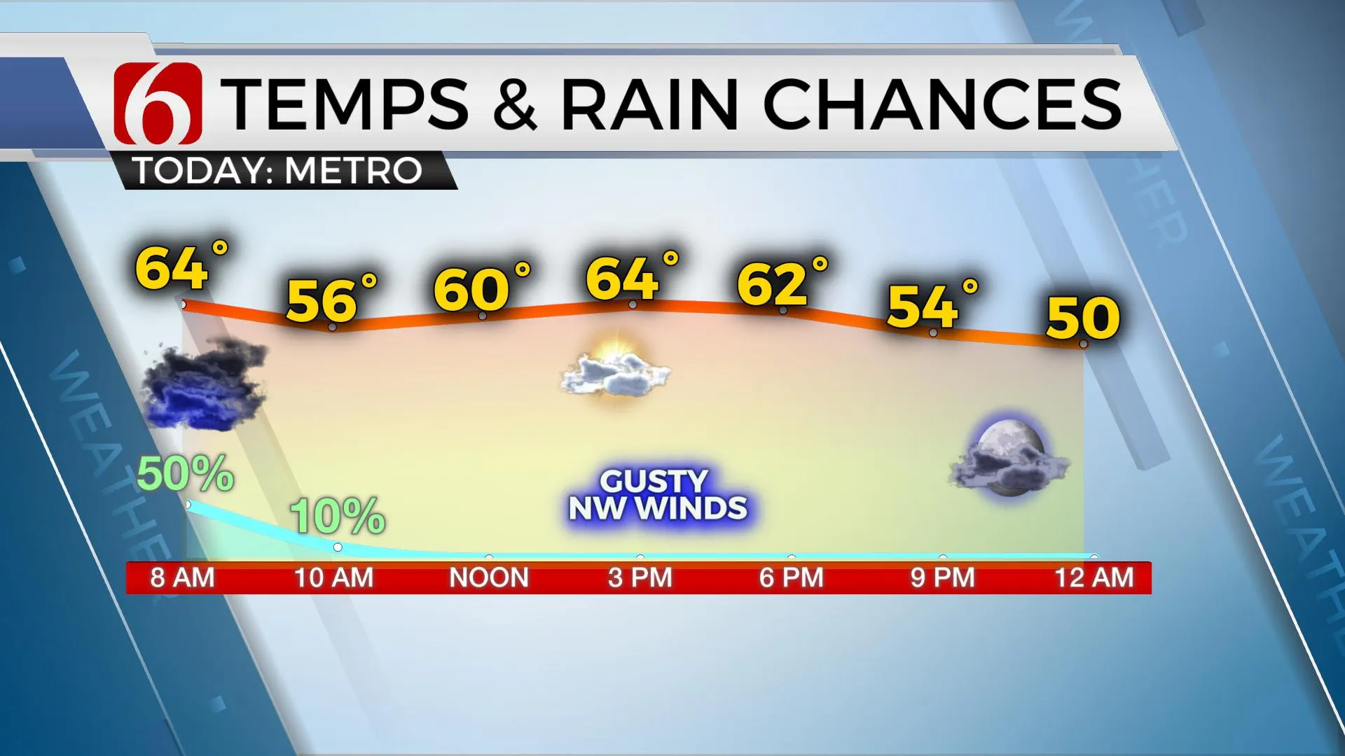
The main upper-level trough will remain near or slightly north of the state this morning through the afternoon before ejecting northeast tonight into Thursday morning. Gusty northwest surface winds will arrive behind the boundary and few spotty showers may populate southern Kansas later this afternoon as the main trough exits the area. Since most of this will remain north of our main area, I will not include this low probability this afternoon. We will deal with some wrap-around clouds across the northern section this afternoon and evening.

Dry air will wrap into the cyclone but the main impact of this airmass will reside across far western OK where Red Flag Warnings are likely later this afternoon due to strong winds, lower humidity and dry conditions. This dry air will also allow our temps to drop this evening into the 50s and will start Thursday morning lows in the mid-40s. Mostly sunny and pleasant weather is likely Thursday with highs in the lower to mid-70s. Unfortunately, the fire danger rates will remain quite elevated Thursday again across Eastern OK.

Our next system will quickly develop and move across the area from Friday evening into early Saturday morning. But most data support low-level moisture confined to the southern half of the state, more so into North Texas, where a few strong to severe storms will remain possible. But the trend is inching more northward with each run, and I’ll be increasing storm chances Friday, more so Friday evening and including the threats of strong to severe storms mostly along and south of I-40 into north Texas.

Our weekend looks mostly good. Saturday morning starts in the 40s and ends with highs in the lower 70s with north winds at 10 to 20 mph before winds return from the south Sunday in advance of our next fast-moving system. Most data now converge on a cold front moving across the state late Sunday night into early Monday morning with a low chance for a few storms.
A quick peek at early next week supports some slightly cooler air with highs mostly in the 60s and lows in the 40s before additional storm threats arrive for the second half of the period.
Thanks for reading the Wednesday morning weather discussion and blog.
Have a super great day!
Alan Crone
KOTV
If you’re into podcasts, check out my daily weather update below. Search for NewsOn6 and ‘Weather Out The Door’ on most podcast providers, including Apple, Stitcher, Tune-In and down below on Spotify.

More Like This
April 7th, 2021
June 21st, 2023
June 19th, 2023
June 13th, 2023
Top Headlines
December 14th, 2024
December 14th, 2024
December 14th, 2024
December 14th, 2024


