Cooler Weather Moves Across The State Starting Monday
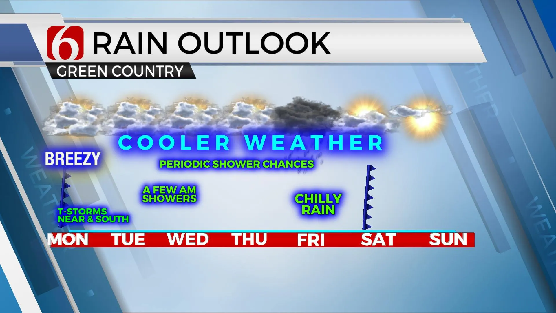
A pattern change, already underway, will bring cooler weather across the state beginning today and continuing through the rest of the week. Morning lows will be centered upon the lower to mid-40s with afternoons mostly in the lower to mid-60s. There will be some variation to the cooler side of those daytime highs, especially Wednesday and Friday when some widespread precipitation chances along with clouds will keep some of the highs in into the upper 50s. The presence of the cooler weather, loweMonday, April 12th 2021, 6:30 am
A pattern change, already underway, will bring cooler weather across the state beginning today and continuing through the rest of the week. Morning lows will be centered upon the lower to mid-40s with afternoons mostly in the lower to mid-60s. There will be some variation to the cooler side of those daytime highs, especially Wednesday and Friday when some widespread precipitation chances along with clouds will keep some of the highs in into the upper 50s. The presence of the cooler weather, lower moisture content in the atmosphere and lack of an unstable atmosphere will keep severe weather threats very low for the entire week: an oddity in mid-April. There will remain a very small window for a few storms later tonight across part of the region that could possibly produce some hail that may trigger a rogue warning.

This change has occurred as a strong upper-level low moving across the northern high plains will translate eastward near the Great Lakes and another trough becomes dominant across the western U.S. Cooler, Canadian air has already invaded a large area of the northern high plains and Midwest with the leading edge across most, but not all of Oklahoma this morning with the arrival of last night's cold front. Deeper gulf moisture is positioned well south of the state this morning and is projected to remain so for the entire week.

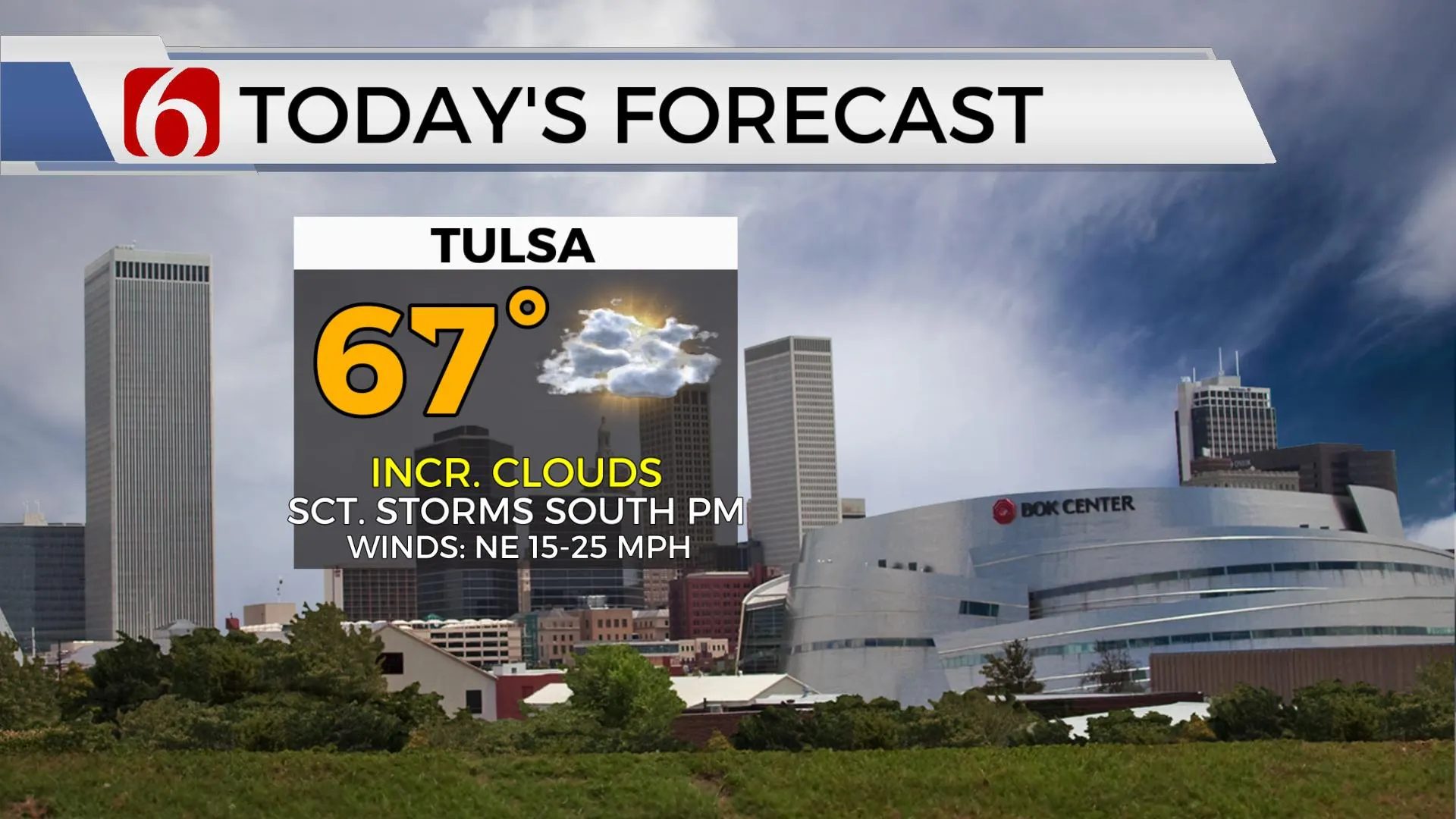
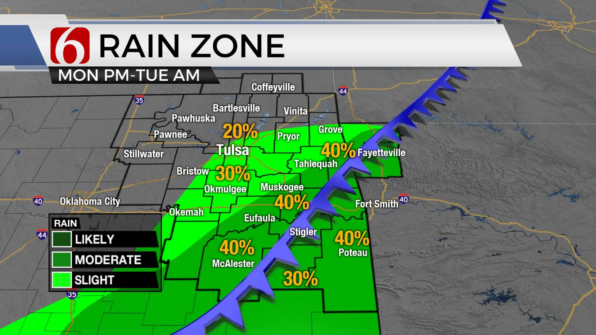
This front is now across far southeastern OK where it will be stalled for the next 12 to 16 hours before getting another shove more southward later tonight. As a weak disturbance approaches from the west this evening, a few storms will attempt to develop slightly north of the surface front, closer to the mid-level boundary which will be positioned between southeastern OK and the I-40 corridor. There still may be enough instability to produce some thunder and even a few cells that could produce small hail. It’s highly unlikely that any of this activity would become strong or severe, but some data supports the mention, and I’ll keep it here on the blog post. This period would be tonight between 8 p.m. and 2 a.m. Tuesday morning as the disturbance moves across the area.

The rest of the week will be characterized by another set of upper-level waves impacting the state with showers and some thunder. The next would be late Tuesday night into Wednesday morning with the higher likelihood of arriving Thursday night into most of Friday. Please keep in mind that not all locations will experience shower activity with these disturbances for the early part of the week. The latter wave Friday seems to have the best chance of widespread rain for most of the eastern sections of the state. As this late week system exits, most of our weekend also appears pleasant as a surface ridge of high pressure dominates the weather Saturday into part of Sunday.
Thanks for reading the Monday morning weather discussion and blog.
Have a super great day!
Alan Crone
KOTV
If you’re into podcasts, check out my daily weather update below. Search for NewsOn6 and ‘Weather Out The Door’ on most podcast providers, including Apple, Stitcher, Tune-In and down below on Spotify.

More Like This
April 12th, 2021
June 21st, 2023
June 19th, 2023
June 13th, 2023
Top Headlines
December 11th, 2024
December 11th, 2024
December 11th, 2024
December 11th, 2024


