6-Star Weather Day, Possible Friday Showers
A six-star weather day is ahead. Possible Friday showers move in.Thursday, May 6th 2021, 6:29 am
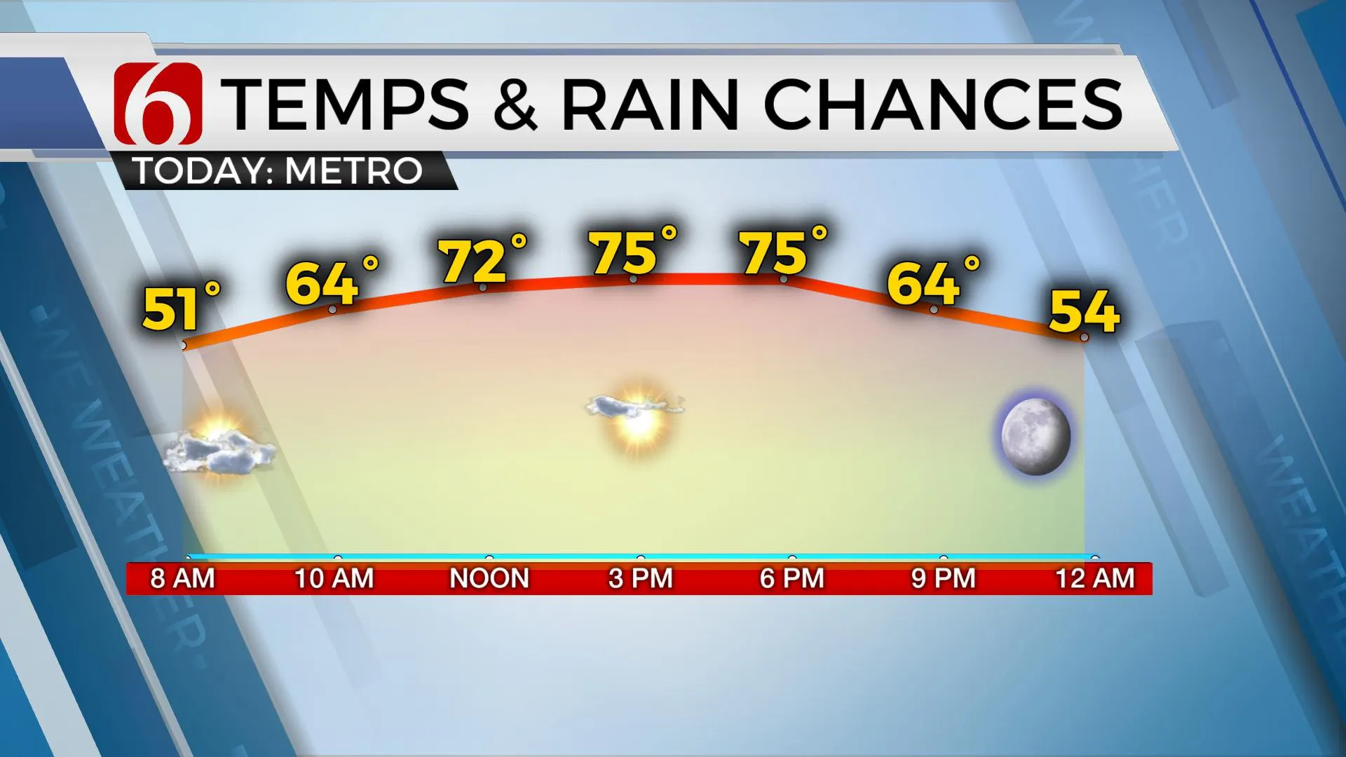
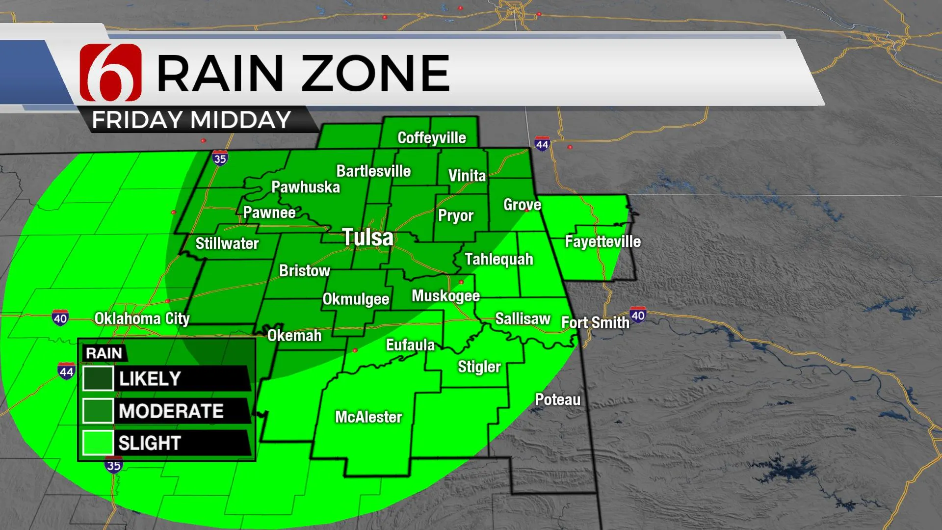
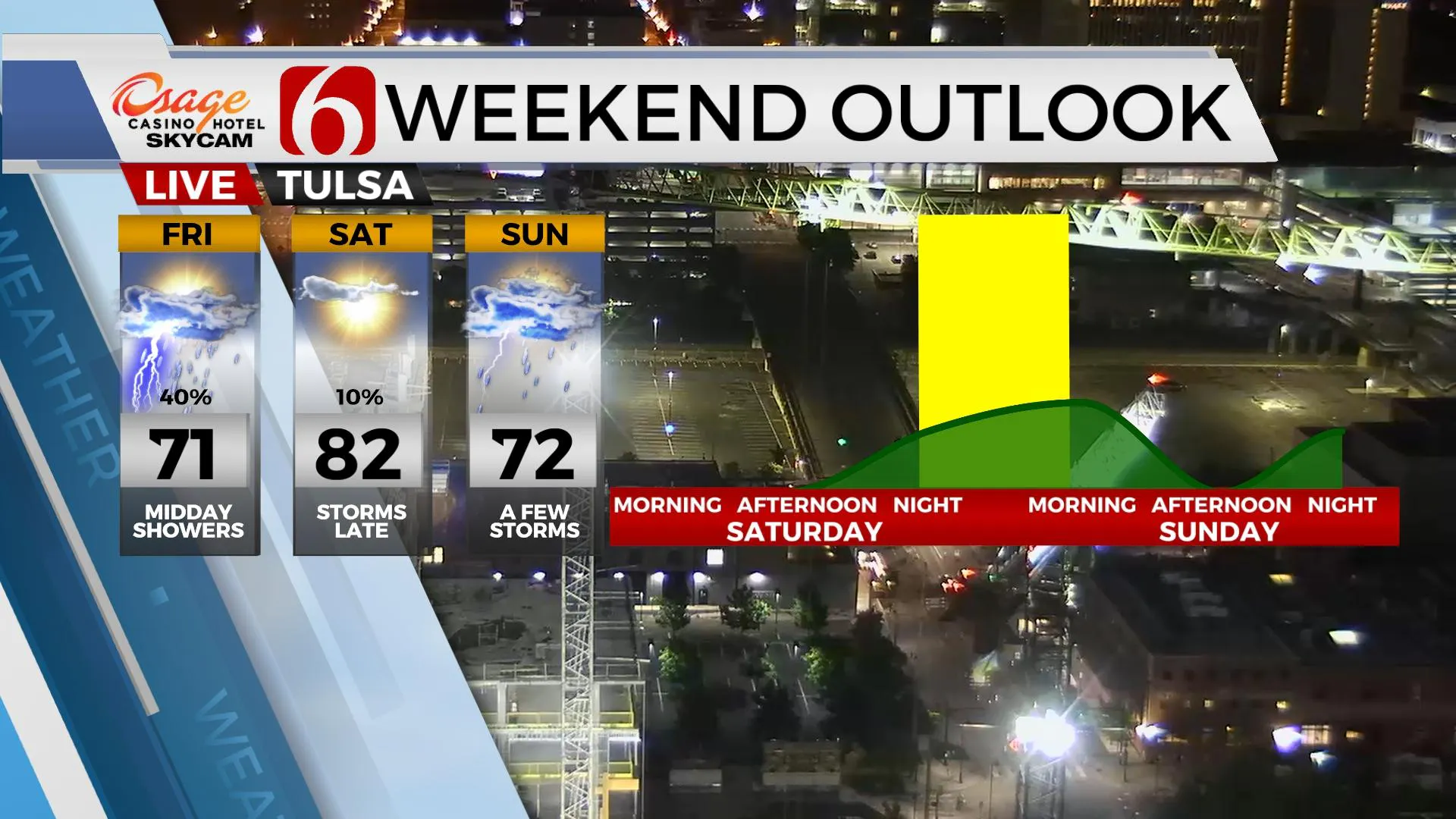
It looks like another six-star weather day ahead with highs reaching the mid-70s along with northwest winds from 10 to 20 mph and more sunshine. Friday features highs reaching the lower to 70s with southeast winds bringing low-level moisture back into the state. A few showers may drop down across northern OK Friday midday before moving rapidly east. No severe weather is expected. A few storms will develop tomorrow afternoon across the northwestern part of the state and could brush far northern OK and southern Kansas late Friday night into Saturday morning. This chance remains low, but not zero. The pattern will be changing soon, including the mentions for a few strong to severe storms for a small period this weekend if the CAP breaks, before cooler and wet weather arrives and remains for several days next week.

The overall thinking regarding the weekend has not changed much from yesterday’s post.
The next stronger upper-level trough is developing this morning across the pacific northwest will move into the northernmost regions of the Rockies later tonight into Friday before moving into the central plains this weekend. Most of the forcing for this system will focus across the central plains early this weekend but will bring some energy around the basal region of the trough Saturday night into Sunday morning.

Strong south winds will bring deep low-level moisture into southern Kansas by Saturday morning with a dryline developing across far western OK by the afternoon. A layer of warm air aloft ( the CAP) is expected to suppress most daytime thunderstorms across most of the state during the day. By Saturday evening into pre-dawn Sunday morning, the CAP will weaken as colder air aloft arrives from the west. Storms will attempt to develop, and some severe threats would be possible late Saturday evening into early Sunday morning. Most data support the CAP holding through this period with very little convective activity late Saturday night, but we’ll need to keep some pops because of the potential severe weather threats, which would include all modes.
During this period, a strong cold front moves from central Kansas southward into northern OK Sunday morning with some showers and storms near this front. This boundary may slowly inch southward Sunday midday before entering southern OK Sunday night and pre-dawn Monday with some additional storm chances, including the threat of some marginally severe storms along the Red River Sunday evening. Our probability for a few storms will remain Sunday, but higher chances for any strong to severe will be confined to the Red River Valley Sunday night.

This same boundary will be south near the north Texas region early next week as the main upper trough remains north and a few short waves move near the state. This will bring additional rain and storm chances near and north of the front, including Monday evening into Tuesday morning, possibly into Wednesday. This period may feature some flooding potential and much cooler than normal temperatures, along with some marginal severe weather threats across southern OK.
Thanks for reading the Thursday morning weather discussion and blog.
Have a super great day!
Alan Crone
KOTV
If you’re into podcasts, check out my daily weather update below. Search for NewsOn6 and ‘Weather Out The Door’ on most podcast providers, including Apple, Stitcher, Tune-In and below on Spotify.

More Like This
May 6th, 2021
February 14th, 2022
January 26th, 2022
January 25th, 2022
Top Headlines
December 13th, 2024
December 13th, 2024
December 13th, 2024
December 13th, 2024


