Chilly Temperatures, Rain Chances Start Off The Week
Grab a jacket as you head out the door, chilly temperatures have made a return to Green CountryMonday, May 10th 2021, 8:35 am
Grab a jacket for the day, and even some rain gear for a few locations. This unsettled weather pattern remains, along with cooler than normal temperatures for the first part of the week.

The upper airflow for the next few days will mostly be zonal or from the west to east before gradually buckling into a northwest flow pattern this weekend and returning to a southwest flow early next week. A series of mostly weak disturbances will skirt the region for the next few days, but with stronger forcing remaining mostly north of the state Wednesday before tracking stronger forcing nearing the plains this weekend as temps warm and humidity values increases.
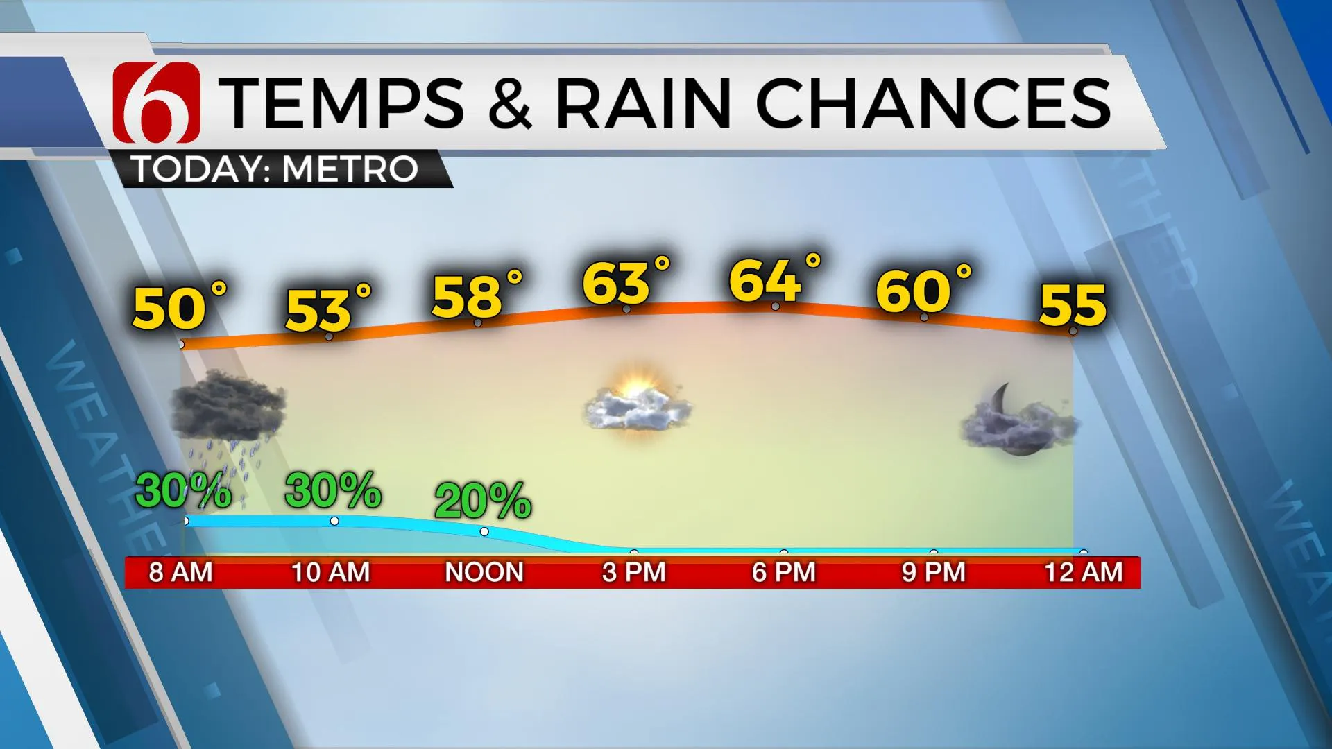
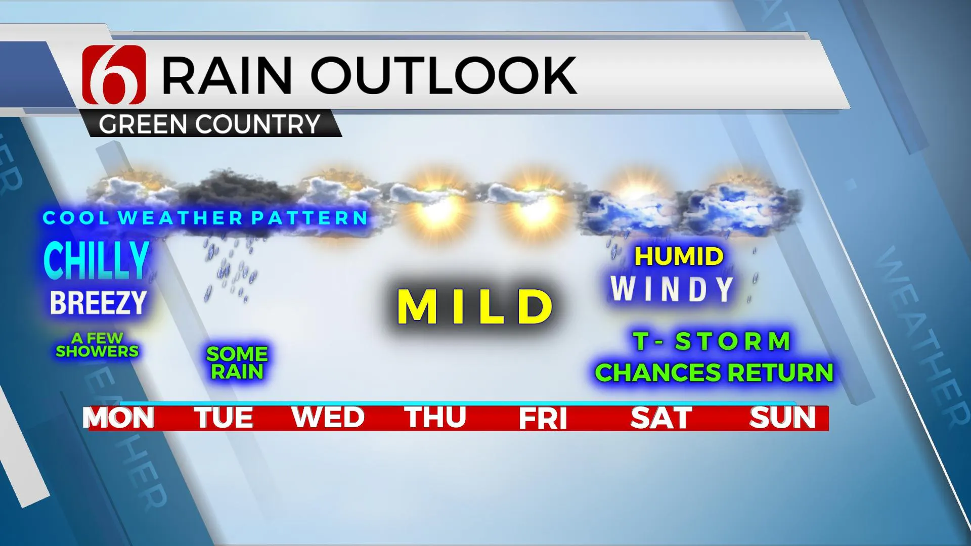
The cold front that moved across the region yesterday morning is positioned well south of our area this morning, but some moisture moving up and over the boundary may bring us a few showers occasionally this morning, but mostly beginning later tonight through Tuesday afternoon or evening. At this point, the higher chances for most of the area appear to arrive Tuesday. No severe weather is expected near our immediate area with any stronger storms along the Red River southward into Texas. This pattern also brings us cooler than normal temperatures for the next few days.

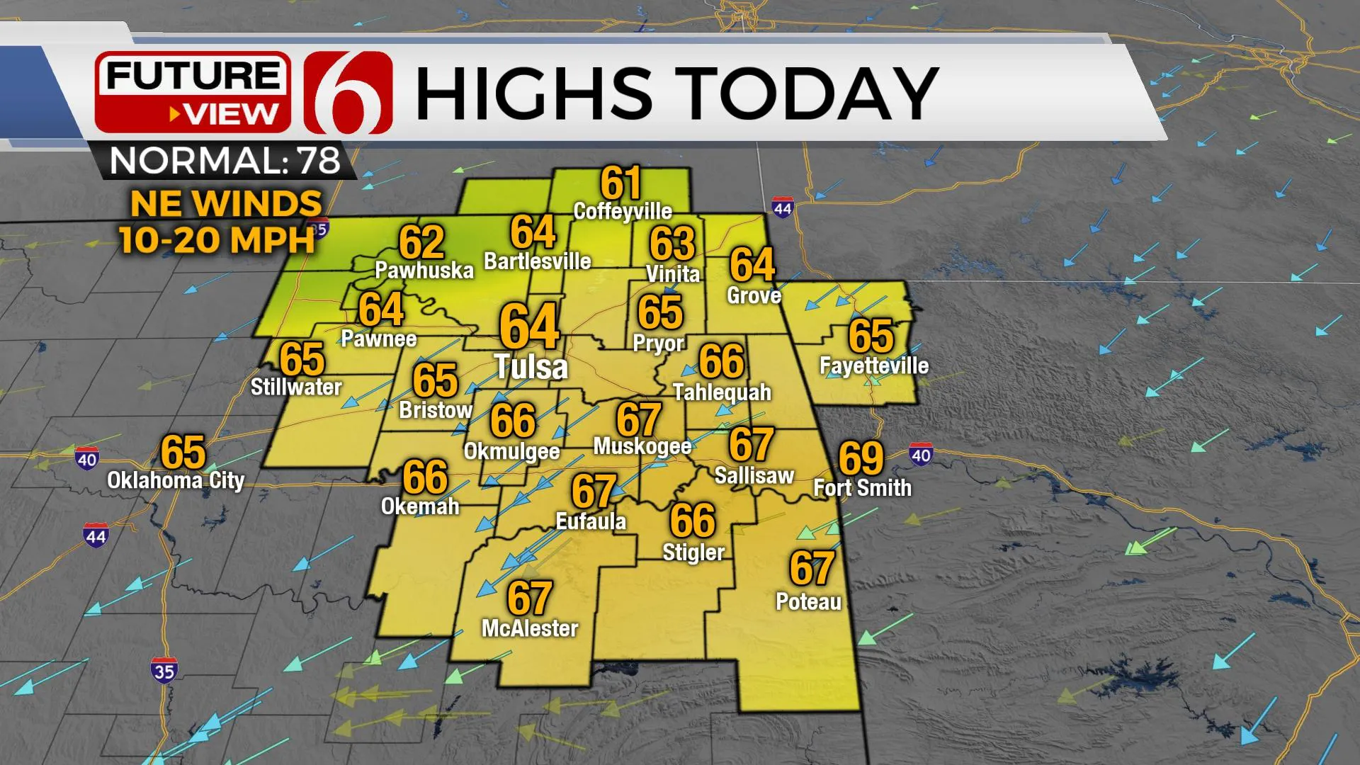
Temperatures this morning will start in the mid to upper 40s with afternoon highs reaching the lower to mid-60s. Tue and Wed morning lows will be near 50 with highs also in the upper 50s to lower 60s. Thursday starts with lows in the upper 40s and highs in the lower to mid-70s. Temps this weekend will rebound with lows in the 60s and highs in the lower 80s along with gusty south winds. The pattern this weekend also brings significant low-level moisture back into the area as a series of upper-level disturbances near the region. The result will be increasing thunderstorm chances at times continuing into early next week.

A quick word about this past weekend. The CAP, or layer of warm air aloft, held for most of the period from late Saturday through pre-dawn Sunday across eastern OK with a few strong to severe storms positioned over northwestern Arkansas. The cold front plowed through the region early Sunday with strong north winds and falling temps, but no significant shower or storm activity occurred for most of the area. We’re now on the cool side of this front and will remain so for the first part of the week.
Thanks for reading the Monday morning weather discussion and blog.
Have a super great day!
Alan Crone
KOTV
If you’re into podcasts, check out my daily weather update below. Search for NewsOn6 and ‘Weather Out The Door’ on most podcast providers, including Apple, Stitcher, Tune-In and below on Spotify.

More Like This
May 10th, 2021
February 14th, 2022
January 26th, 2022
January 25th, 2022
Top Headlines
December 13th, 2024
December 13th, 2024
December 13th, 2024
December 13th, 2024


