Scattered Showers Continue For Green Country
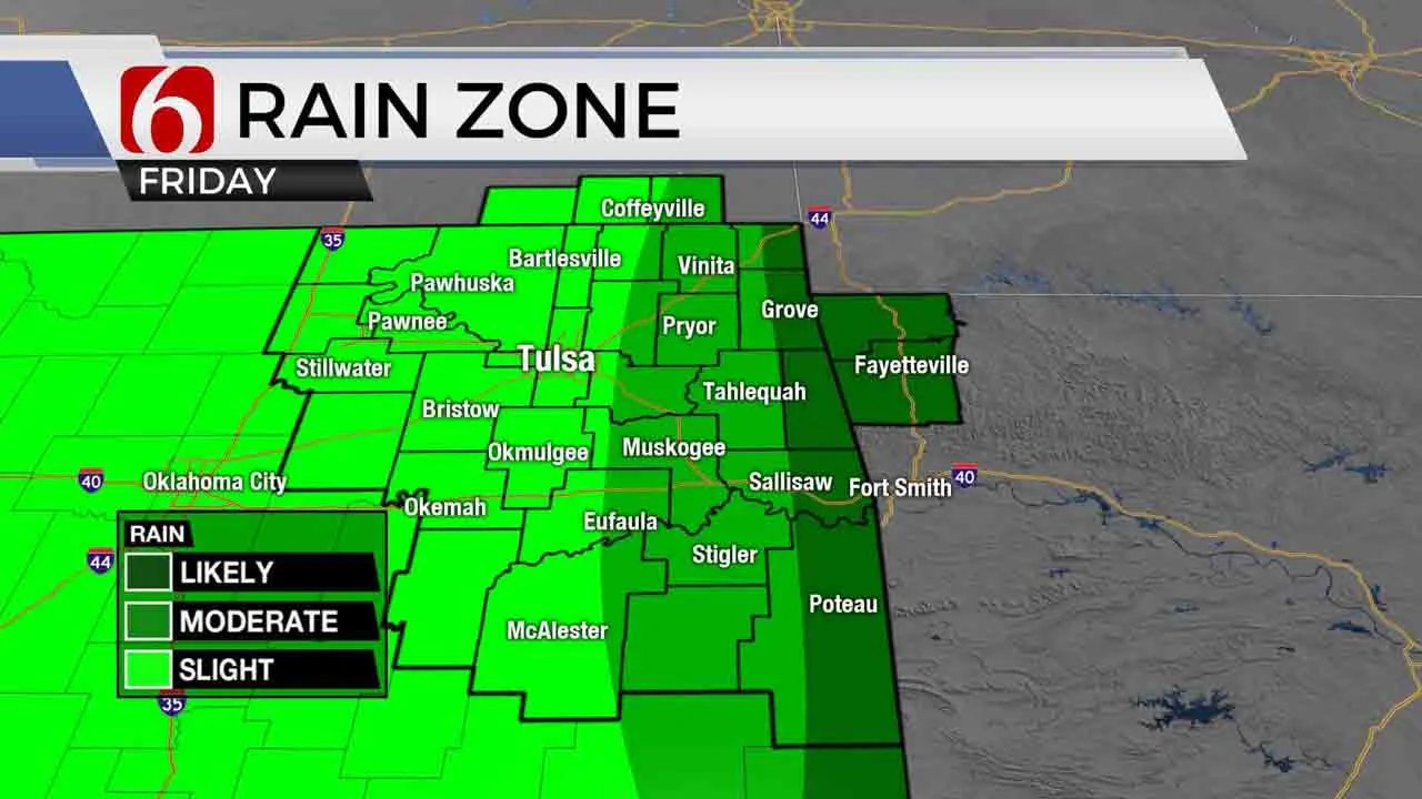
Keep the rain gear handy both today and Saturday. Occasional showers will move across part of the area today, with additional precip chances remaining into the weekend. While the overall active weather pattern remains for the next several days, some minor changes will occur.Friday, May 21st 2021, 11:09 am
Keep the rain gear handy both today and Saturday. Occasional showers will move across part of the area today, with additional precip chances remaining into the weekend. While the overall active weather pattern remains for the next several days, some minor changes will occur.

The pattern will slowly be changing for the next few days as a mid-level ridge of high pressure attempts to settle slightly east, mostly across central Arkansas eastward into the southeastern part of the nation. The latest data this morning suggests this ridge may be weaker on the western edge and the center still too far east to have major impacts for our immediate area for the short term. We’ll continue to track a few showers today, but fewer compared to yesterday. I’ll need to make a few changes for the weekend, most notable to increase precip chances Saturday morning as a disturbance moves into the metro region early tomorrow morning and may fester into the afternoon. But the rest of the extended remains intact from yesterday. The ridge drops southeast away from our region early next week as the next trough ejects into the northern high plains Monday and Tuesday. The middle of next week features the flow flattening and bringing stronger winds aloft across the central plains as several disturbances travel the region. A weak surface front is also likely to develop and may become a focus for thunderstorm chances midweek into late next week, including the potential for a few strong to severe storms.

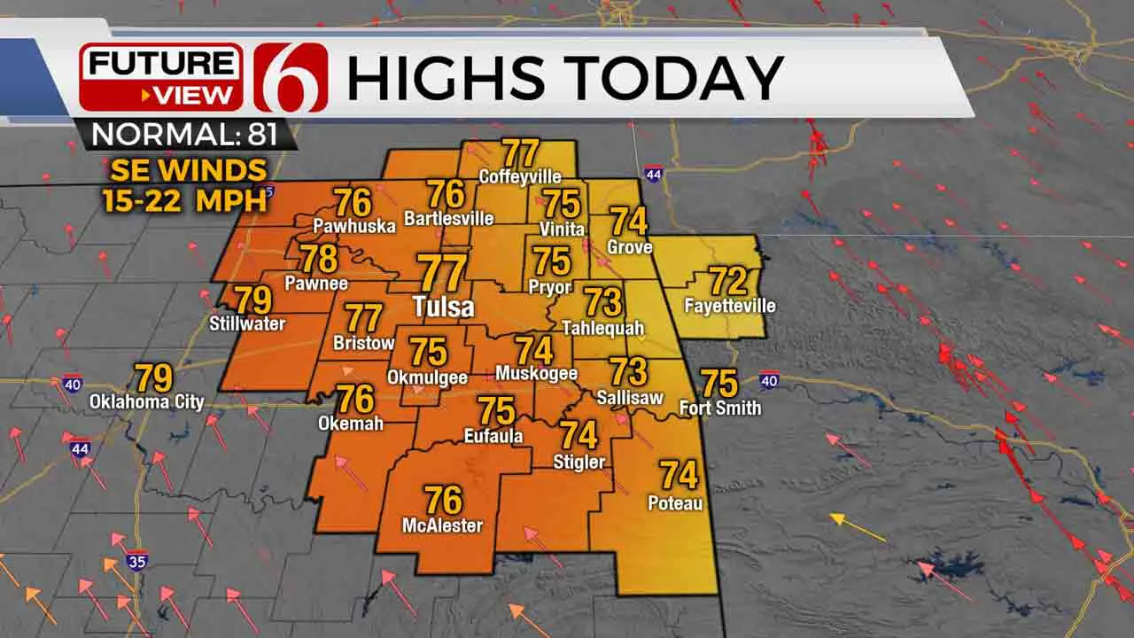
Today, occasional passing showers will arrive from the south to north along with mostly cloudy sky and south winds from 15 to 20 mph. Afternoon highs will mostly stay in the upper 70s but a few spots could near 80 to the west.

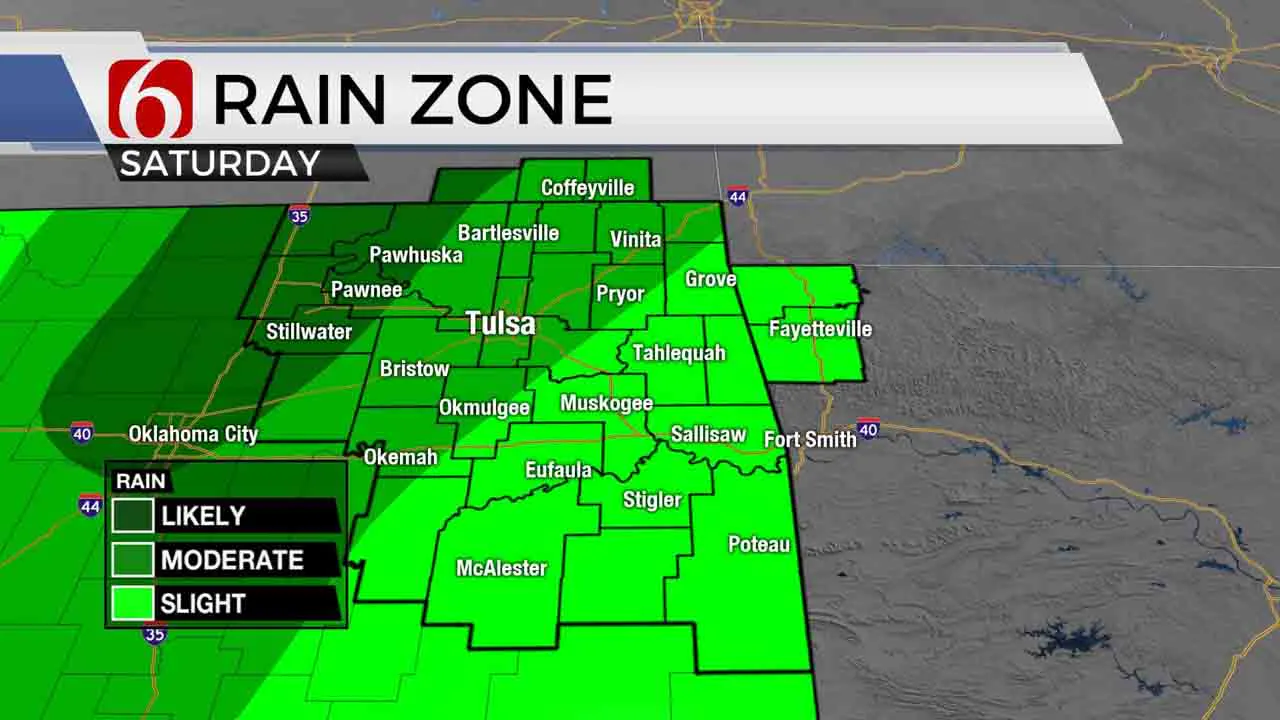
Later tonight into early Saturday morning, a wave should trigger showers, and possibly some thunder near and northwest of the metro with activity moving north to northwest through the morning hours. Our tropical-like atmosphere will support some moderate downpours, but limited instability should keep the thunder on the low side. Later tomorrow afternoon, this same area of showers may drift more northeast around the western periphery of the ridge and impact part of northeastern OK. Thus, the increase in probability for Saturday. Afternoon highs tomorrow should reach near 80 with south winds from 15 to 20 mph and mostly cloudy sky.
Thanks for reading the Friday morning weather discussion and blog.
Have a super great day!
Alan Crone
More Like This
May 21st, 2021
August 8th, 2023
July 4th, 2023
May 8th, 2023
Top Headlines
March 13th, 2025
March 13th, 2025


