Another Hot, Humid Day, Highs In the Lower 90s
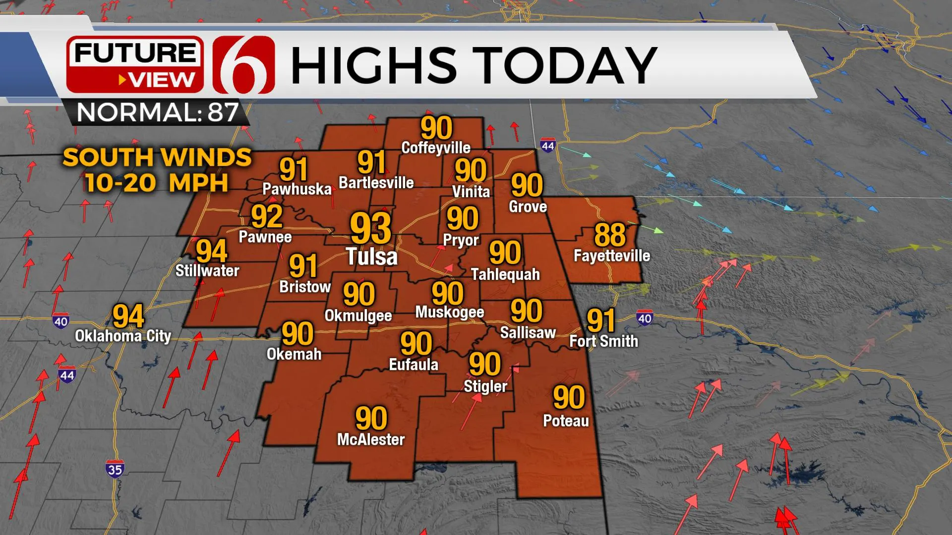
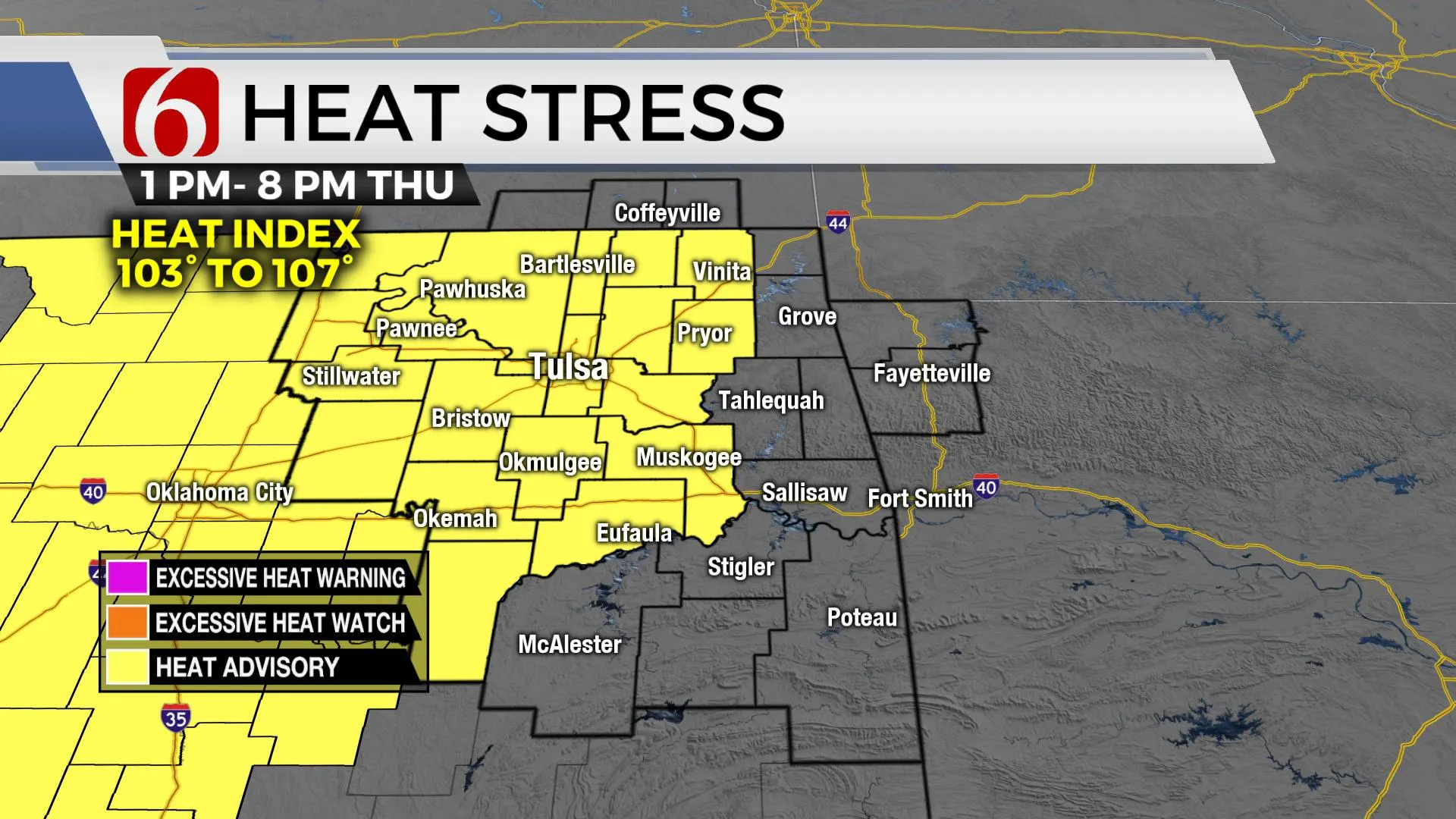
Another warm and humid day is underway, a heat advisory is in effect for most of the area.Thursday, June 10th 2021, 7:07 am
Warm and steamy weather likely both today and tomorrow.

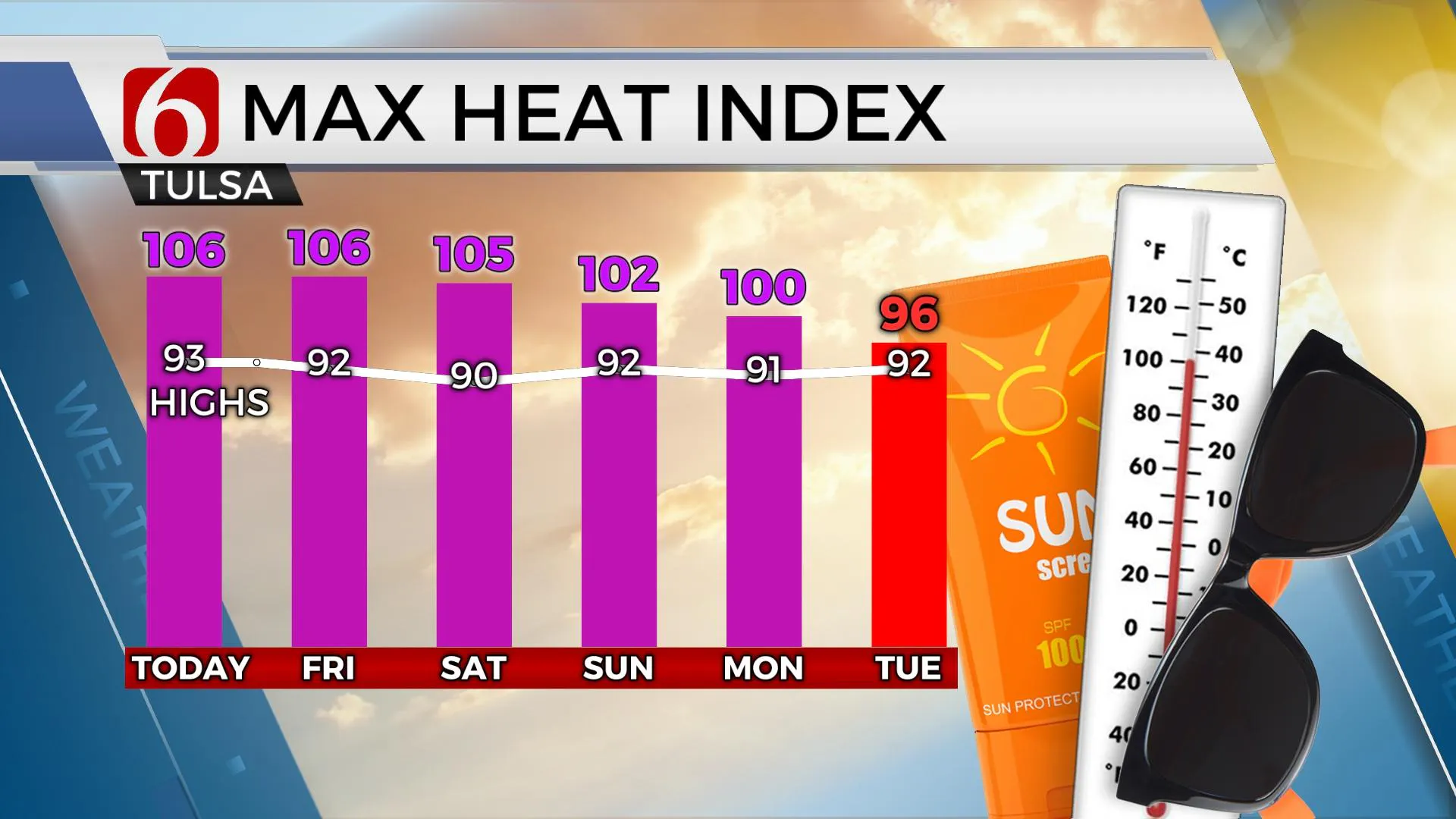
Our main concern will be the slowly increasing heat index for the next few days. Most of the area is going to be included in heat advisories for the next few days as these values range from 100 to 107. A significant surge of tropical moisture is already entrenched across eastern OK. Recent rainfall will also act to add some additional moisture into the boundary layer resulting in a very humid atmosphere now through the weekend despite a weak front scheduled to enter eastern OK Friday night into Saturday morning. This front will bring a chance for a few storms nearby, even the possibility of a small complex of storms across southeastern Kansas into northeastern OK late Friday night into early Saturday morning, but the air mass behind the boundary will remain quite tropical with no major changes in humidity values. The overall pattern may change enough by the middle of next week to offer some slightly cooler and less humid conditions while opening the gate for a few storm systems to impact the state.

Temps this morning will start in the lower to mid-70s with a few morning clouds and light wind. A few isolated showers or storms will again be possible this morning across extreme northeastern Ok and western Arkansas, but most locations will remain dry. The mid-level ridge of high pressure now building from west TX into western OK will nudge northeastward nearing our part of the state this afternoon. The far northeastern sections will remain on the peripheral of the ridge and may offer a small window for a few afternoon or evening storms across extreme northeastern OK and southeastern Kansas this evening. Even with a low chance for any activity, mature storms would produce locally heavy rainfall and gusty winds. Most locations will remain dry. I will keep a 30% chance for a few storms, or even a small complex of storms late Friday night into pre-dawn Saturday.

Early next week, the ridge will be shifting slowly west and creating a meridional flow over the central plains. This will bring a chance for a few storms nearby, including the reduction in temps into the mid-80s by midweek. Dew points currently in the mid to upper-70s will drop into the lower and mid-60s by the latter half of next week offering some relief from high heat index values.
Thanks for reading the Thursday morning weather discussion and blog.
Have a super great day!
Alan Crone
KOTV
If you’re into podcasts, check out my daily weather update below. Search for NewsOn6 and ‘Weather Out The Door’ on most podcast providers, including Apple, Stitcher, Tune-In and down below on Spotify.

More Like This
June 10th, 2021
February 14th, 2022
January 26th, 2022
January 25th, 2022
Top Headlines
December 13th, 2024
December 13th, 2024
December 13th, 2024
December 13th, 2024


