Another Warm & Breezy Day, Storm Chances Return Through The Weekend
Another warm and breezy day will be likely before the pattern brings storm chances back to the state later tonight through the weekend. This active pattern is likely to persist for several days.Friday, June 25th 2021, 7:55 am
TULSA, Oklahoma -
Another warm and breezy day will be likely before the pattern brings storm chances back to the state later tonight through the weekend. This active pattern is likely to persist for several days.

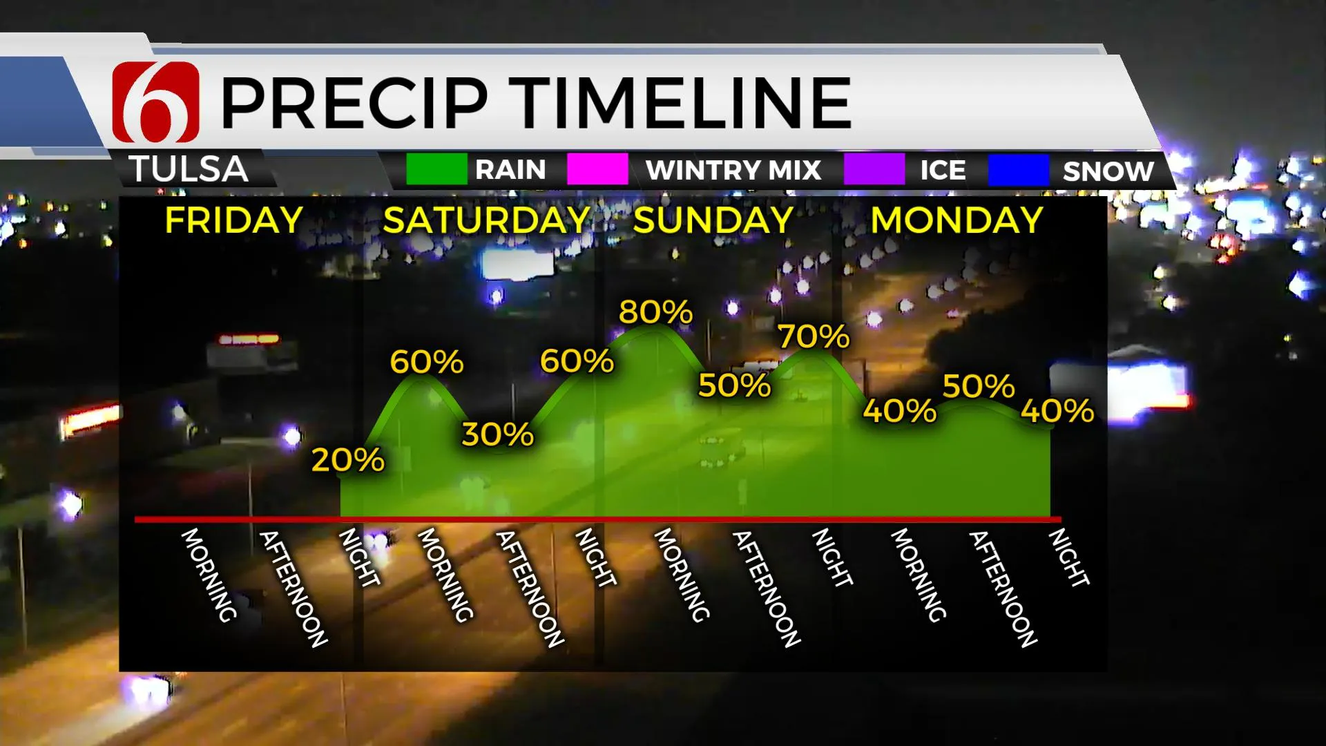
Our main issues revolve around storm chances, the exact timing and the impact for weekend plans. The advertised cold front (boundary) continues to slow down in some of the data. The real-deal cold front probably stays northwest of our immediate area for the entire weekend, but several outflow boundaries generated from nearby storms will cause some minor variation in the wind direction at times. Data today has flipped to slightly higher chances for storms later tonight into early Saturday morning for a few hours before thinning some Saturday midday to afternoon. Additional storms will attempt to fire up Saturday afternoon and evening but not for all locations. A few of the storms may be strong to severe, but upper-level flow and support for severe storms will mostly be located northeast of our immediate area after Saturday morning to midday. But surface instability and the potential convective energy is expected to be moderate to strong Saturday afternoon and may support a few pulse-type severe storms with wind damage in a cell or two. But the overall trend in most of the data suggests our higher threats will be locally heavy tropical downpours resulting in localized flooding issues. Basically, what happens Saturday morning has a direct impact on the location and amount of storm activity Saturday afternoon into the evening hours.

Sunday into early next week features the boundary near or slightly northwest of the metro but the upper-level chart depicts a broad upper low positioned to our north, across the central plains. This position will bring several weak disturbances at the base of the flow across Oklahoma for several days next week resulting in daily storm chances through at least Wednesday and we may need to now include chances all the way through the July 4th holiday. A highly unusual pattern is setting up for late June and early July with a sub-tropical ridge across the mid-Atlantic, another ridge across the western U.S. and a broad trough positioned across the central part of the country. This blocking pattern will keep our weather very active. The benefit will eventually be cooler weather. The potential for flooding will increase in this pattern.

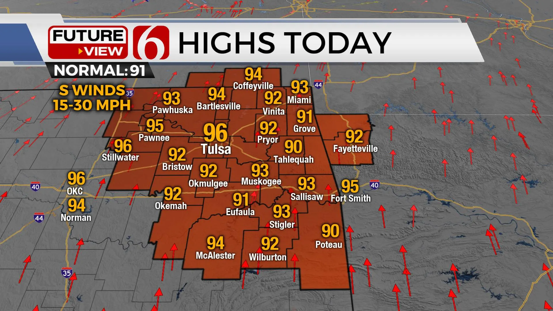
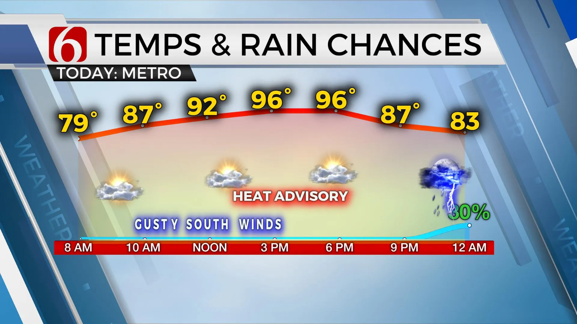
Temps today are expected to reach the mid-90s again with heat index values nearing 105 to 107 nearby that would trigger a heat advisory for some locations. Saturday starts in the upper 70s with highs still reaching the upper 80s or even lower 90s and heat values near 100 before a noticeable cool-down occurs Sunday into early next week as daytime highs dip into the lower to mid-80s. The presence of tropical moisture will remain, so the humid weather also remains into early next week.
Thanks for reading the Friday morning weather discussion and blog.
Have a super great day!
Alan Crone
KOTV
If you’re into podcasts, check out my daily weather update below. Search for NewsOn6 and ‘Weather Out The Door’ on most podcast providers, including Apple, Stitcher, Tune-In and down below on Spotify.

More Like This
February 14th, 2022
January 26th, 2022
January 25th, 2022
Top Headlines
December 12th, 2024
December 12th, 2024
December 12th, 2024
December 12th, 2024


