Heat And Humidity Start To Climb Across Green Country
Partly to mostly sunny skies with humid conditions returning. Highs closer to normal with a light south breeze.Tuesday, July 13th 2021, 9:02 am
TULSA, Oklahoma -
After a spectacular start to the week, more typical summertime conditions are on their way back to Green Country.
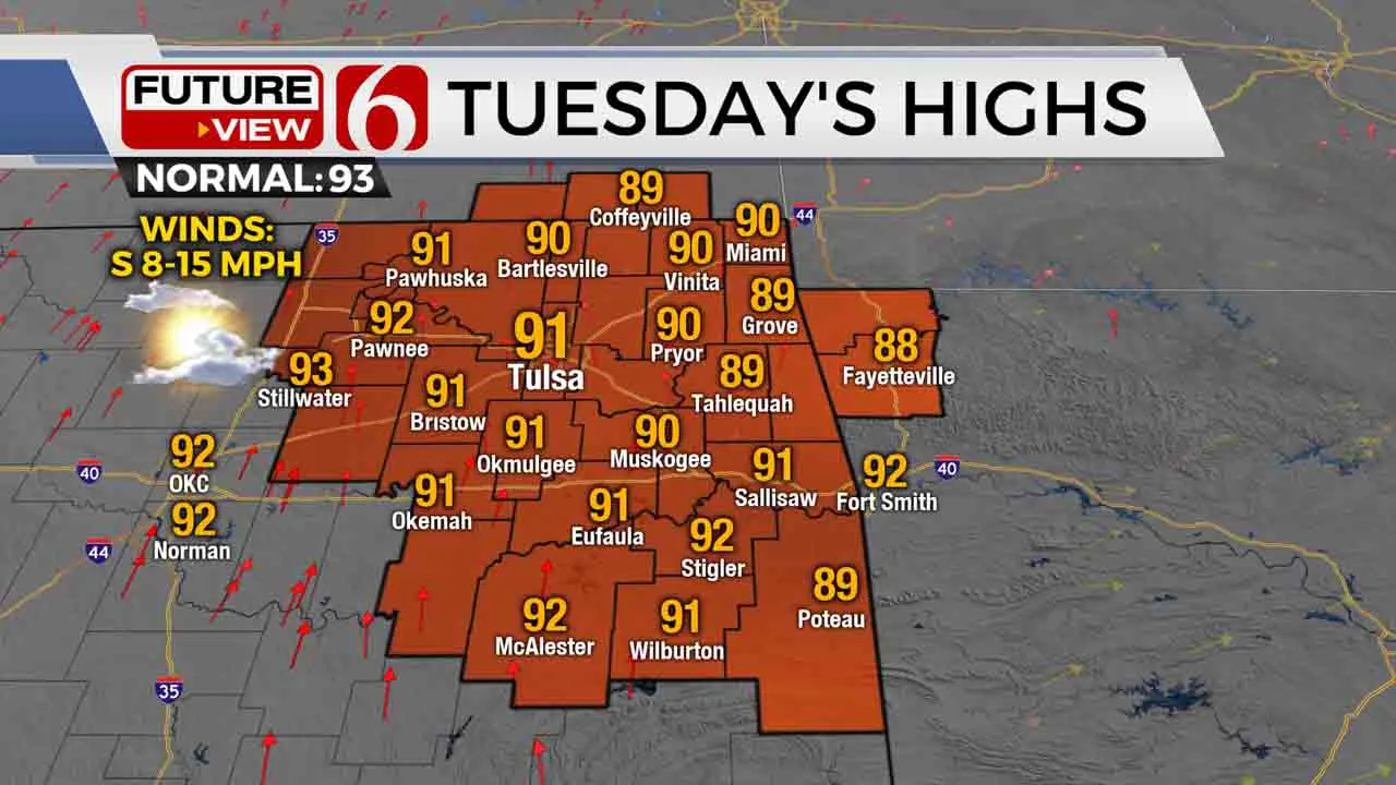
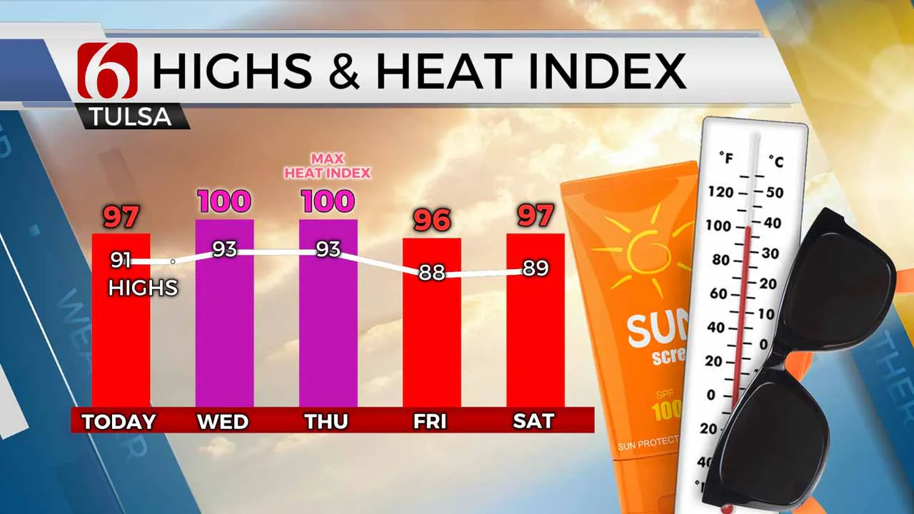
We’ve gotten off to another very pleasant start to our Tuesday, but temperatures will climb quickly today. Highs will climb back toward the lower 90s this afternoon, with heat index values reaching the mid to upper 90s as humidity also climbs. A very slim chance for an isolated shower still exists today, though the large majority of us will stay dry.

It’s back to typical July for the middle of the week as the muggies stick around. We’ll be much warmer in the lower 70s Wednesday morning, with highs in the 90s and heat index values around 100 Wednesday afternoon. Thursday morning and Thursday afternoon look very similar to Wednesday as well. But by late Thursday, we’ll be watching to our north in Kansas for storms to fire.
An upper-level trough will help trigger those storms in Kansas on Thursday, and by late Thursday into Thursday evening some of those storms will try to shift into southeastern Kansas and far northern Oklahoma. Storms look more likely to move into Green Country late Thursday night into Friday morning, and a few of those could be heavy to occasionally severe.

Weak upper-level disturbances will linger around the Southern Plains over the weekend, giving us chances for pop-up thunderstorms through the weekend into early next week. But the additional clouds and occasional rain will also keep our temperatures from getting too terribly hot in the extended!
I hope you have a great Tuesday, Green Country! Stay safe! You can also follow me on Twitter @StephenNehrenz as well as my Facebook page Meteorologist Stephen Nehrenz to stay up to date with the very latest.
More Like This
July 13th, 2021
February 14th, 2022
January 26th, 2022
January 25th, 2022
Top Headlines
December 13th, 2024
December 13th, 2024
December 13th, 2024
December 13th, 2024


