Humid Thursday With Rain Chances Returning Soon
Very warm, humid, and breezy with partly cloudy skies. A slight chance of a showers during the day, with a better chance of storms late tonight.Thursday, July 15th 2021, 8:43 am
TULSA, Oklahoma -
Typical July weather continues across Green Country with rain and storm chances looming to wrap up the week.

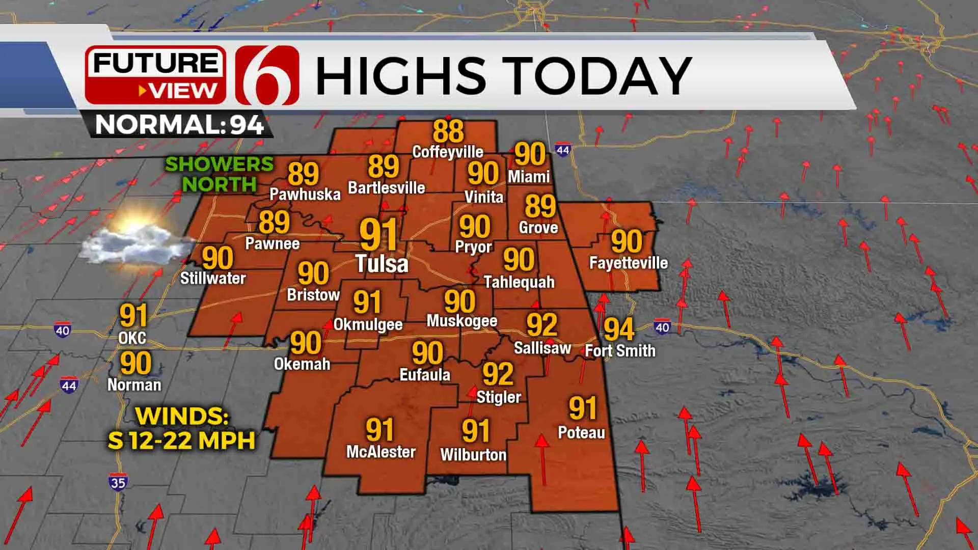
Our Thursday temperatures will be pretty much identical to what we had Wednesday, with highs in the upper 80s to lower 90s and afternoon heat index values in the upper 90s. A few isolated showers are possible during the midday and afternoon hours, primarily in our far northern counties along the Oklahoma/Kansas state line.

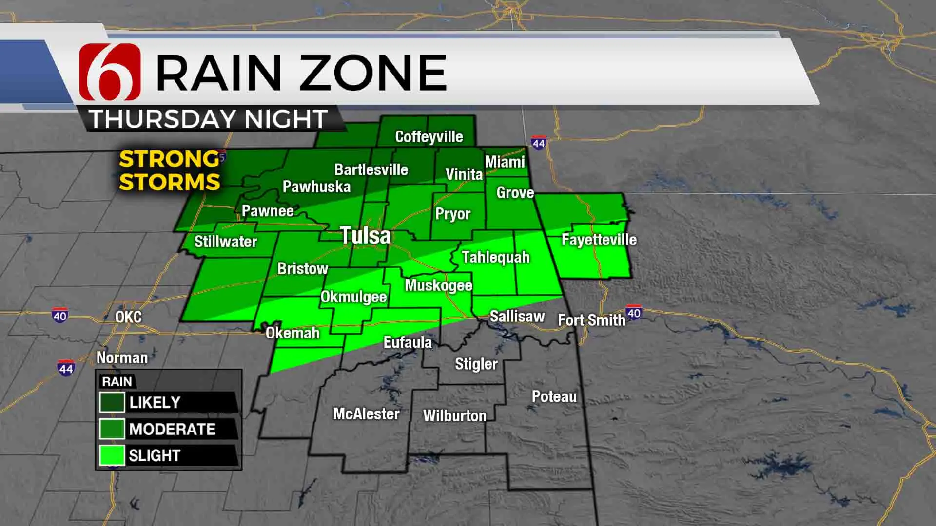
An upper level trough will help trigger some stronger thunderstorms during the mid to late evening hours across southeastern Kansas, and storms will gradually slide south into far northeastern Oklahoma through the late night hours. A few of the storms this evening and tonight could become strong to occasionally severe with hail and strong winds.
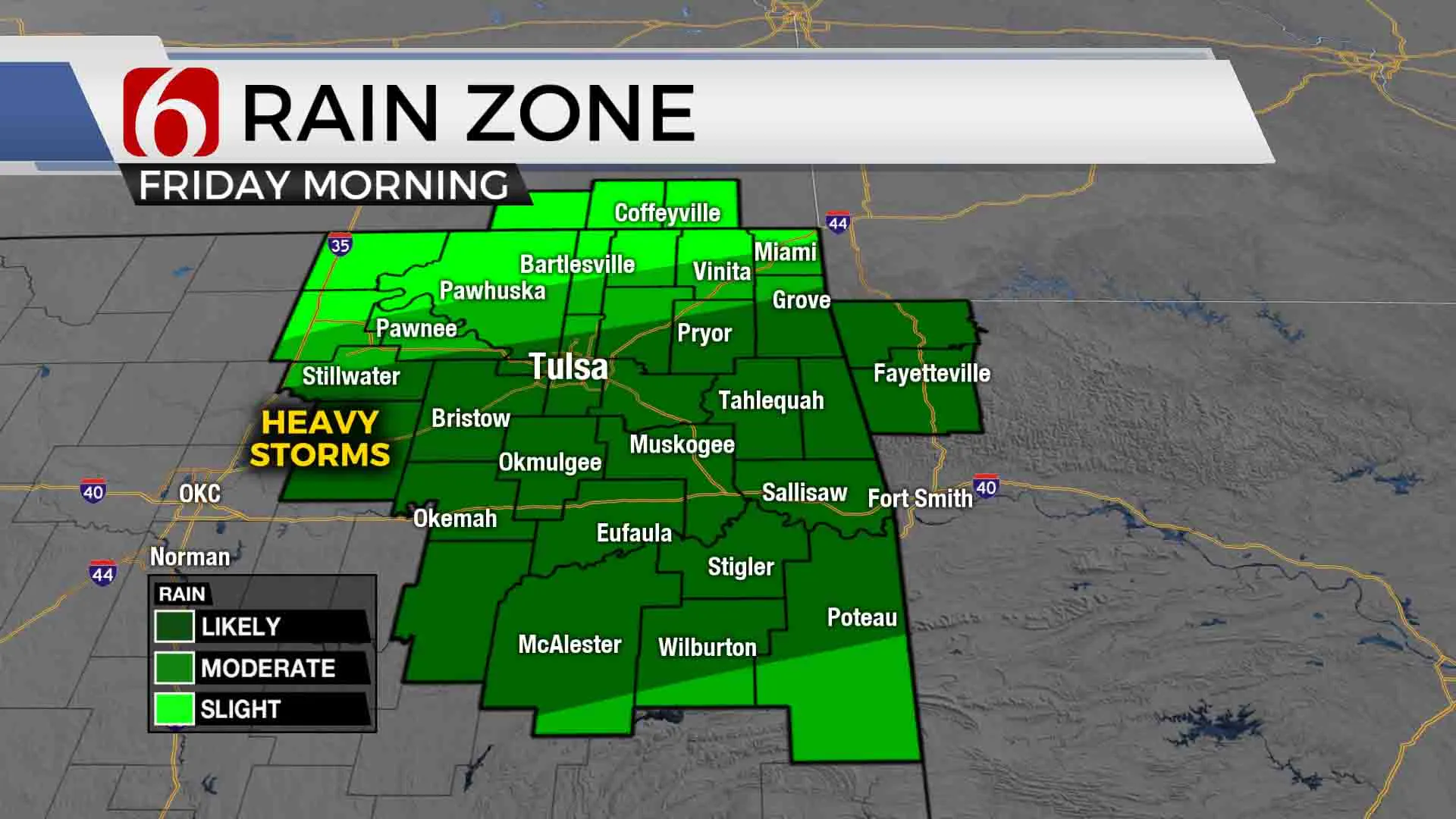
Storm chances around the Tulsa metro look to be highest late overnight (after midnight) into early Friday morning. Severe weather threats look very limited by early Friday, but some locally heavy storms will again be possible. Rain and storms will gradually thin in coverage by late morning Friday, with mostly dry conditions expected Friday afternoon.

We’ll stay unsettled though as we head into the weekend, so just be aware for your outdoor plans! Scattered storms will try to flare back up Friday night into Saturday morning with a few locally heavy. And we’ll again see a potential flare-up of storms Saturday night into Sunday morning. Off-and-on storm chances will hang with us into Monday of next week.
I hope you have a great Thursday, Green Country! Stay safe! You can also follow me on Twitter @StephenNehrenz as well as my Facebook page Meteorologist Stephen Nehrenz to stay up to date with the very latest.
More Like This
July 15th, 2021
February 14th, 2022
January 26th, 2022
January 25th, 2022
Top Headlines
December 13th, 2024
December 13th, 2024
December 13th, 2024
December 13th, 2024


