Hot Thursday Weather Before Weekend Relief Arrives
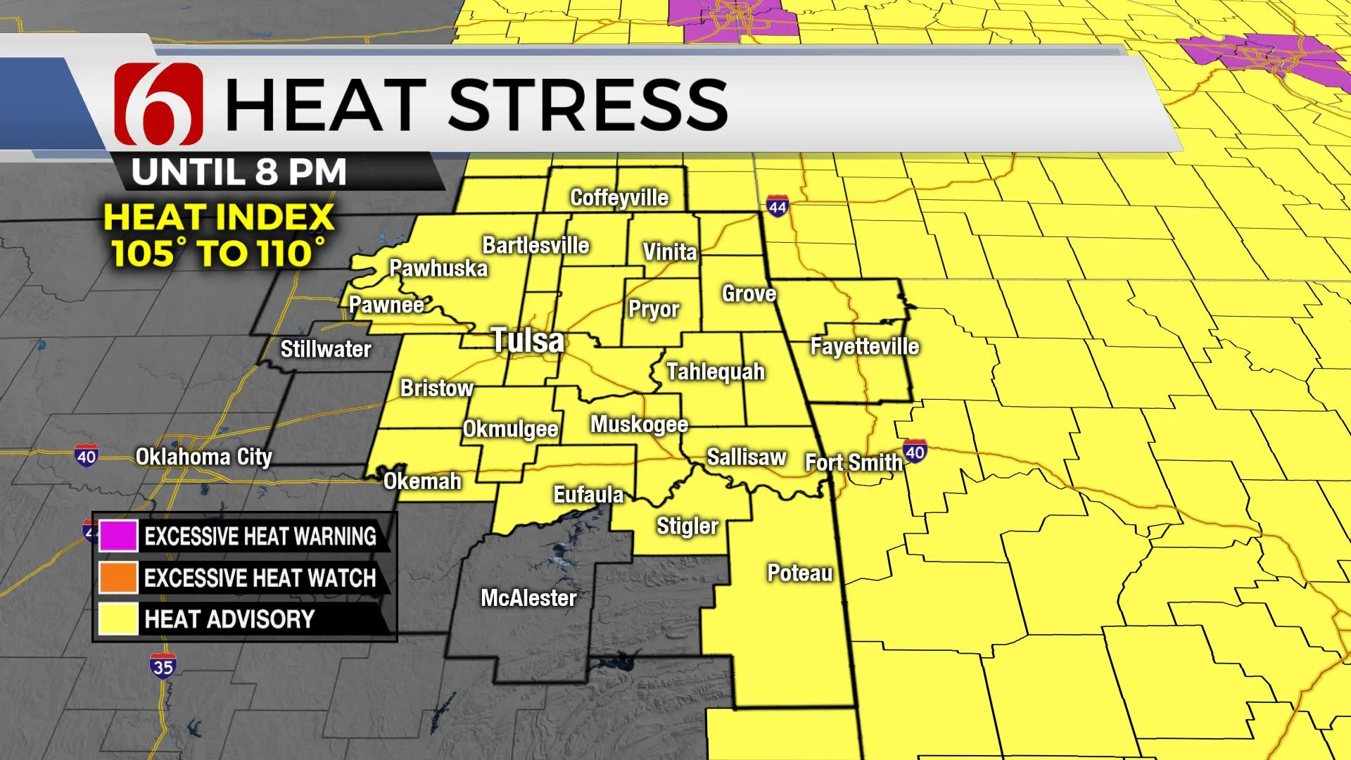
Another hot and humid day is expected with heat advisories required for most of northeastern OK and southeastern Kansas with heat index values from 105 to 109.Thursday, August 12th 2021, 4:52 am
TULSA, Oklahoma -
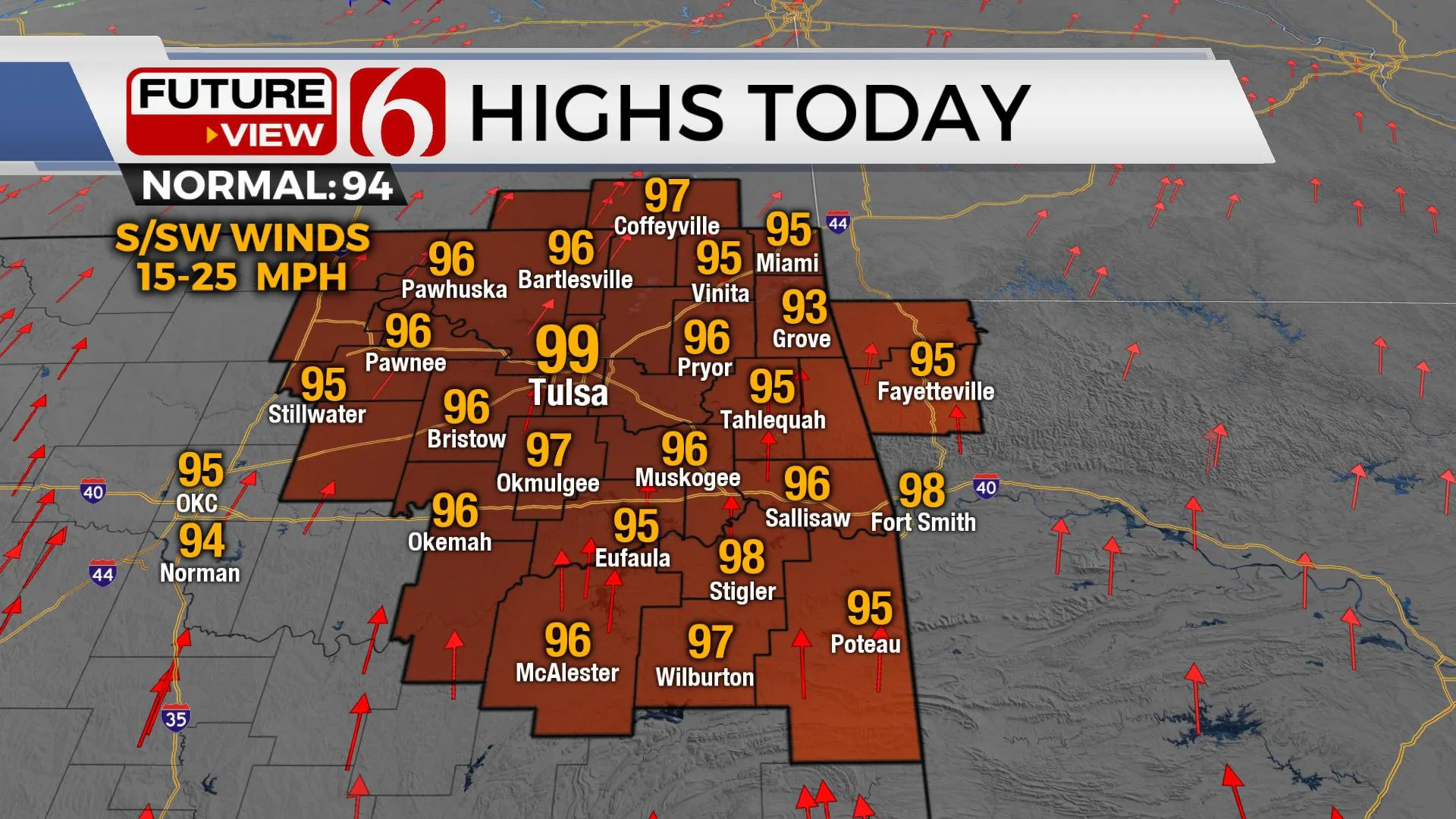
Another hot and humid day is expected with heat advisories required for most of northeastern OK and southeastern Kansas with heat index values from 105 to 109. Daytime highs will approach the upper 90s, near 100 with south winds from 15 to 25 mph. Storm chances will return to part of the region soon along with an expectation of a noticeable cool-down into the weekend.

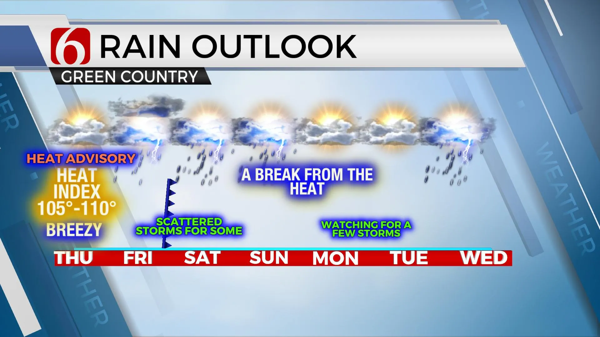
Mid-level ridging will slowly break down this afternoon and evening while a strong mid-level trough advances across the Midwest. A surface boundary is already moving southward and will provide a focus for scattered thunderstorms this afternoon and evening across central Kansas. A few of these storms will move southeast later tonight and may survive the trip into far northeastern OK early Friday morning. Most of this activity should dissipate but a residual outflow boundary or even a small cluster of storms could offer a sneak attack for the early morning hours. This boundary will progress southward during the day Friday and should trigger additional showers and storms with the daytime heating process by late afternoon into the evening hours. A few of these storms will be strong to severe with hail and wind the primary threats along with locally heavy rainfall. The rest of the weekend basically depends on how much storm activity develops Friday evening, but we continue to provide some hope with a minor reduction in temperature and humidity this weekend with highs in the upper 80s and lows in the upper 60s to lower 70s. The pressure gradient will relax some compared to most of this week and northeast winds from 10 to 15 mph will be likely Friday evening into Saturday as the boundary moves south of the metro and becomes diffuse or stalls Sunday with a return of east to southeast winds by afternoon and evening.

A weak disturbance will be near the eastern part of the state early next week and this could bring a few additional scattered storms, but the stronger upper airflow will remain well-removed north of the state and organized severe weather threats are not expected. This will also keep us in the lower 90s for highs with heat index values in the mid-90s, at least early next week.

Tropical Depression Fred (soon to be a tropical storm again) continues to move closer to Florida during the next few days, and additional development is likely across the Atlantic Basin during the next days and even weeks. Additional named storms are likely soon, including within the next 3 to 5 days.
Thanks for reading the Thursday morning weather update and blog.
Have a super great day!
Alan Crone
KOTV
If you’re into podcasts, check out my daily weather update below. Search for NewsOn6 and ‘Weather Out The Door’ on most podcast providers, including Apple, Stitcher, Tune-In and down below on Spotify.

More Like This
August 12th, 2021
February 14th, 2022
January 26th, 2022
January 25th, 2022
Top Headlines
December 12th, 2024
December 12th, 2024
December 12th, 2024
December 12th, 2024


