Heat, Humidity Return To Green Country
The forecast remains steady state for the next few days but with a few limited shower chances and slowly increasing heat and humidity.Tuesday, August 31st 2021, 5:33 am
TULSA, Oklahoma -
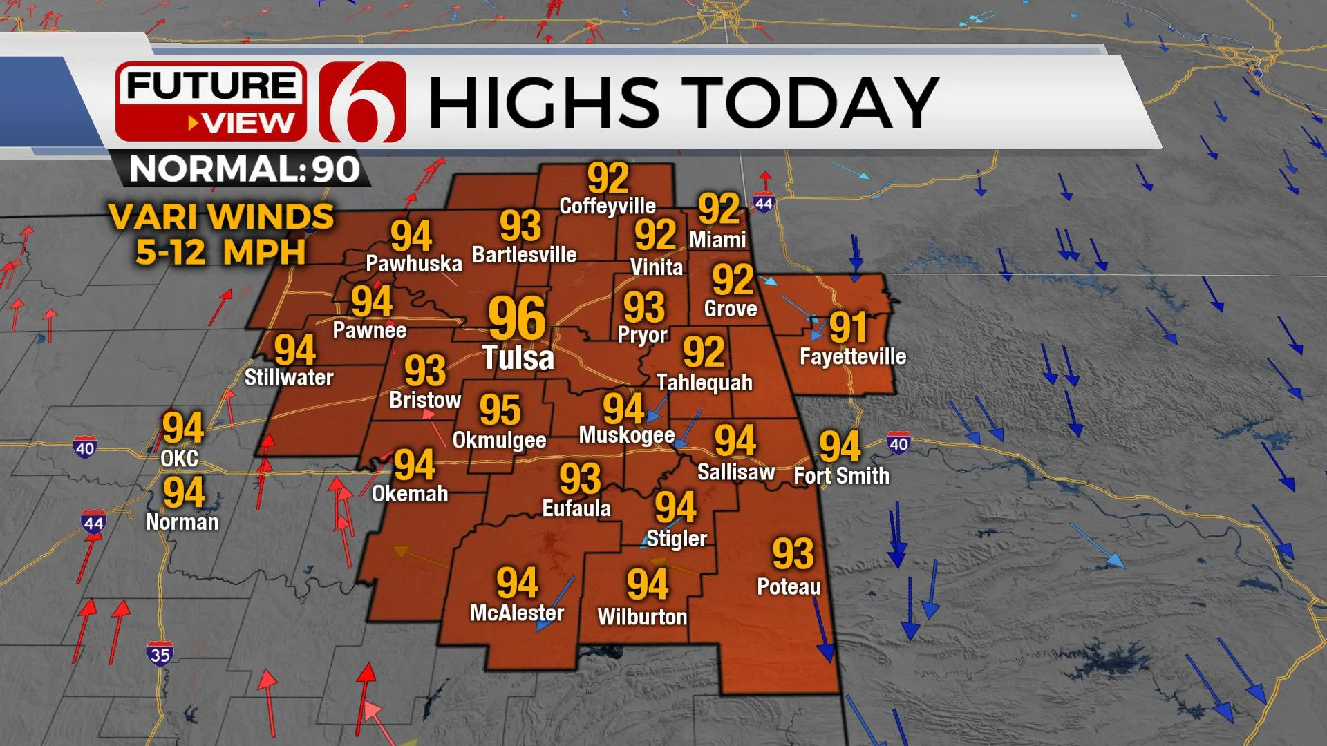
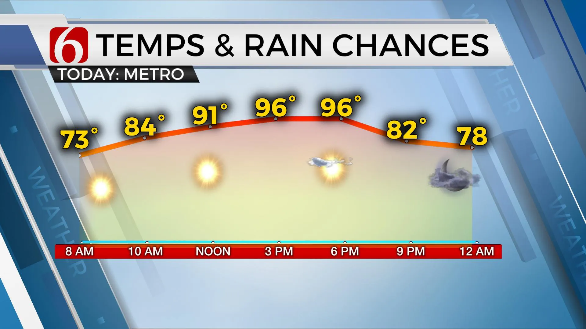
The forecast remains steady state for the next few days but with a few limited shower chances and slowly increasing heat and humidity. Highs this afternoon will once again reach the mid-90s near the metro with heat index values around 103. The lack of wind speed will allow us to feel every bit of this moisture, but these values should not trigger heat advisories. But we’re closer to some of these values Wednesday and Thursday before the humidity starts slowly dropping a bit during the afternoon. Storms are underway this morning across part of the central plains, northern Kansas, and Missouri. A small cluster will drop southeast and should dissipate.

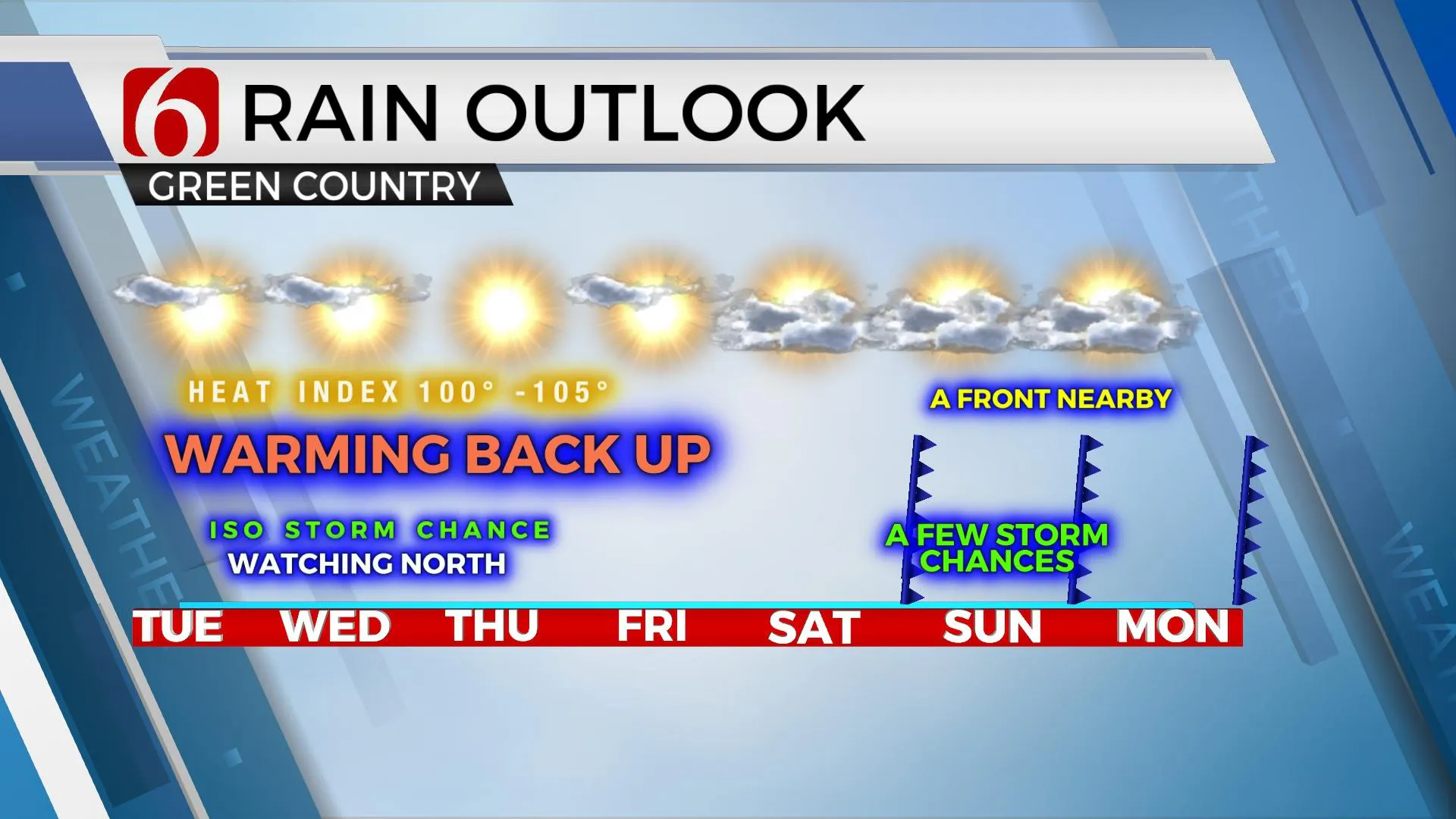
Storms are likely to redevelop this afternoon to our north across Kansas along a weak boundary or outflow and move southeast later tonight into early Wednesday. The latest data keeps most it not all this activity slightly northeast of our immediate area, but there will be a low chance for a few showers or storms to sneak into far northeastern OK with a possibility of localized outflows moving southward. We’ll keep low probabilities for this scenario later tonight into pre-dawn Wednesday across extreme northeastern OK and northwestern Arkansas. The eventual outcome of any showers across far OK Wednesday would have an impact on a possible low shower chance for Thursday morning in the same area. But, as this is occurring, a mid-level ridge of high pressure attempts to redevelop across central OK and expand in size and strength through the end of the week. This will keep any major system out of the state while slowly increasing the heat and humidity. Daytime highs will max out in the mid-90s along with heat index values nearing 100 to 105 for a few days. We’ll be close to heat advisory criteria but may continue to add some additional heat stress to the mix through the end of the week.

By the weekend, the pattern attempts to change as the ridge flattens allowing another weak front to move southward nearing the state as early as late Saturday night or Sunday morning before stalling and entering the area again Tuesday into Wednesday of next week. This front, if it survives the southward trip, should bring a decent chance of storms for the middle of next week. I’ll have a low chance for a few storms late Saturday evening into pre-dawn Sunday, and then again Monday night into early Tuesday morning.

Thanks for reading the Tuesday morning weather discussion and blog.
Have a super great day!
Alan Crone
KOTV
If you’re into podcasts, check out my daily weather update below. Search for NewsOn6 and ‘Weather Out The Door’ on most podcast providers, including Apple, Stitcher, Tune-In and down below on Spotify.

More Like This
August 31st, 2021
February 14th, 2022
January 26th, 2022
January 25th, 2022
Top Headlines
December 12th, 2024
December 12th, 2024
December 12th, 2024
December 12th, 2024


