Cool Mornings But Getting Hot This Weekend
Cool mornings will bring warm, even hot afternoons through the end of the week into the weekend.Wednesday, September 8th 2021, 5:23 am
TULSA, Oklahoma -
Cool mornings will bring warm, even hot afternoons through the end of the week into the weekend. Storm chances will be limited, if not zero, until the middle of next week.

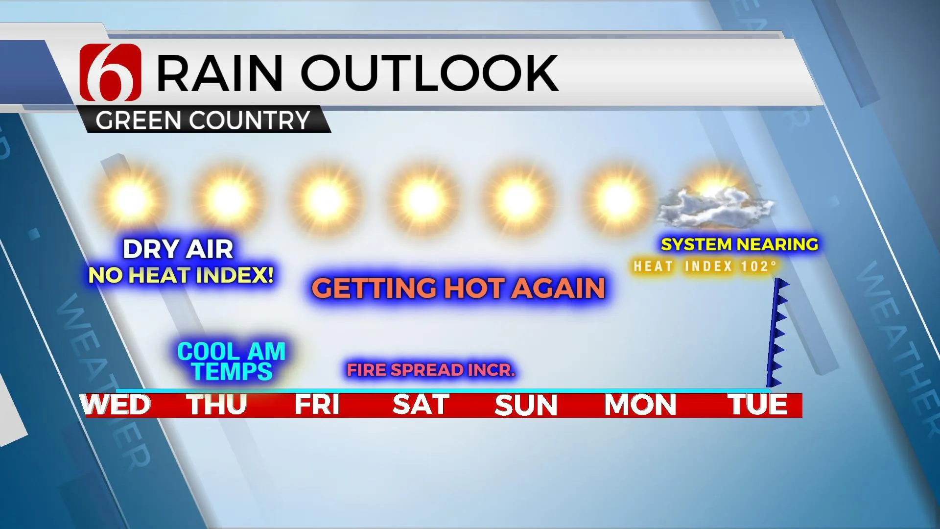
Last night’s front will set us up some very pleasant morning lows the next few days as lower-level dry air arrives from the Missouri Valley. But this dry air also brings the potential for most hot weather by Friday through the weekend. At least the lack of low-level moisture for the next few days will keep us out of the running for any heat advisories or excessive heat index values. Unfortunately, the lack of widespread precipitation across the state is bringing an increasing fire danger threat to the state by the end of the week, into part of the weekend. A few locations near or west of the metro may be experiencing increasing fire spread rates Friday and especially Saturday with southwest winds from 15 to 25 mph and highs nearing 100. The next front, and next chance of precipitation, may not approach the state until the middle of next week.

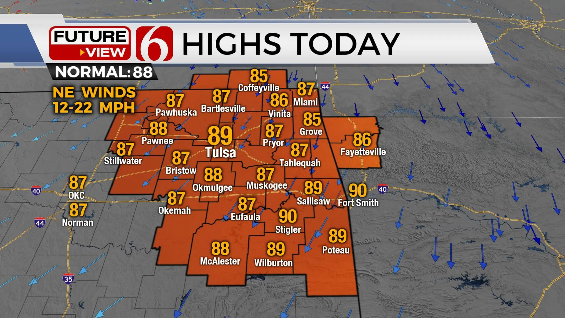
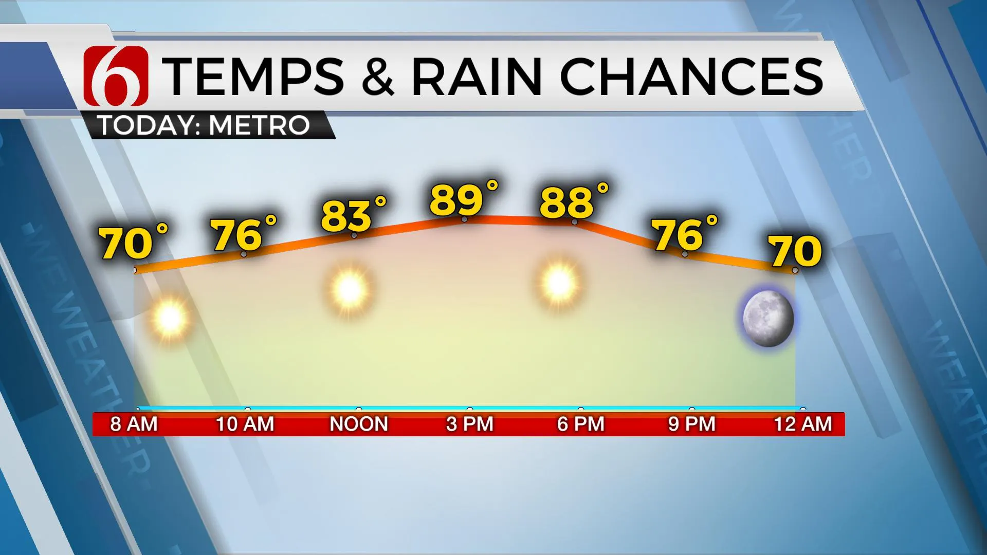
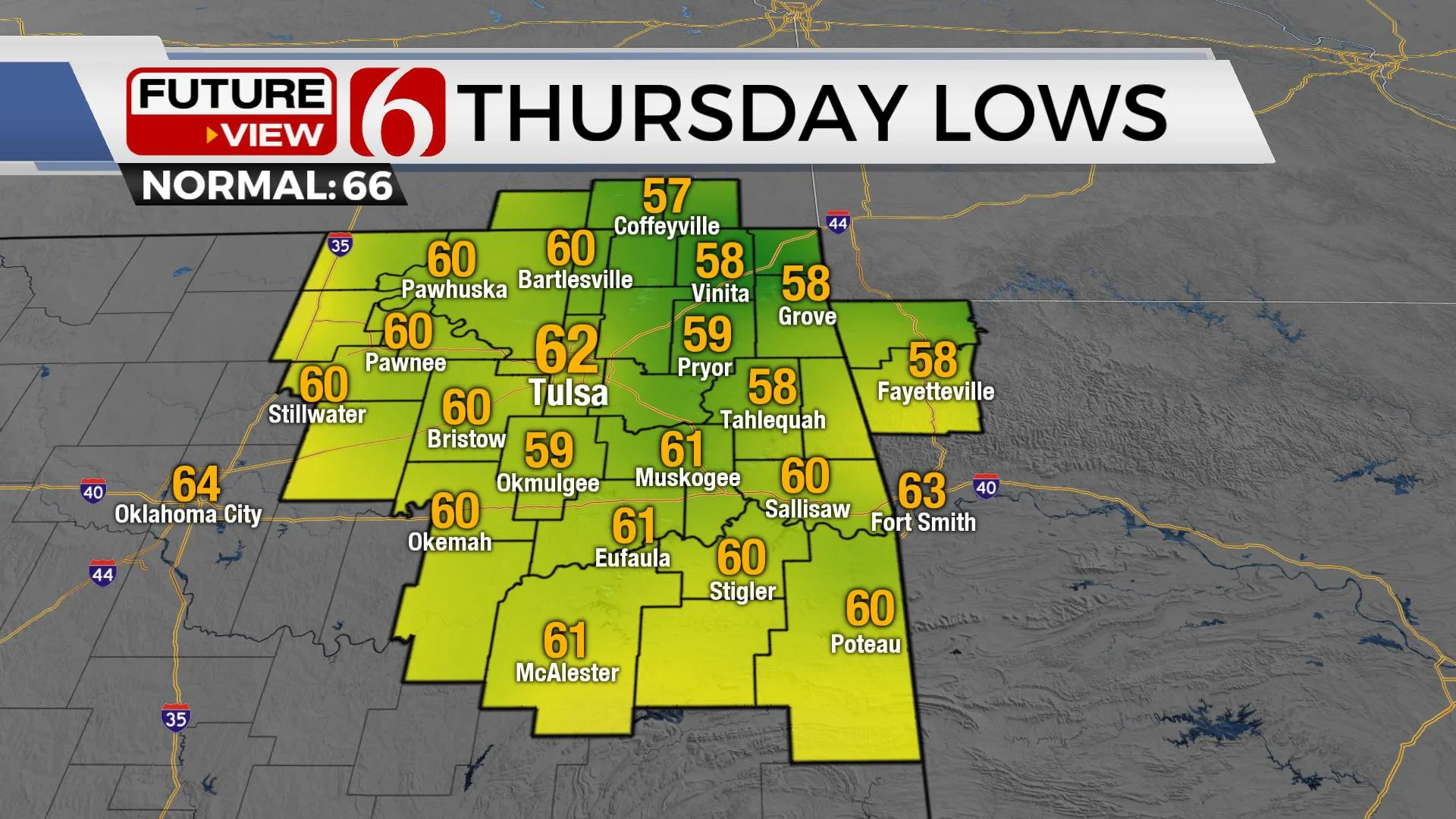
Northeast surface winds will bring pleasant weather into the state today with morning lows in the lower to mid-60s. This pattern will usher in some pleasant afternoon highs, with many spots staying in the mid-80s this afternoon with the metro moving into the upper 80s near 90. Compared to the past few days, today will be spectacular. I think Thursday morning could be a six-star weather morning with most locations dropping into the mid to upper 50s outside of the Tulsa metros lower 60s. The position of the mid-level ridge and the combination of surface to mid-level airflow may also bring some smoky, hazy skies from the western U.S. wildfires back across the area for the next few days.

The weekend continues to look hot and dry. Early next week, the mid-level ridge flattens with a progressive northern stream offering a front nearing by midweek and a possible low-pressure area across East Texas bringing a few showers or storms northward. We’ll introduce a few storm chances Wednesday and Thursday of next week.

Thanks for reading the Wednesday morning weather discussion and blog.
Have a super great day!
Alan Crone
KOTV
If you’re into podcasts, check out my daily weather update below. Search for NewsOn6 and ‘Weather Out The Door’ on most podcast providers, including Apple, Stitcher, Tune-In and down below on Spotify.

More Like This
September 8th, 2021
February 14th, 2022
January 26th, 2022
January 25th, 2022
Top Headlines
December 11th, 2024
December 11th, 2024
December 11th, 2024


