Summer Returns Before Sunday Night Storms
We're heading into three of the four seasons over the next week or so.Thursday, October 7th 2021, 8:09 am
TULSA, Oklahoma -
We're heading into three of the four seasons over the next week or so. Buckle-up. We're back to summer soon, then a bout of spring thunderstorms followed by some autumnal weather. Patchy fog is possible across part of the area this morning before clearing around midday.
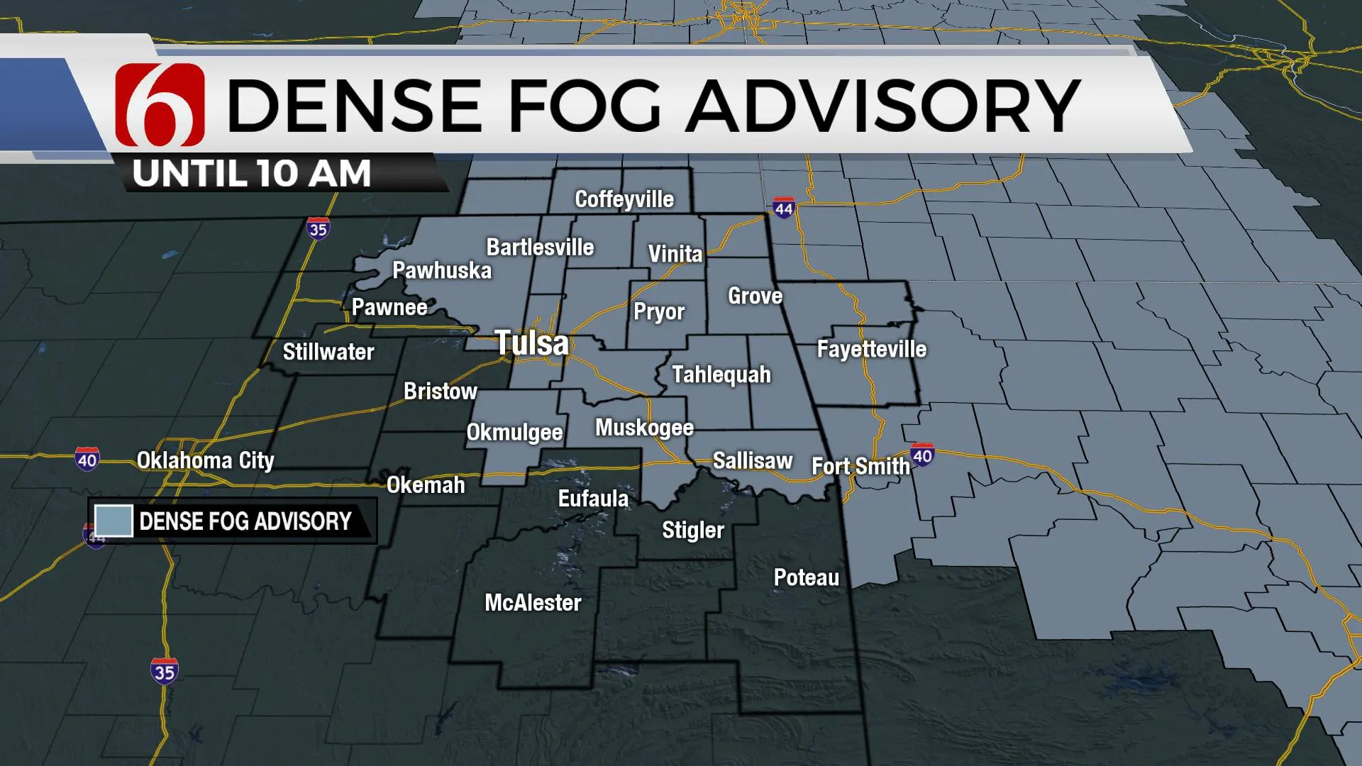
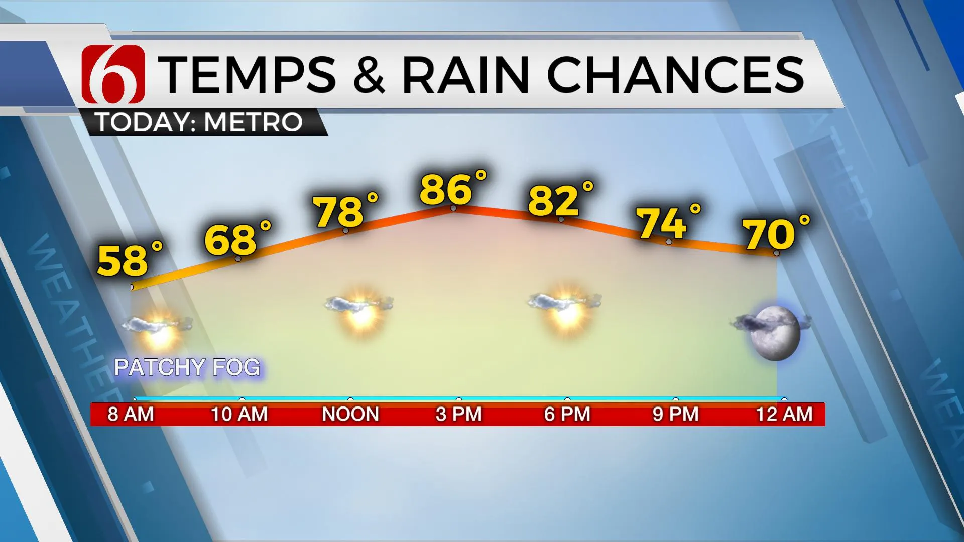
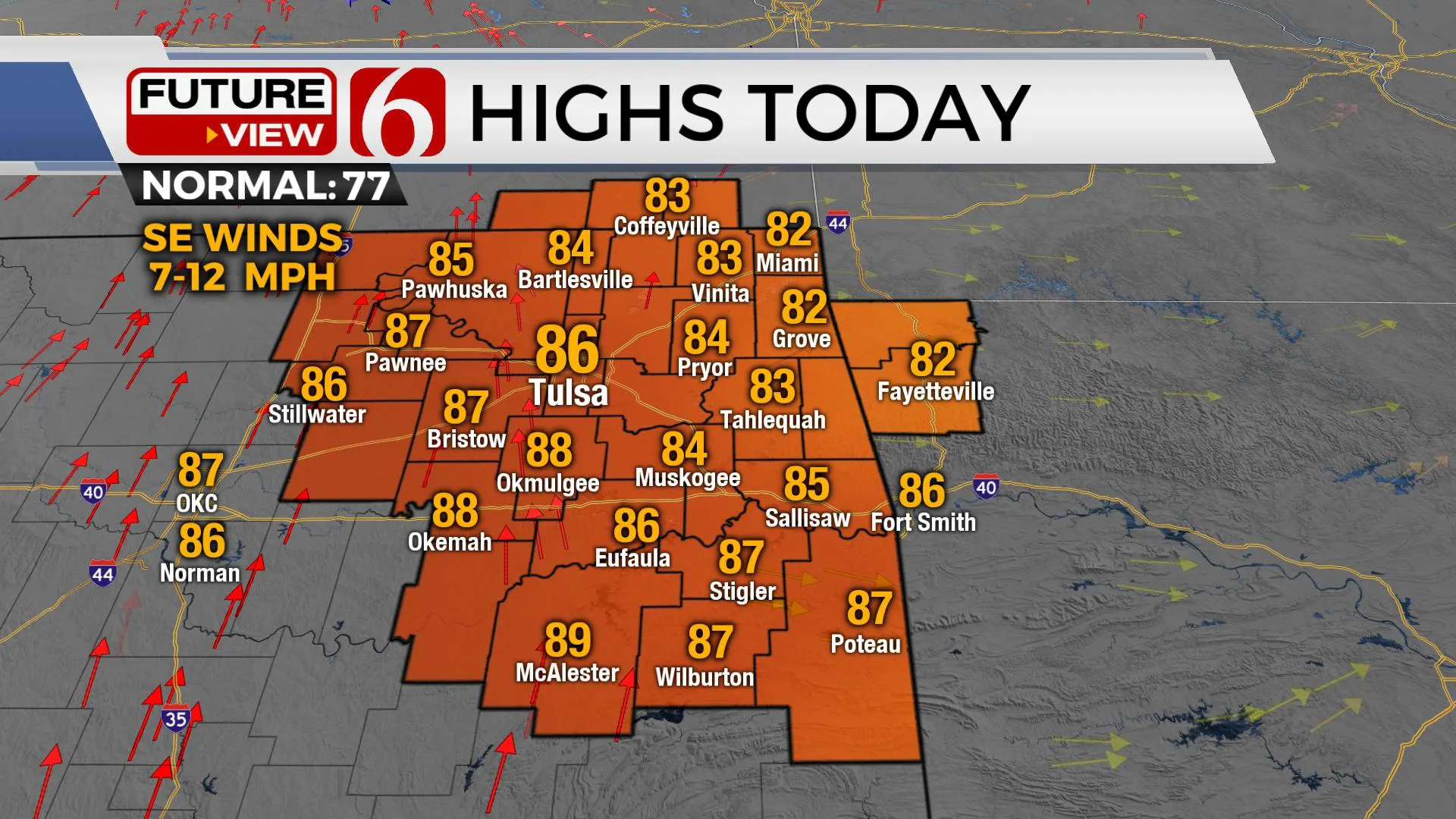
We're cool again this morning with many locations in the mid to upper 50s as the cut-off low to our east begins moving northeast toward the Midwest this afternoon. Southeast surface winds return today with afternoon highs reaching the lower to mid-80s. A weak disturbance is scheduled to slip down across southeastern Kansas and extreme northeastern OK pre-dawn Friday as warmer air expands north and could offer some ' sunrise surprise' showers but the chance remains very low. I'll just mention it here but not include a real pop on the 7-day planner.
As the first trough develops and influences the plains this weekend, south to southwest surface winds will return with gusts between 15 to 25 mph Friday and near 30 to 35 mph gusts Saturday. Low-level moisture will be slow to return at first, and fire spread rates will increase, especially Saturday across part of the area.
Sunday morning low-level moisture should return in advance of the first of at least two, possibly three storm systems to influence the nation, including northeastern OK. Storm chances will arrive by Sunday evening into early Monday morning, including the possibility of strong to severe thunderstorms.
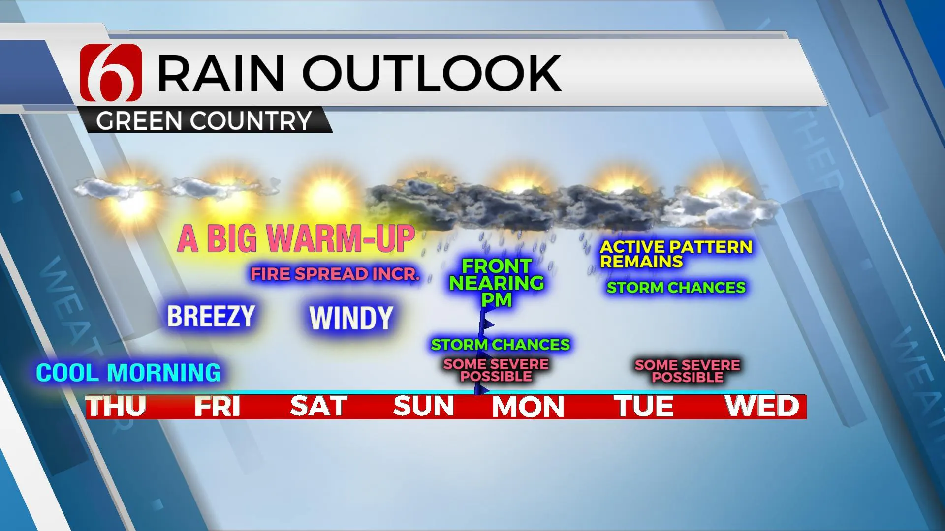
The main concern arrives with a significant pattern change as the westerlies begin dropping southward and several major troughs develop across the Pacific and western U.S., with the first one ejecting across the southern and central plains Sunday evening and the second arriving for the middle of next week. This pattern will bring active weather to a large portion of the intermountain regions and plains, including the possibility of several severe weather episodes beginning Sunday evening into Monday morning. The exact timing of the first system has yet to be nailed down, but wind fields point toward severe storm possibilities. The outcome of some important features with the first system will have a direct impact on the probabilities associated with the trough for the middle of next week. Since we're still several days out, I'll keep from too many specifics at this point, but we could be dealing with severe weather threats late Sunday into early Monday, Tuesday morning, late Tuesday evening into Wednesday, and possibly even late Friday into next Saturday morning. The 2nd trough is very strong in most of the data. While any of the storm threats in the extended forecast offer severe potential, the 2nd trough needs to be monitored very carefully. As this system finally moves out of the plains later next week, we'll get a few days break into the following weekend before additional systems arrive.
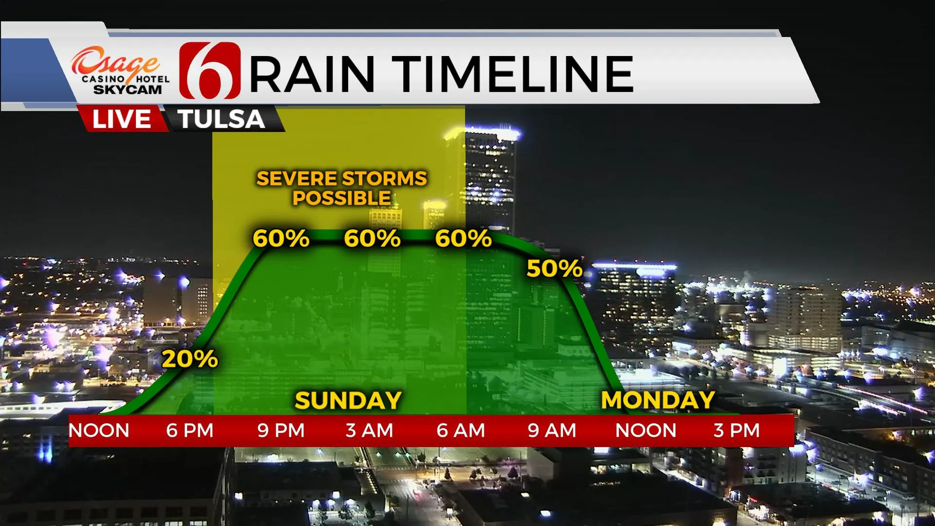
The battle is getting set between spring and fall. This is not unusual. It occurs every year. Some years we have more of an extended period of severe threats during the fall. It appears we’re starting this process next week.
Thanks for reading the Thursday morning weather discussion and blog.
Have a super great day!
Alan Crone
KOTV
If you’re into podcasts, check out my daily weather update below. Search for NewsOn6 and ‘Weather Out The Door’ on most podcast providers, including Apple, Stitcher, Tune-In and down below on Spotify.

More Like This
October 7th, 2021
February 14th, 2022
January 26th, 2022
January 25th, 2022
Top Headlines
December 13th, 2024
December 13th, 2024
December 13th, 2024
December 13th, 2024


