Storms Return Overnight, Wednesday Morning
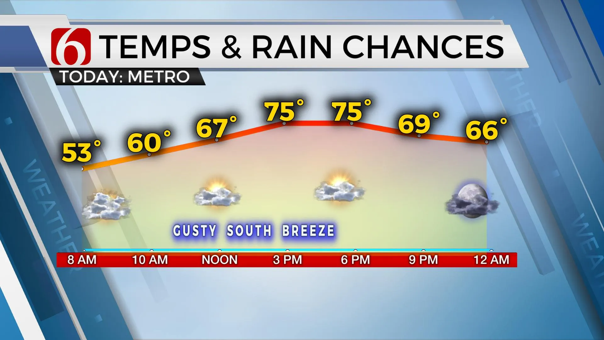
Gusty south winds return today before our next storm chance arrives later tonight through early Wednesday morning.Tuesday, October 26th 2021, 5:38 am
TULSA, Oklahoma -
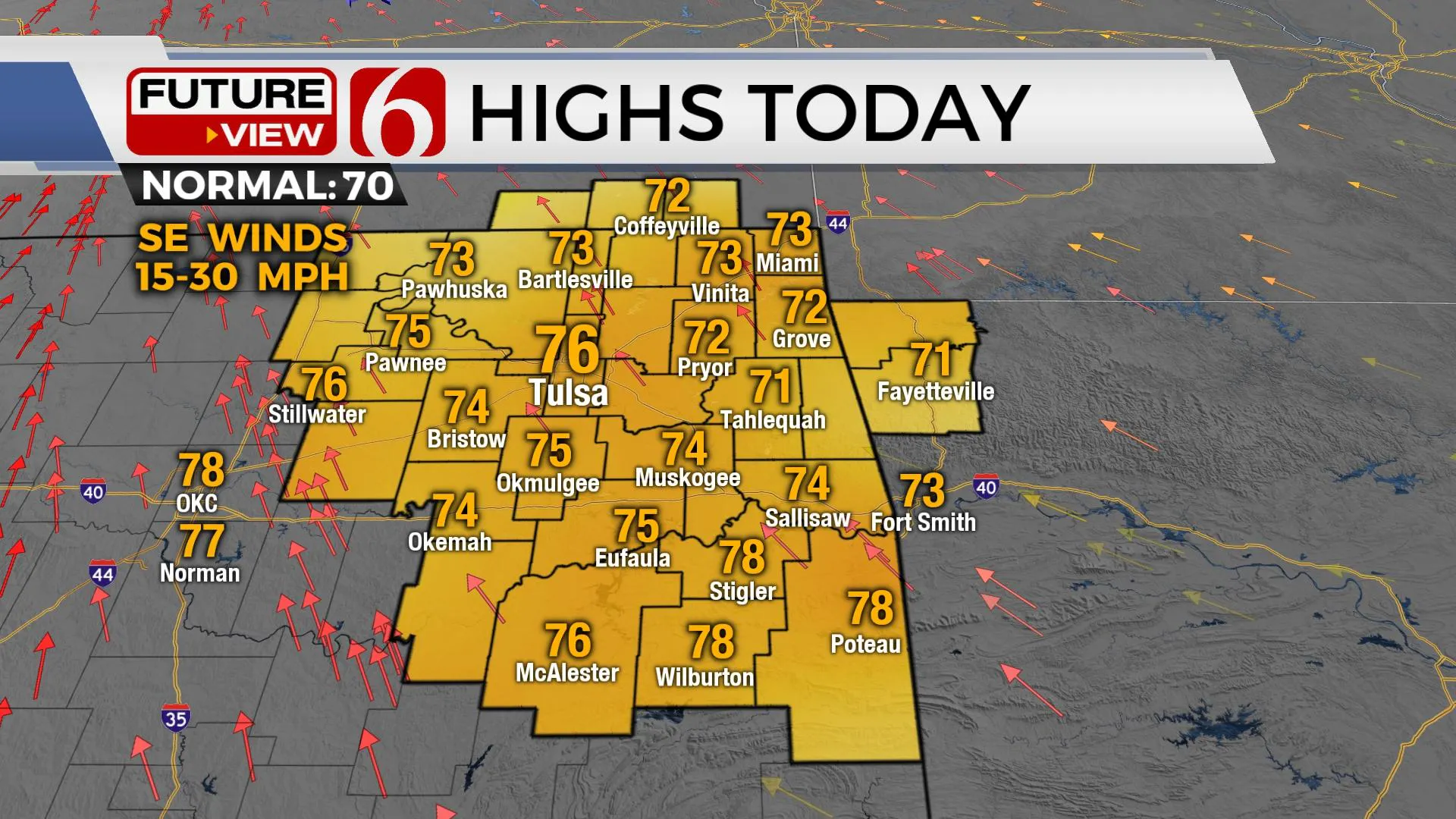
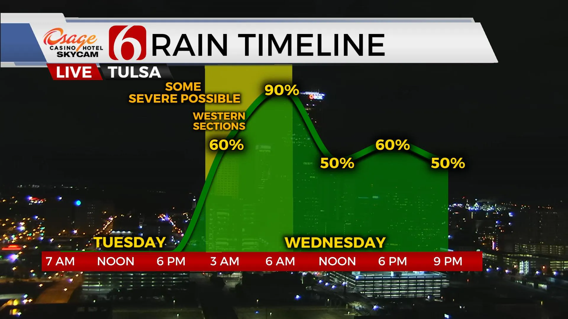
Gusty south winds return today with highs advancing to the mid-70s before our next storm chance arrives later tonight through early Wednesday morning. Fall weather returns Wednesday and remains for the foreseeable future. A few storms may be strong to severe overnight into early Wednesday with higher chances for severe weather near or slightly west of Tulsa.

A powerful upper-level system arrives across the Rockies today and ejects slowly across the southern and central plains tonight through Wednesday. This system may stall or begin to close up some near or east of the state Wednesday evening before finally moving out of the region Thursday morning. This will keep rain and storm chances in the forecast beginning later tonight, part of Wednesday and for a small portion Thursday morning. Severe weather threats will be highest tonight across the western half of the state but a few strong to severe storms may survive nearing the I-35 corridor by 3 a.m. Wednesday. A line of storm activity is likely to impact part of Eastern OK pre-dawn to Wednesday morning, but severe threat should be diminishing as the line moves more eastward throughout the early morning hours. Regardless, we’ll need to keep a small window for a few strong to severe storms as the system nears the eastern third of the state. After early Wednesday morning, we’ll see a few breaks before another round of showers or storms will arrive as the main upper-level system wraps out of the area. Temps are expected to remain in the 60s Wednesday with south winds changing out of the northwest by afternoon and evening at 15 to 25 mph as the true cold front arrives from the northwest. As the system pulls away from the state Thursday morning, a few showers will quickly end with very strong northwest winds likely from 20 to 40 mph through the day. This will more than likely require wind advisories for most of Thursday.

Friday into the weekend, more fall weather remains with morning lows in the 40s and afternoon highs in the mid to upper 60s.
Another strong system nears the state Sunday into Monday. South winds return late Saturday evening through Sunday morning before a strong cold front moves across northeastern OK Halloween afternoon bringing gusty northwest winds and decreasing temps in the 50s for evening activities. There will be a chance for showers developing Monday into part of Tuesday, near and south of the metro before more fall-like weather arrives for next week.

Thanks for reading the Tuesday morning weather discussion and blog.
Have a super great day!
Alan Crone
KOTV
If you’re into podcasts, check out my daily weather update below. Search for NewsOn6 and ‘Weather Out The Door’ on most podcast providers, including Apple, Stitcher, Tune-In and down below on Spotify.

More Like This
October 26th, 2021
June 21st, 2023
June 19th, 2023
June 13th, 2023
Top Headlines
December 14th, 2024
December 14th, 2024
December 14th, 2024
December 14th, 2024


