Strong Winds Rolling Across Oklahoma
Strong northwest winds will remain for the entire day along with periods of drizzle and light rain near and east of Tulsa as a strong upper-level system remains near northeastern OK and southern Missouri.Thursday, October 28th 2021, 7:50 am
TULSA, Oklahoma -
Strong northwest winds will remain for the entire day along with periods of drizzle and light rain near and east of Tulsa as a strong upper-level system remains near northeastern OK and southern Missouri. This system will finally exit the area Friday morning bringing improving weather into the weekend. Another front enters the state Sunday and slowly moves southward early next week as shower chances gradually return.

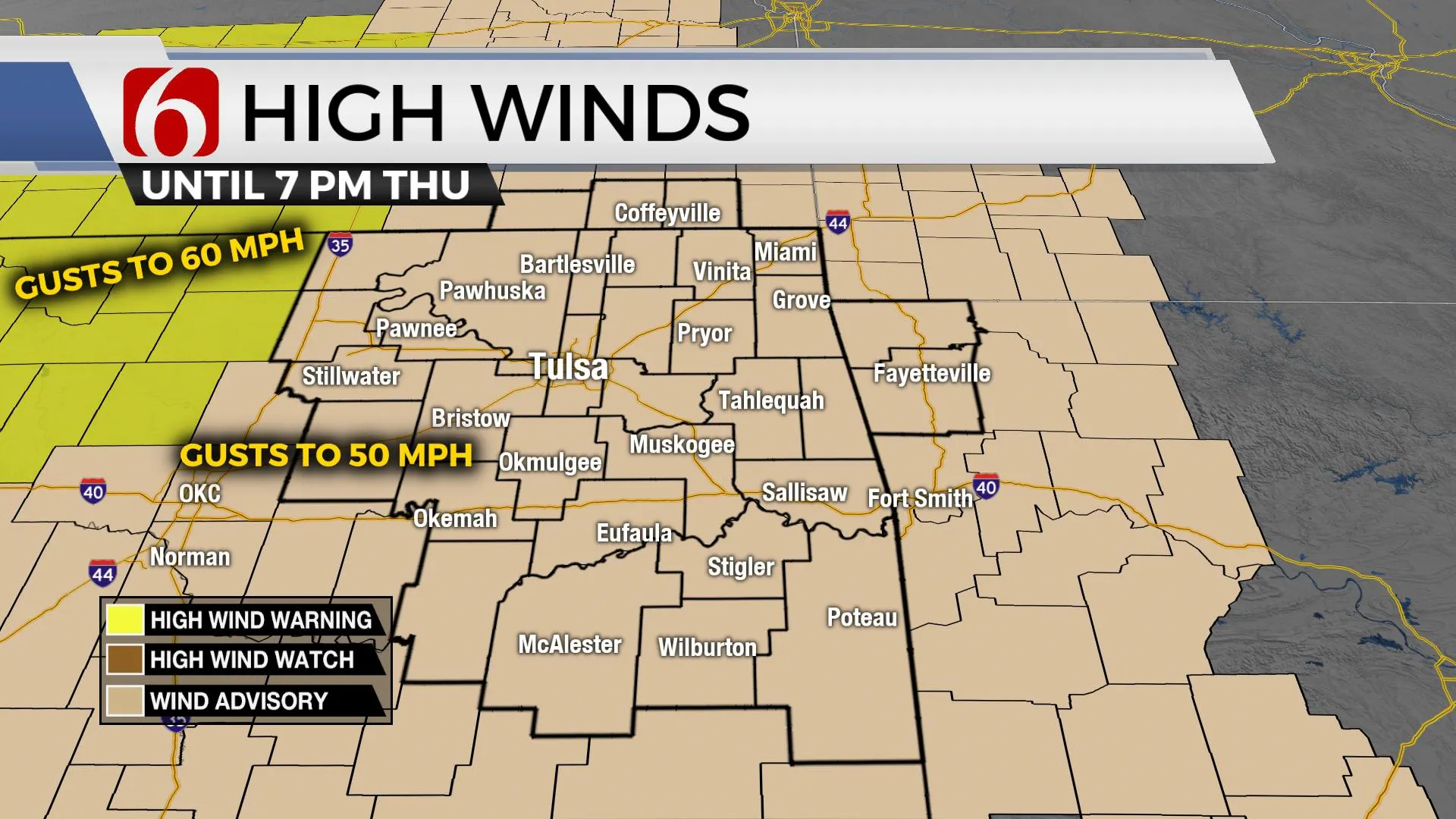
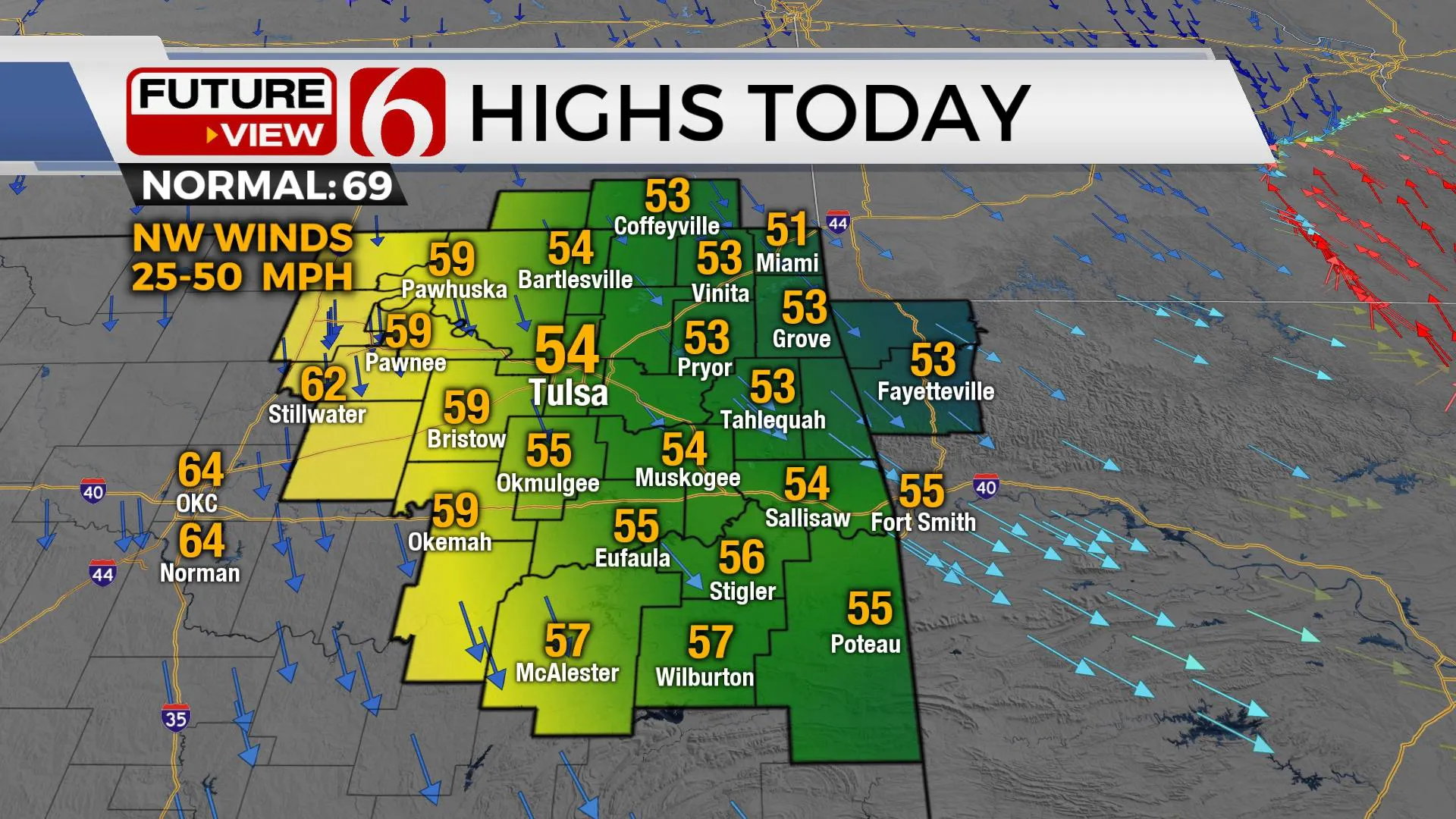
Wind advisories will be in effect for all of Eastern OK today with northwest winds from 25 to near 50 mph. Locations near and west of I-35 will have more sunshine and even stronger winds, nearing 60 mph by midday to early afternoon. These strong winds will remain into the early evening hours before dropping into the 15 to 30 mph range Friday.
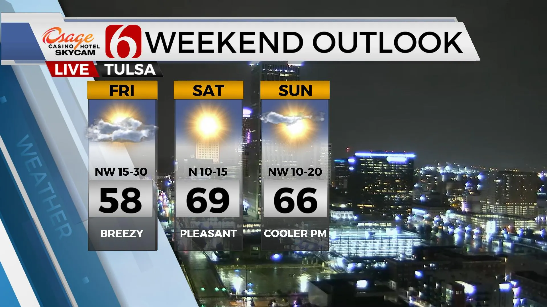
Periods of showers and drizzle will remain occasionally through the day, especially from the metro eastward where temperatures will remain in the lower to mid-50s. Locations slightly west of Tulsa will have decreasing showers after the morning hours, and some sun-cloud mix by later this afternoon. These locations will see temperatures move into the upper 50s and lower 60s. Friday morning starts in the upper 40s with some clouds and a few locations of drizzle before quickly ending. Temperatures Friday afternoon will remain in the mid to upper 50s from Tulsa east with decreasing clouds. Locations west of the metro will have full sunshine and highs in the mid-60s.

The weekend looks great with lows in the lower 40s and highs Saturday in the upper 60s along with light north winds and sunshine. The next surface boundary enters the state Sunday morning to midday and moves southward before stalling near I-40 for the afternoon. Locations to the north will experience highs in the mid-60s with northeast winds, while southeastern OK will see highs in the lower 70s and southeast winds. This front will gradually sink southward as another strong upper-level system moves across the central U.S. Monday evening into Tuesday bringing some additional shower chances and more chilly weather.

Thanks for reading the Thursday morning weather discussion and blog.
Have a super great day!
Alan Crone
KOTV
If you’re into podcasts, check out my daily weather update below. Search for NewsOn6 and ‘Weather Out The Door’ on most podcast providers, including Apple, Stitcher, Tune-In and down below on Spotify.

More Like This
October 28th, 2021
February 14th, 2022
January 26th, 2022
January 25th, 2022
Top Headlines
December 13th, 2024
December 13th, 2024
December 13th, 2024
December 13th, 2024


