Gusty South Winds Return Friday
Mostly sunny and cool as strong south winds return.Friday, November 19th 2021, 7:11 am
TULSA, Oklahoma -
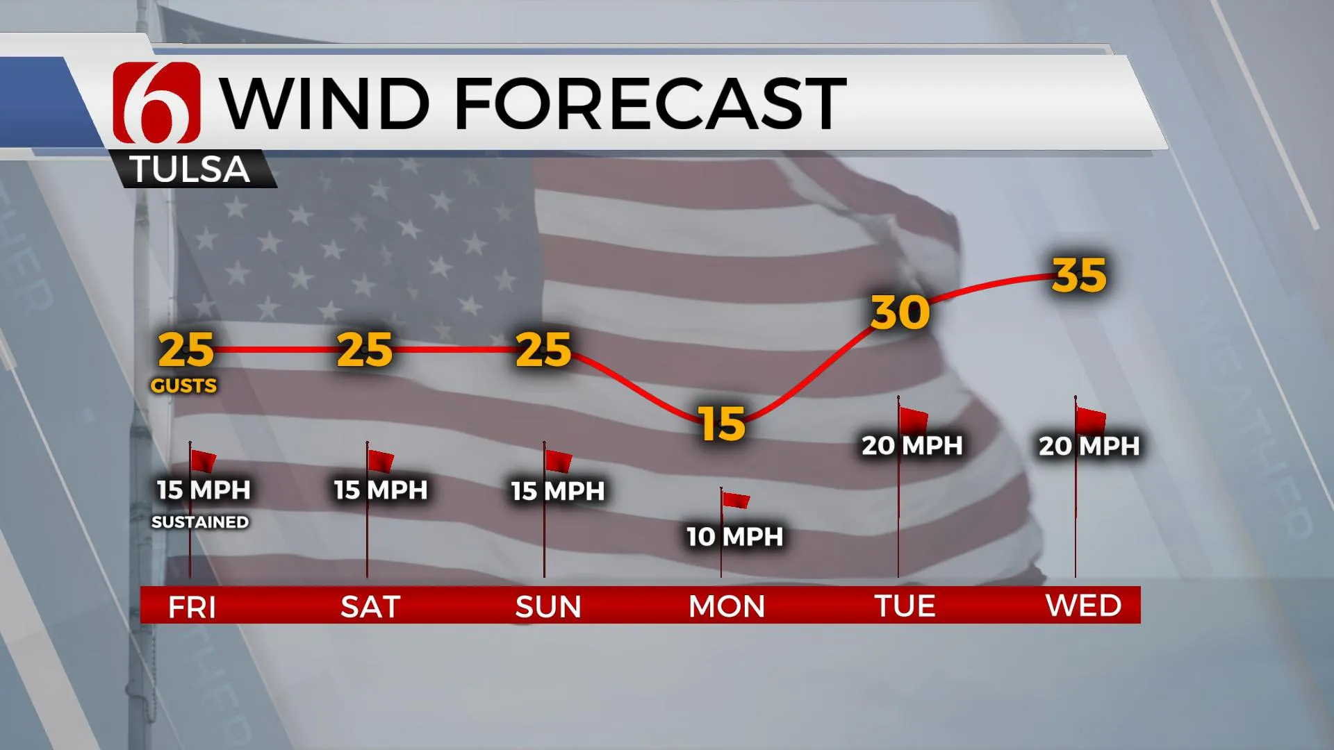
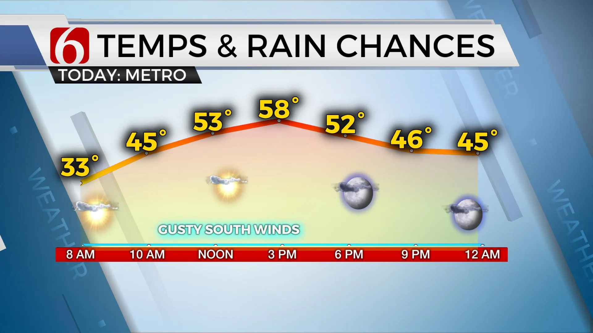
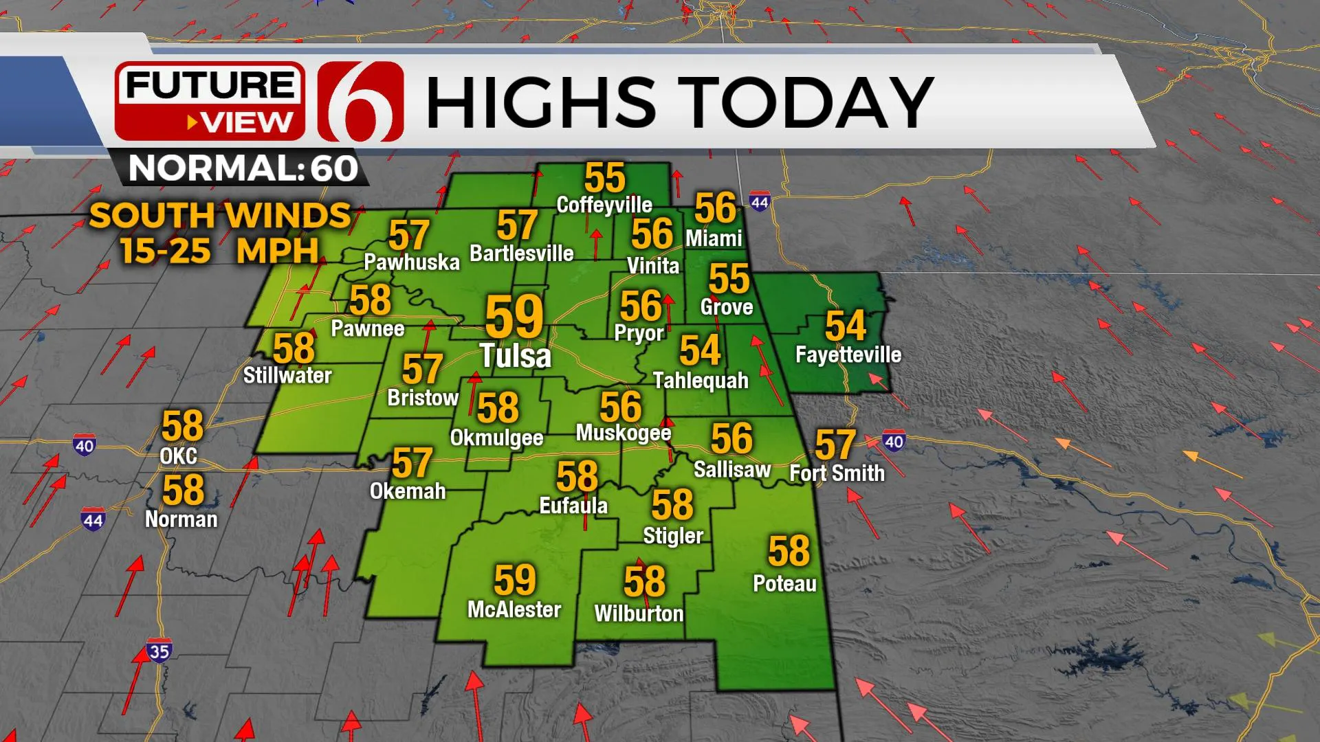
A surface ridge of high pressure near and east of the area this morning combined with clear sky and dry air allowed for a widespread freeze across Eastern OK into part of north TX. As the ridge moves east, southeast winds will quickly increase today with a new system moving out of the Rockies into the plains. Gusty south winds from 15 to 25 mph will remain both today and tomorrow with afternoon highs into the upper 50s and lower 60s today and nearing 70 tomorrow before the next cold front quickly advances across the area early Sunday morning. Low-level moisture remains limited, and any sprinkles or showers should be confined to extreme eastern OK or western Arkansas with this Sunday morning system. Northwest winds arrive early Sunday morning with temps reaching the mid to upper 50s for maximum highs before dropping into the upper 40s late Sunday evening. Monday morning another freeze is possible across at least the northeastern third of the area with lows in the upper 20s or lower 30s. Light north winds remain Monday with highs only in the upper 40s to lower 50s with another small ridge of high pressure nearby. The rest of the week centers upon another storm system nearing the area by Wednesday that may have some impacts for the latter half of the week into the following weekend.

Strong south winds will return Tuesday and remain Wednesday with winds from 20 to 35 mph as the next strong upper-level wave moves across the western U.S. Most of the previous upper-level systems have been more north, but this incoming midweek system may have a developing low at the base of the mean trough that could become established across the southwestern U.S. bringing stronger lift near the state.

The forecast for the 2nd half of the week remains highly inconsistent in the data and additional changes are likely from Thursday into the weekend. As of this morning, a surface front arrives late Wednesday evening or early Thursday morning. A few showers or even storms will develop as the front surges southward and colder weather arrives on Thursday morning with temps starting in the mid to upper 50s and dropping into the upper 40s by later in the day. The southwestern upper low will move east with a new surface low developing across south TX. This should bring rain and storms across Texas Thursday and Friday and may spread northeast into part of OK Friday into next weekend. Again, additional changes are likely for this period, so check back for updates.

Thanks for reading the Friday morning weather discussion and blog.
Have a super great day!
Alan Crone
KOTV
If you’re into podcasts, check out my daily weather update below. Search for NewsOn6 and ‘Weather Out The Door’ on most podcast providers, including Apple, Stitcher, Tune-In and down below on Spotify.

More Like This
November 19th, 2021
February 14th, 2022
January 26th, 2022
January 25th, 2022
Top Headlines
December 11th, 2024
December 11th, 2024
December 11th, 2024


