Above Normal Temperatures Remain
A series of fronts will move across the state over the next 7 to 10 days but in the short term, no major changes are expected as temperatures will continue to remain above the seasonal average for the week, both morning lows and afternoon highs.Tuesday, November 30th 2021, 8:30 am
TULSA, Oklahoma -
A series of fronts will move across the state over the next 7 to 10 days but in the short term, no major changes are expected as temperatures will continue to remain above the seasonal average for the week, both morning lows and afternoon highs. A slightly stronger front combined with some upper-level support nears the state Friday night into Saturday morning bringing a chance for a few showers and storms across the eastern third of the state into northeast Texas. As this front clears the area by Saturday midday, temps will drop closer to seasonal norms with afternoon highs in the upper 50s to lower 60s. A stronger front is likely to arrive for the middle of next week bringing more seasonal cool air across the central plains and part of Oklahoma.

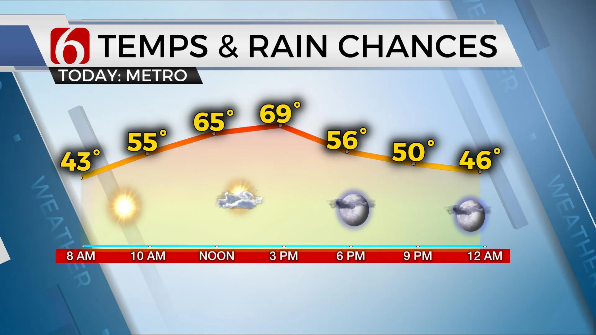
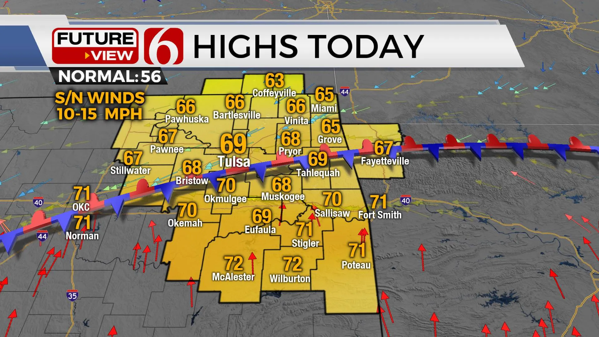
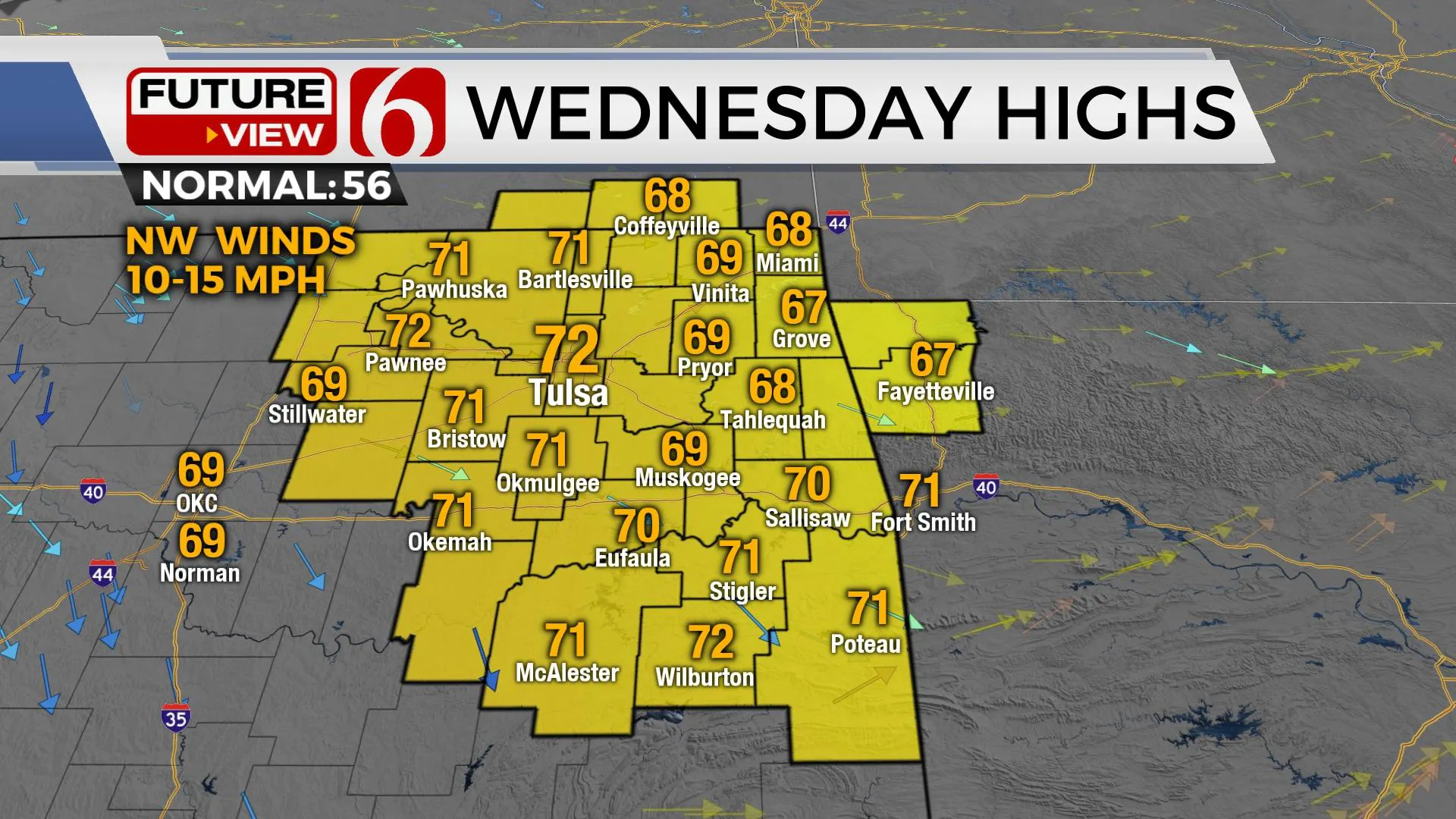
Highs this afternoon will stay in the mid to upper 60s north and lower 70s south as a weak front enters northern OK this morning and stalls around the I-40 corridor by afternoon with northeast winds near and north of the metro and south winds across southeastern OK. A few clouds will arrive near or north, but no measurable precipitation is expected in our immediate area of concern. A few sprinkles may populate extreme southeastern Kansas. Temps Wednesday will start in the upper 30s and lower 40s with daytime highs reaching the lower 70s. The warmest day of the week arrives Thursday as southwest winds from 10 to 20 mph help to bring temps into the mid or upper 70s with some locations near record highs. Low-level moisture will return Thursday evening into Friday before our next system nears the state.
Friday a broad area of low pressure at the surface will develop across the western half of the state while slowly traversing eastward by early Saturday morning. As a weak southern stream upper impulse nears the region, a few scattered showers or storms will attempt to develop near and east of the low. These chances will remain relatively low at this point, but some spotty shower activity is likely to occur with this system, but some locations will remain dry. As this system moves away from the state Saturday evening a stronger cold front will move across the state Sunday afternoon and evening with north winds and seasonal air early next week for a few days. Strong south winds quickly return Tuesday before a stout front is expected by the middle of next week.

Thanks for reading the Tuesday morning weather discussion and blog.
Have a super great day!
Alan Crone
KOTV

More Like This
November 30th, 2021
February 14th, 2022
January 26th, 2022
January 25th, 2022
Top Headlines
December 12th, 2024
December 12th, 2024
December 12th, 2024
December 12th, 2024


