Another Warm Afternoon Before Weekend Changes
A progressive pattern continues through the weekend and early next week with several storm systems and cold fronts scheduled to impact the state.Friday, December 3rd 2021, 10:40 am
TULSA, Oklahoma -
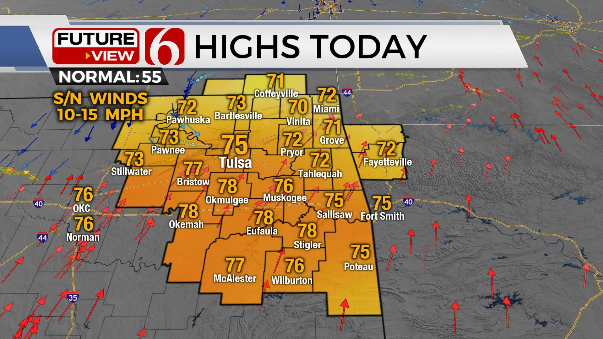
A progressive pattern continues through the weekend and early next week with several storm systems and cold fronts scheduled to impact the state. But our weather today will continue to feature springlike conditions with highs reaching the mid to upper 70s with some locations nearing record highs. A weak front enters northern sections this afternoon and moves southward tonight before stalling along the I-44 corridor. This signals the beginning of some changes to the pattern for the weekend and early next week.

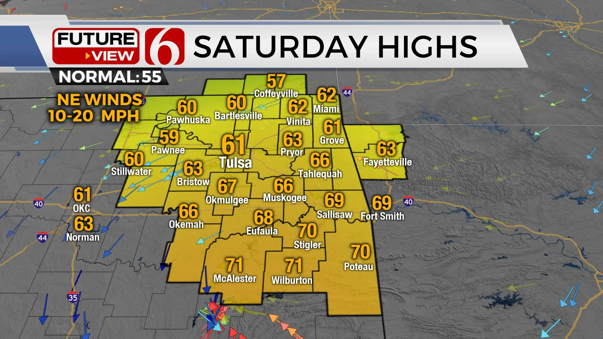
As the front moves southward later tonight, a few showers may develop into pre-dawn Saturday near this boundary, with a chance of drizzle or mist along the northern edge of the front. These chances will remain low for most locations. Temps Saturday morning will start in the 40s and 50s, with afternoon highs staying in the upper 50s to 60 across northern OK Saturday with overcast conditions with locations south of the boundary reaching the lower 70s. Later Saturday evening into early Sunday morning, a broad area of low pressure will be located along the Red River Valley with south winds returning to most of the eastern third of the state. As southerly flow returns, a few showers or drizzle may also develop with Sunday morning lows in the middle 50s. Most of Eastern OK will be in the warm sector of our developing system Sunday afternoon with highs reaching the lower to mid-70s from the metro southward and staying in the mid to upper 60s along the OK-Kansas state line. By Sunday afternoon, a strong cold front rolls across the state bringing fall temps and northwest winds. As the front enters southern and eastern OK Sunday evening, storms will be possible, including the potential for a few strong to severe storms. The higher probability for thunderstorms Sunday evening will remain southeast of the Tulsa metro. Colder air will filter in the area Sunday night bringing Monday morning lows in the upper 20s and lower 30s. Monday afternoon highs are expected to remain in the mid to upper 40s north and lower 50s south. A progressive pattern remains next week with another front nearing the state Wednesday, along with a stronger system by next weekend.

Thanks for reading the Friday morning weather discussion and blog.
Alan Crone
KOTV
If you’re into podcasts, check out my daily weather update below. Search for NewsOn6 and ‘Weather Out The Door’ on most podcast providers, including Apple, Stitcher, Tune-In and down below on Spotify.

More Like This
December 3rd, 2021
February 14th, 2022
January 26th, 2022
January 25th, 2022
Top Headlines
December 13th, 2024
December 13th, 2024
December 13th, 2024
December 13th, 2024


