Near-Record Highs Possible During The Holiday Period
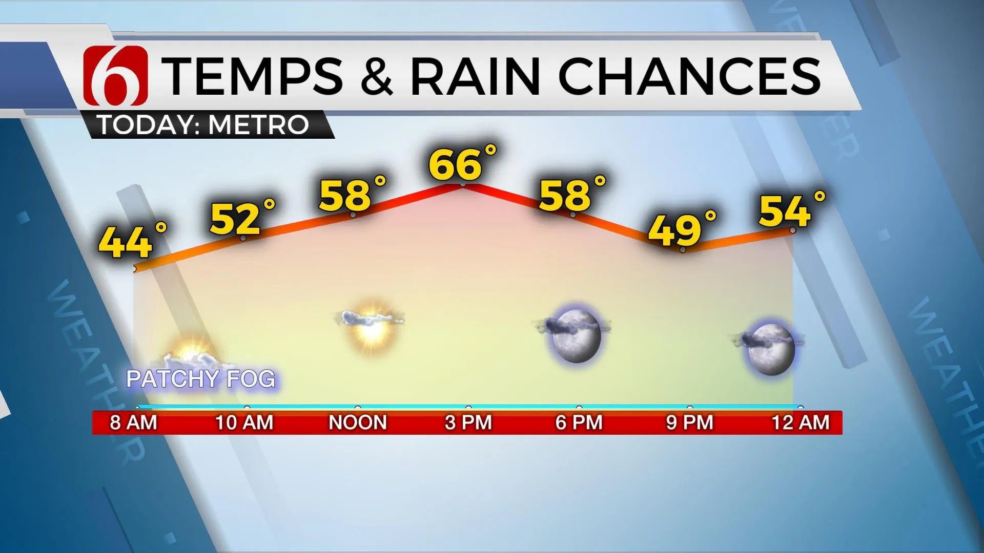
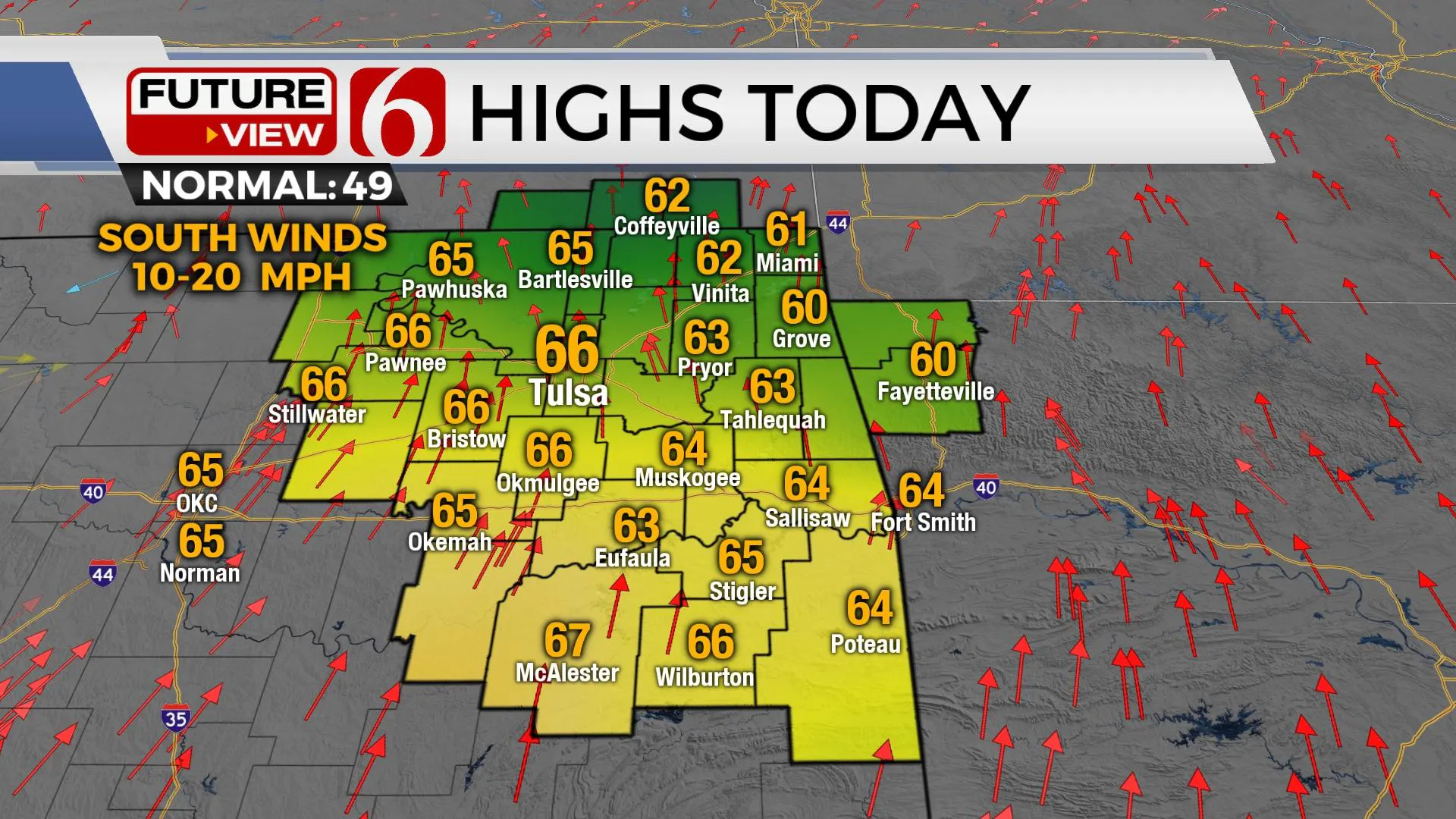
A sunshine-cloud mix is likely today with highs reaching the lower to mid-60s.Thursday, December 23rd 2021, 7:18 am
TULSA, Oklahoma -
A sunshine-cloud mix is likely today with highs reaching the lower to mid-60s. Near-record highs will be possible during the Holiday period before a series of cold fronts arrive next week. Some low clouds and fog will also remain possible for the morning hours in some, but not all locations. Dense fog advisories are currently posted for some locations near I-35 into southern OK.

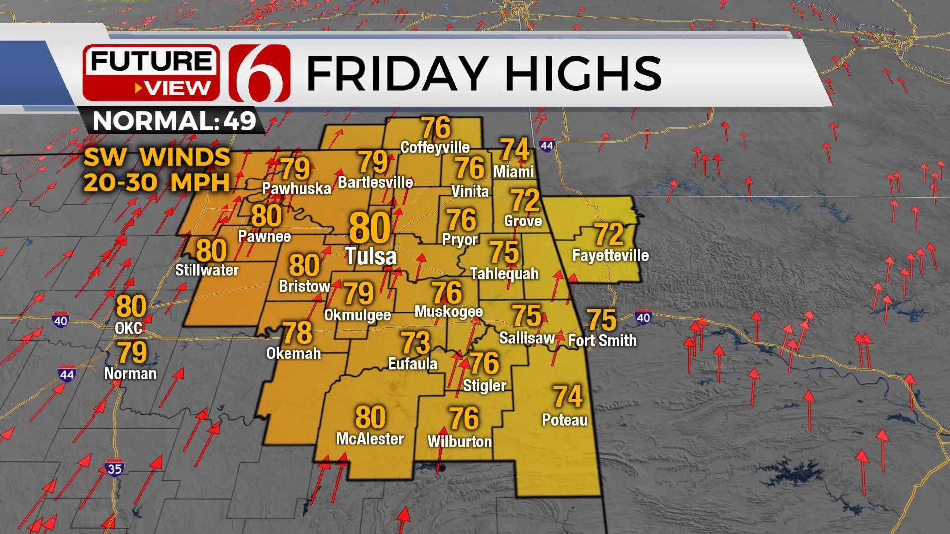
The short-term issues center upon a warming trend through most of the Christmas Holiday before the pattern becomes more active next week, including the possibility of a few showers and storms across the eastern fringes of the area and the opportunity for colder weather. As we continue to warm the next few days, surface winds from the southwest and dry air will support increasing fire spread issues with conditions most favorable Friday as a dry line attempts to establish near and west of the metro by Friday afternoon. If this dry air can settle near and west of the metro, temps may indeed reach the lower 80s Christmas Eve afternoon near Tulsa with southwest winds from 20 to 30 mph. Humidity in the 20% to 30% range would also support a very high fire danger for the afternoon. Some data is not quite as dry in the lower levels. This would still bring us highs in the upper 70s. The first of several fronts will be nearing the state this weekend. But next week, the polar jet begins migrating southward and should bring several cold fronts into the state allowing another evolution of colder weather for our pattern.

A mid-level ridge of high pressure will keep us above seasonal averages for the next few days but will be replaced with an increasingly active upper flow this weekend into next week. A series of short waves will transverse the plains and a series of surface lows will develop and move from the west to east. Each of these low-pressure areas will bring a front southward at times next week. A stronger-looking front is likely Wednesday, and then again Friday of next week. Both fronts will knock the temps down, but it’s the latter half of the week that shallow, cold arctic air could arrive for the New Year’s Holiday weekend.
The potential for some showers and storms will be possible with these fronts and low-pressure areas, but the exact positioning and amount of low-level moisture remains questionable for any definitive chances, other than low mentions for now, with the first being late Sunday night into early Monday morning along the OK-Kansas state line region, and the 2nd Tuesday into Wednesday. These will remain low chances for now.

Thanks for reading the Thursday morning weather discussion and blog.
Have a super great day!
Alan Crone
KOTV
If you’re into podcasts, check out my daily weather update below. Search for NewsOn6 and ‘Weather Out The Door’ on most podcast providers, including Apple, Stitcher, Tune-In and down below on Spotify.

More Like This
December 23rd, 2021
February 14th, 2022
January 26th, 2022
January 25th, 2022
Top Headlines
December 13th, 2024
December 13th, 2024
December 13th, 2024
December 13th, 2024


