Below Freezing Temperatures Stick Around
Cold temperatures stick around on this cloudy and windy Thursday, but a slight warm up could soon arrive.Thursday, January 20th 2022, 6:07 am
TULSA, Oklahoma -
Cold temperatures stick around on this cloudy and windy Thursday, but a slight warm up could soon arrive.
Here are the details from News On 6 Meteorologist Alan Crone:
The arctic air remains in place for the next 48 hours, including some of the coldest air of the season early Friday morning. The airmass modifies this weekend. Morning lows will still be in the 20s, but Saturday afternoon highs will reach the mid to upper 40s. Sunday max temps will move into the upper 50s or lower 60s. This warm-up should continue Monday before another strong front moves across the state bringing another surge of colder air for the middle of next week. The upper-level pattern does support the mention of some precipitation with this next system, currently in the form of some light snow.

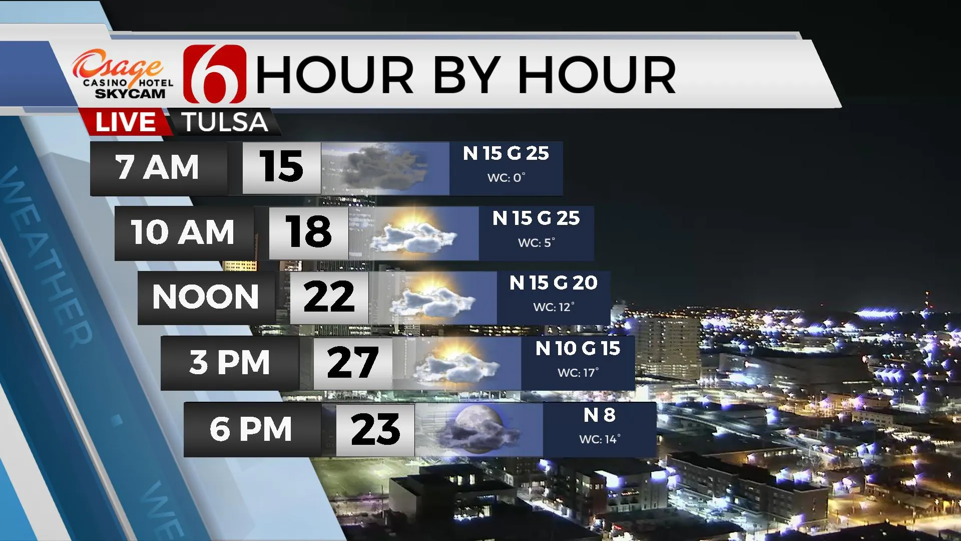
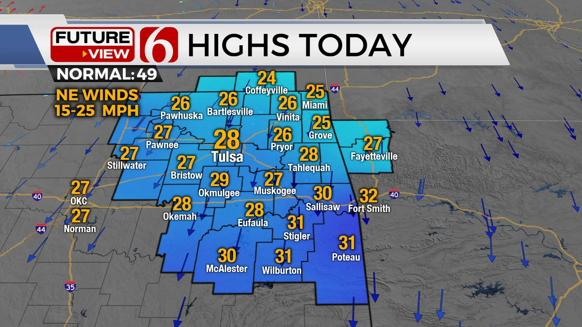
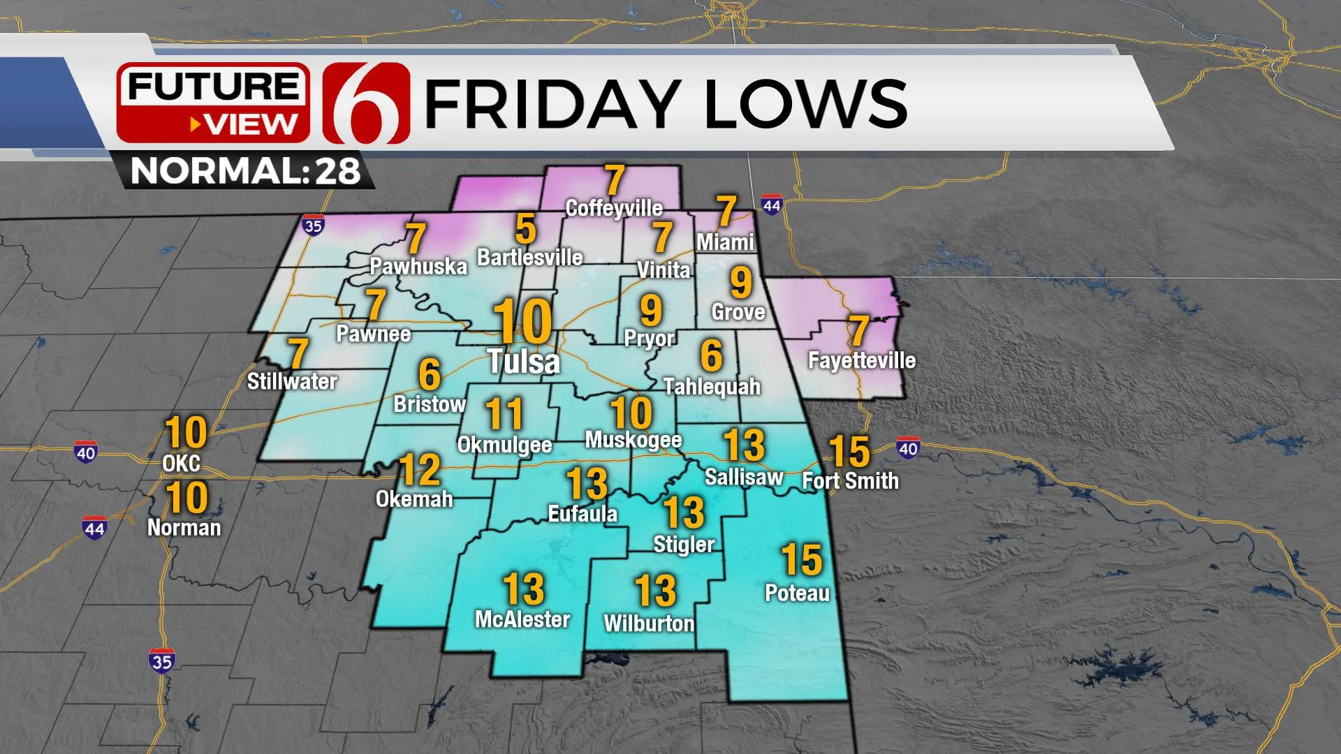
Thursday morning starts in the mid to upper teens, but wind chill values in the single digits to sub-zero readings will continue for a few hours in the morning. Afternoon highs will reach the mid-20s with partly cloudy conditions and northeast winds from 15 to 25 mph. Afternoon wind chills will range from 12 to 18 degrees. Wind speeds are expected to finally decrease later tonight into early Friday morning as a surface ridge of high pressure to our northeast influences Northeastern OK. This will allow for the coldest night of the winter season. Valley locations will drop into the single digits while metro communities will reach lows in the lower teens with clear sky and light wind. Friday afternoon highs are expected to reach above freezing into the mid and upper 30s with sunshine and a return of south winds at 10 mph by afternoon.

Next week the pattern suggests another storm system will move across Texas Monday and could clip far southeastern or east-central OK with showers. As this system exits the area, colder air arrives Monday night into Tuesday morning. Most of the moisture from the southern storm should be exiting to the east but later Tuesday night into Wednesday morning another upper disturbance should be nearing from the west. Cold air will be already in place, and we’ll have a low chance for some light snow showers Tuesday night into Wednesday morning.

Thanks for reading the Thursday morning weather discussion and blog.
Have a super great day!
Alan Crone
KOTV
If you’re into podcasts, check out my daily weather update below. Search for NewsOn6 and ‘Weather Out The Door’ on most podcast providers, including Apple, Stitcher, Tune-In and down below on Spotify.

More Like This
January 20th, 2022
February 7th, 2024
October 21st, 2023
October 3rd, 2023
Top Headlines
December 12th, 2024
December 12th, 2024
December 12th, 2024
December 12th, 2024


