Tracking The Next Cold Front
It’s been a pleasant week, but a cold front could mean chillier weekend temperatures.Thursday, February 10th 2022, 7:15 am
TULSA, Oklahoma -
It’s been a pleasant week, but a cold front could mean chillier weekend temperatures.
Here are the details from News On 6 Meteorologist Alan Crone:
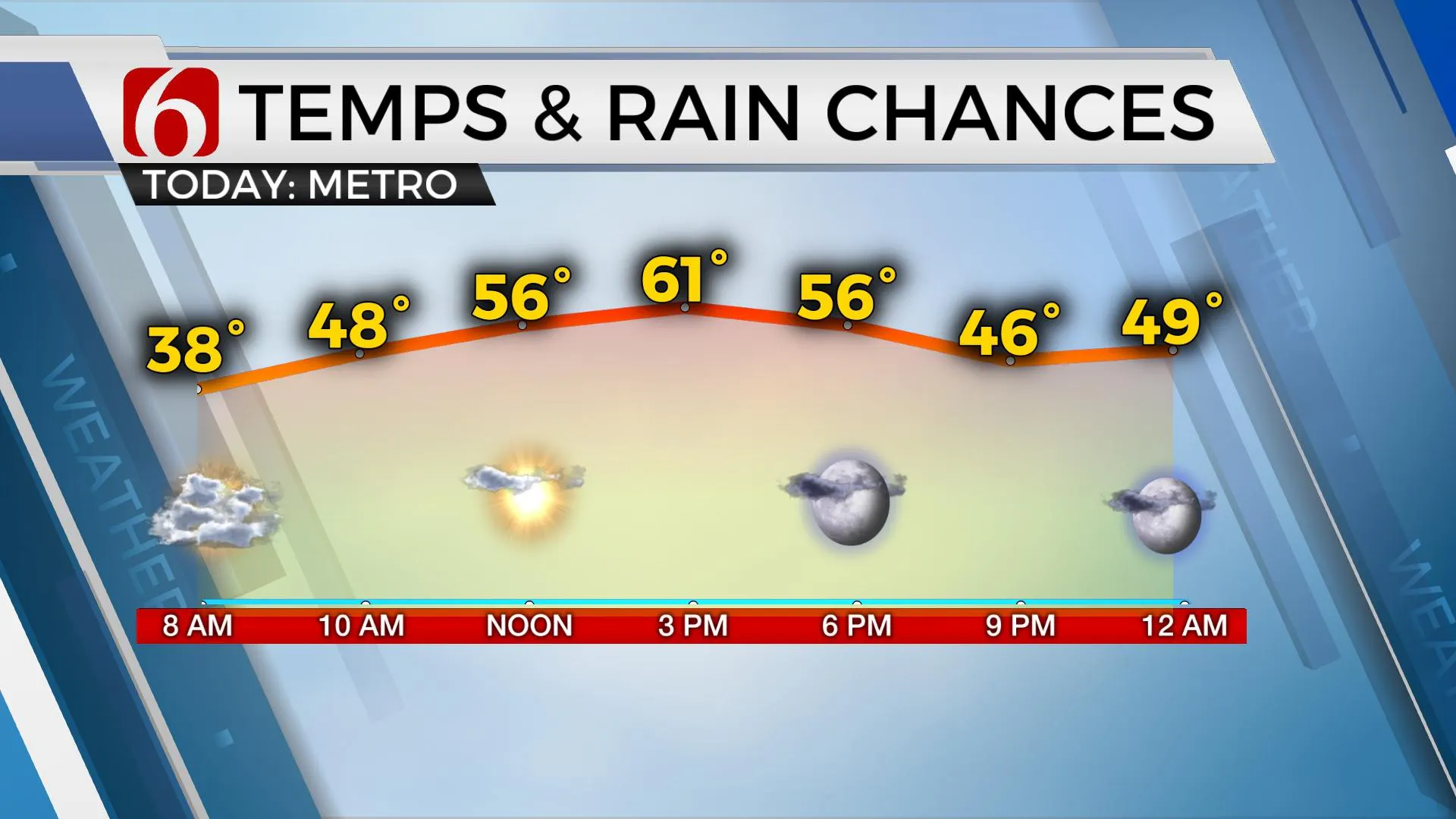
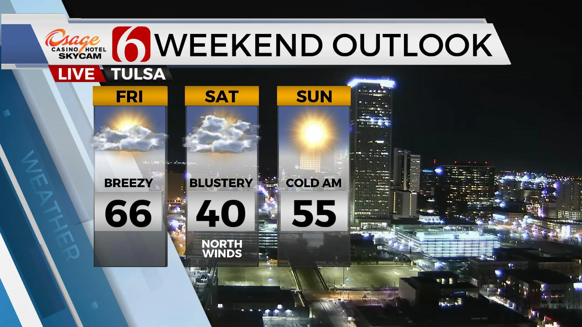
A weak system is moving across the area on Thursday morning producing some clouds and even a sprinkle or two. This disturbance will quickly exit the area with more sunshine by midday to afternoon. Northeast winds will bring slightly cooler temps with afternoon highs in the upper 50s across northeastern OK and lower 60s across southeastern sections of the state. South winds quickly return Thursday evening and will aid in bringing another mostly pleasant day on Friday with highs reaching the 60s and 70s across the state. The trend in the data is for a faster frontal passage Friday. But the colder air seems to be lagging the initial front by a few hours. We’ll have north winds by midday Friday and temps should become cooler by later in the afternoon and evening. By Saturday morning, temps will be in the upper 20s and lower 30s with strong north winds at 20 to 30 mph. Afternoon highs will max out only in the upper 30s and lower 40s with decreasing clouds throughout the day. Sunday starts cold with morning lows in the 20s, but the colder air quickly modifies, and afternoon highs return to the 50s.

The upper air pattern changes early next week from the northwest to southwest and eventually brings active weather, including thunderstorm chances into the state Wednesday night and Thursday morning. South winds early next week will rapidly bring low-level moisture from the Gulf into Oklahoma Tuesday and Wednesday. Regardless, the fire spread rate will be increasing, more so Tuesday. As the system nears the state, stronger winds aloft will also arrive and will support the mention of thunderstorm activity with part of the system. Colder air will follow the system, but the moisture should be shunted eastward before arriving. At this point, wintry precipitation seems unlikely behind the system for most of our area. Higher chances will be supported more north, across part of Kansas.

Thanks for reading the Thursday morning weather discussion and blog.
Have a super great day!
Alan Crone
KOTV
If you’re into podcasts, check out my daily weather update below. Search for NewsOn6 and ‘Weather Out The Door’ on most podcast providers, including Spotify, Stitcher, Tune-In and down below on Apple.

More Like This
February 10th, 2022
February 7th, 2024
October 21st, 2023
October 3rd, 2023
Top Headlines
December 13th, 2024
December 13th, 2024
December 13th, 2024
December 13th, 2024


