Spring Pattern Remains
Spring-like weather continues across Green Country this week.Tuesday, March 1st 2022, 6:53 am
TULSA, Oklahoma -
Spring-like weather continues across Green Country this week.
Here are the details from News On 6 Meteorologist Alan Crone:
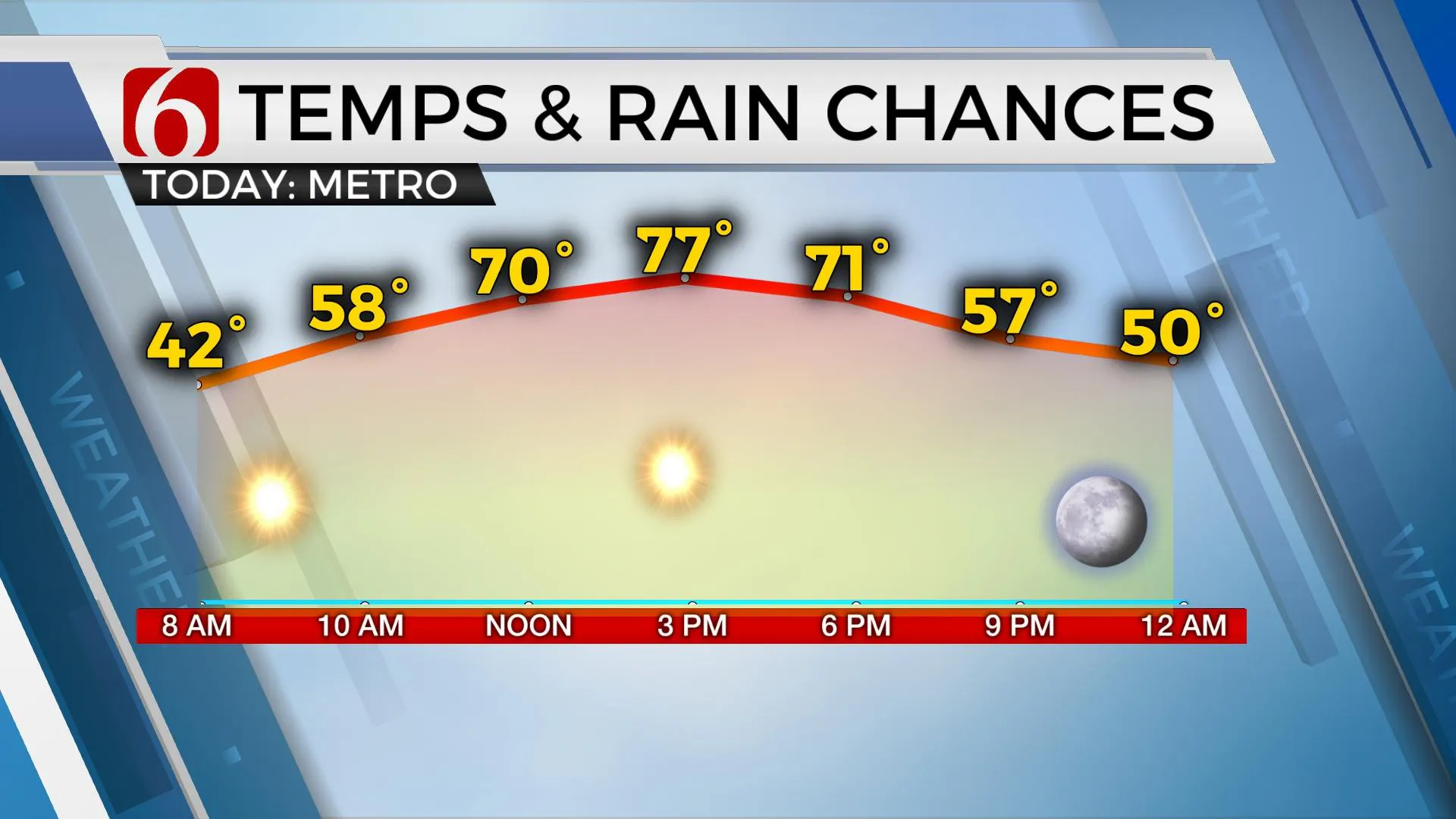
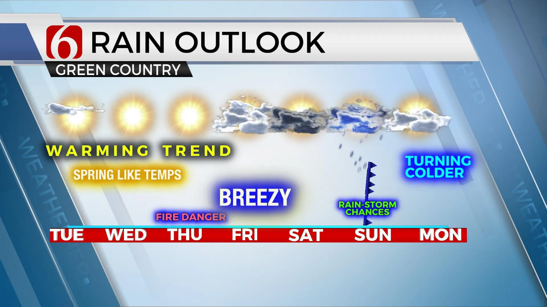
Our weather continues to look good for the next few days with increasing temps and mostly sunny conditions. Afternoon highs are expected to crest well above normal with most locations in the mid to upper 70s through Friday. Southwest winds will remain both Tuesday and Wednesday around 10 to 18 mph. Relatively low afternoon humidity and drying conditions will lead to enhanced fire spread rates, especially Thursday with increasing wind speeds from 15 to 25 mph. Even stronger south winds are likely Friday from 20 to 35 mph but low-level flow from the Gulf is likely to bring moisture into the state by midday to afternoon mitigating some of the fire danger issues. This will also aid in shower and storm development this weekend as a storm system and surface front slowly approaches the area.

A broad trough is expected across the western U.S. for the next few days while a surface ridge of high pressure to our southeast impedes gulf moisture from the area. As the ridge migrates eastward and the trough nears, stronger winds will bring moisture into the state by the end of the week. A series of disturbances are likely to round the base of the western trough and provide sufficient lift for shower and thunderstorm chances for part of the weekend. The timing remains difficult this morning, but some activity is possible Saturday afternoon and evening across the eastern third of the state as a dry line quickly advances east. Locations west of this feature will experience near critically high fire spread rates Saturday afternoon. A surface front is expected to move southward but may stall Sunday morning near or south of the I-40 corridor. Showers and storms will remain possible Sunday near the vicinity of the boundary before it moves southward bringing colder air Sunday afternoon and early next week. Timing differences in the data, unfortunately, bring low confidence for the Sunday forecast and additional changes are possible, even likely. These could include mentions of strong to severe storms if the system slows down. Cooler (colder) air will arrive behind the exiting system Monday and Tuesday. At this point, it appears most of the moisture will be gone before most of the colder air arrives.

Thanks for reading the Tuesday morning weather discussion and blog.
Have a super great day!
Alan Crone
KOTV
If you’re into podcasts, check out my daily weather update below. Search for NewsOn6 and ‘Weather Out The Door’ on most podcast providers, including Spotify, Stitcher, Tune-In and down below on Apple.

More Like This
March 1st, 2022
June 21st, 2023
June 19th, 2023
June 13th, 2023
Top Headlines
December 14th, 2024
December 14th, 2024
December 14th, 2024
December 14th, 2024


